Before the Covid pandemic struck I was fortunate enough to make two trips in 2020 – Pune and Panchgani in February and Chennai in March. I have written about my Chennai trip in a story earlier as a part of Tripoto’s contest my last trip before lockdown. This is the story of my first trip of 2020 or the second last before lockdown. I was actually in Pune for a conference organised by CDAC and held at IISER. After the conference concluded I had kept on hand an extra day to explore this region. Not to mention that there are numerous hill stations in this region that serve as weekend getaways for Punekars. But the best time to visit the region is during or after the monsoon when the landscape is at its best green. Unfortunately, I was there at a time when there were only dry leaves and grasses on the hills.
After a lot of consideration about where to go, I narrowed it down to Panchgani. Panchgani is a small hill town near the more touristic Mahabaleshwar. The choice of ‘small’ was good because I was looking for a place to explore on foot. In hill stations, it is best to hire a taxi or rent a two-wheeler to go around different points. Panchgani is no different but also has a set of places close to the town that can be explored on foot and for a bit distant places one can take a shared jeep that plies along the main road. So on the 2nd of February morning, I boarded a bus from Pune’s Swargate that would drop me off at Wai. From Wai, I took another bus to Panchgani. Panchgani is a hundred kilometres from Pune and takes about 4 hours to reach by public bus.
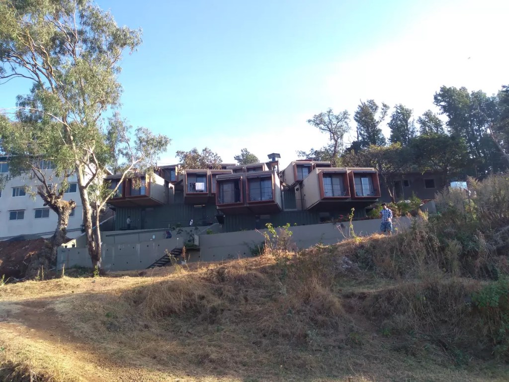
Zostel Panchgani was yet another reason to come to this place. The hostel is unique because the dorms and rooms are made from shipping containers stacked over one another along a hill slope that offers a panoramic view of the valley below. Check out this video on YouTube that made me say yes to this location.
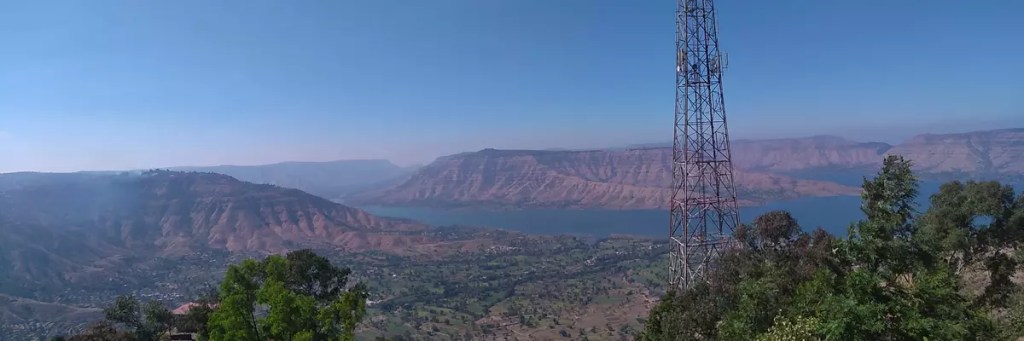
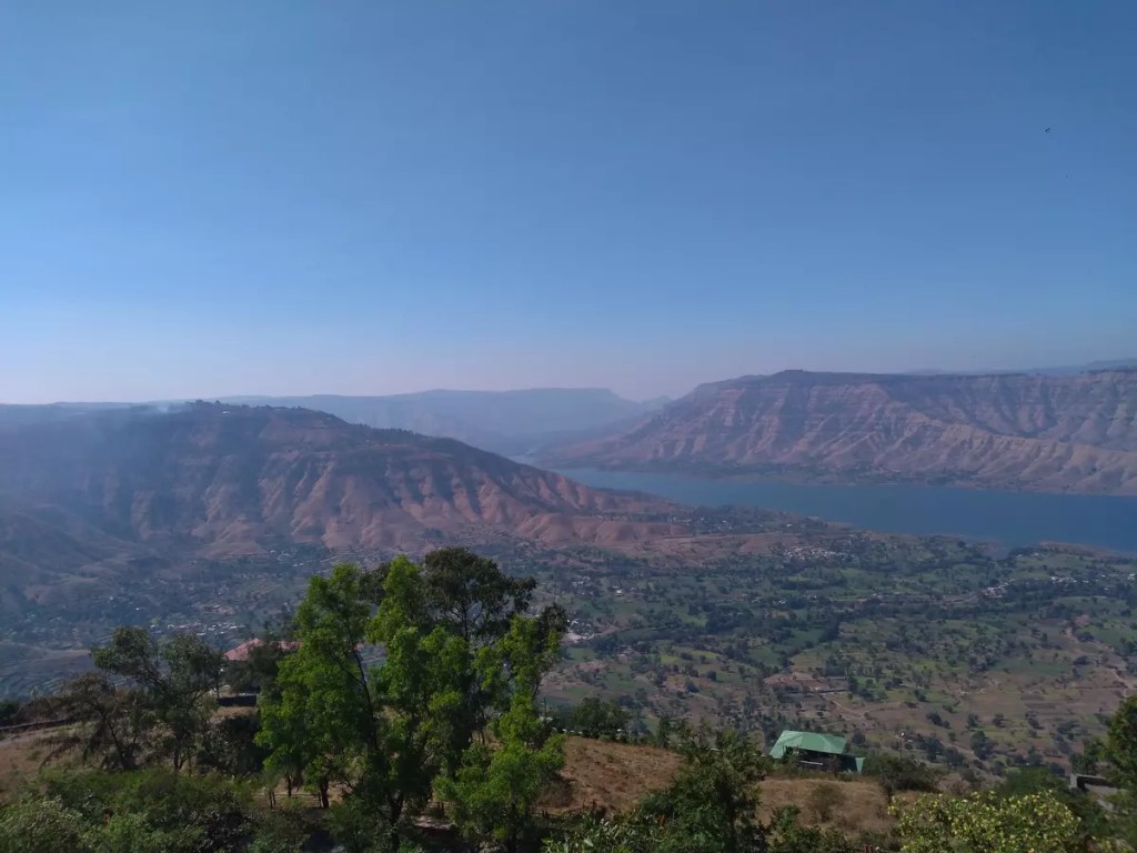
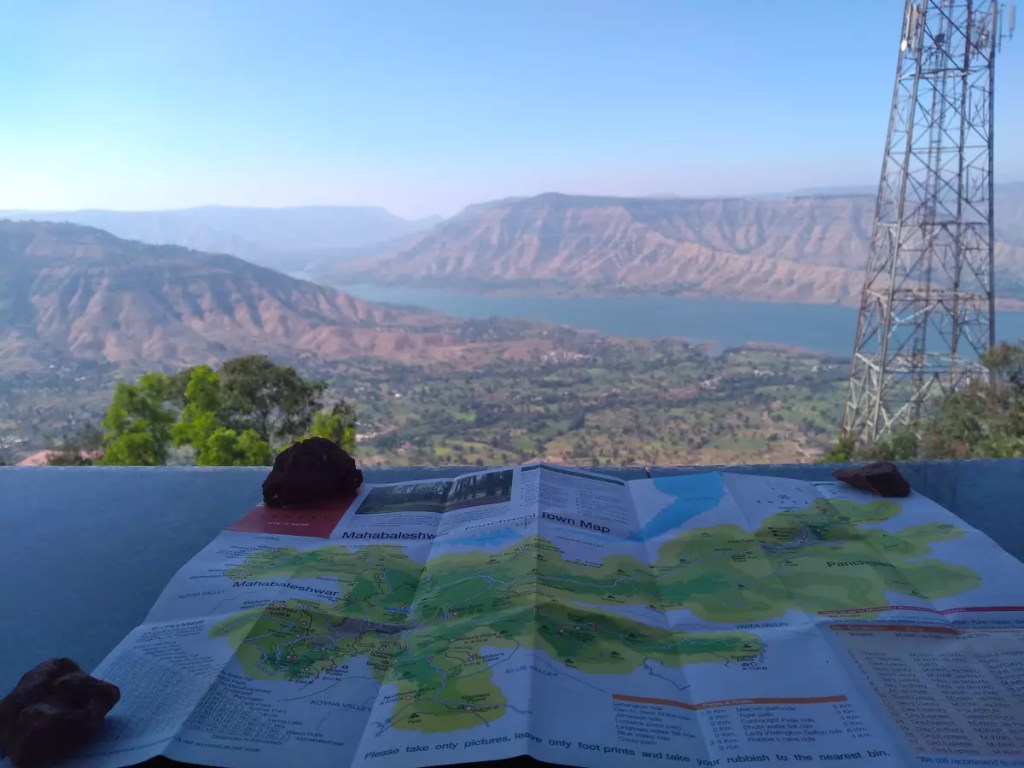
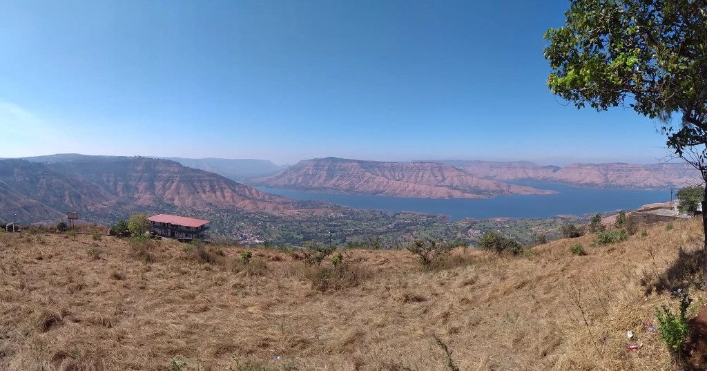
If you are from Wai, you would cross Zostel about three kilometres before reaching Panchgani town. However, due to a wrong interpretation of Google Maps, I had assumed it to be after crossing the Panchgani bus stand. By the time I realised this, the bus had reached the bus stand and I had to walk back. After having settled down I had 24 hours to explore this place. The good people at Zostel helped me prepare an itinerary for the day. I started with a walk again to the town to have lunch. The central place in Panchgani is not too big with just a few hundred shops around the bus stand. Post lunch I headed to the first viewpoint in my itinerary, the Sydney point. I literally have no idea why this place is named after an Australian city. While entering Panchgani from Wai, a road branching right near the toll gate goes spiralling up to Sydney Point. The place offers an amazing view of the Dhoom Dam. But the best part was the amazing breeze that came from the lake in the hot afternoon, which helped soothe the tiredness from listening to a continuous session of talks the day before. I happily spent an hour or two in the sole sitting area here. Lucky enough to find it empty.
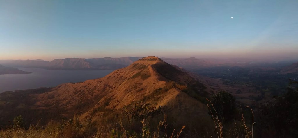
As it was closing at 4 pm, I had to head back to the hostel to join the Zostel organised hike to a sunset viewpoint. From the hostel, we were first taken to the base by car and then walked over a kilometre to the viewpoint that again offered a superb view of the sunset taking place over the hills surrounding Dhoom Lake. This was the point I felt, it was worth coming to Panchgani even in the offseason. It was just magical to see the hills surrounding me turn to gold as the rays from the setting sun fell on the brownish-yellow dry grasses. To experience this magic, you have to stay at Zostel as the location is private and not frequented by others.
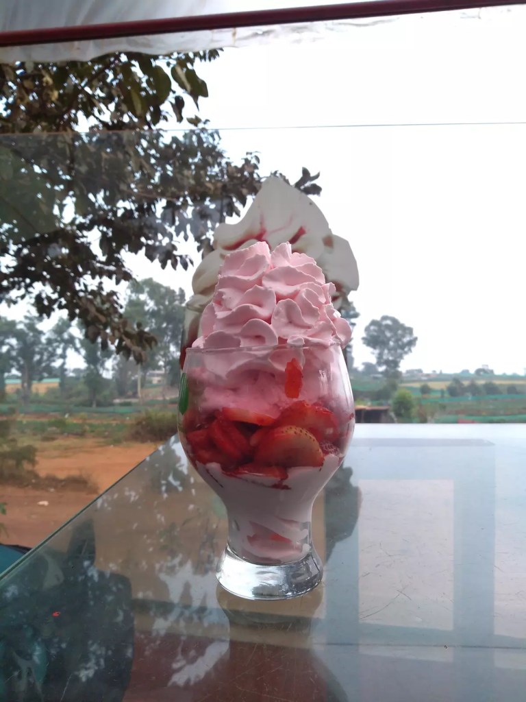
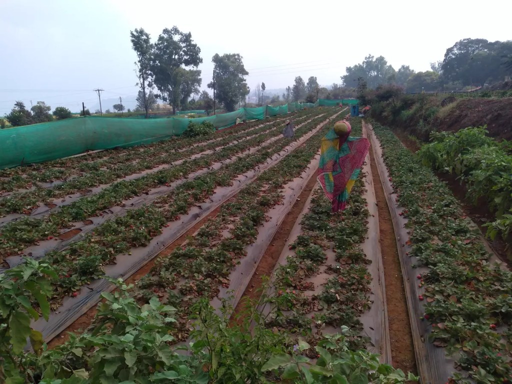
Once I was done with this, along with a few other hostellers, I headed to Mapro Garden. This is another recommended place to be while in Panchgani or Mahabaleshwar. Panchgani and the surrounding areas is famous for their berries. In season, you would find different types of berries being sold all along the road in Panchgani. The area also houses several food processing companies and Mapro is one of them. The food court at Mapro Garden offers a wide range of food starting from pizzas to soups to beverages. But what beats all others is their speciality whipped strawberry cream served over fresh strawberries and strawberry-flavoured ice cream. Besides, the food court, Mapro Garden also houses a store that sells locally processed fruit-based products like juices, syrups, jams, candies etc.
The night had another great planned activity – a star-gazing hike to the famed tabletop of Panchgani. Again, this was organised by Zostel for its members. The tabletop is a flat land above Panchgani town. We were first taken by the car and hiked through the dark to the top where a bonfire was arranged to keep warm.
Day 2 and the last few hours in the town. I woke up early expecting to get a glimpse of the sunrise. But unfortunately, it was cloudy. I freshened up and headed back to the Centre for breakfast, followed by another walk towards Parsi Point. Again the views here were blinded by the clouds. What can be better than a cup of strawberry cream to clear the bad luck? Hence, I headed once again to Mapro Gardens. When I had gone the day before, it was pitch dark outside and nothing much was visible but today, it was amazing to see the stretches of berry farms around. I was also able to shop for some strawberries directly from the farm. And this was the end of exploring yet another small town in India. I returned back to Zostel, collected my bags and headed to Pune via Wai from where I had a train to Allahabad.
Check out more pictures from the trip on Instagram.
So my last trip before #Lockdown was to Chennai. Not a leisure trip but to attend a conference at IIT-Madras. I was to leave Allahabad on the 4th March early morning by train and on the 3rd evening a piece of news flashed in Times Of India that visas for people from a few countries had been suspended. This was probably the first major step taken by the Government of India to prevent the outbreak of Corona in the country. Over the previous few days, I had seen big conferences including those of the American Physical Society getting cancelled due to the Coronavirus outbreak. The IIT conference starting on the 6th was to have several speakers and participants from Japan and I feared should the event get cancelled. With some hope, I boarded the train on my way to Chennai. While on board, I received an email that the event would go on as planned except that the Japanese participants would join in via video-conferencing.
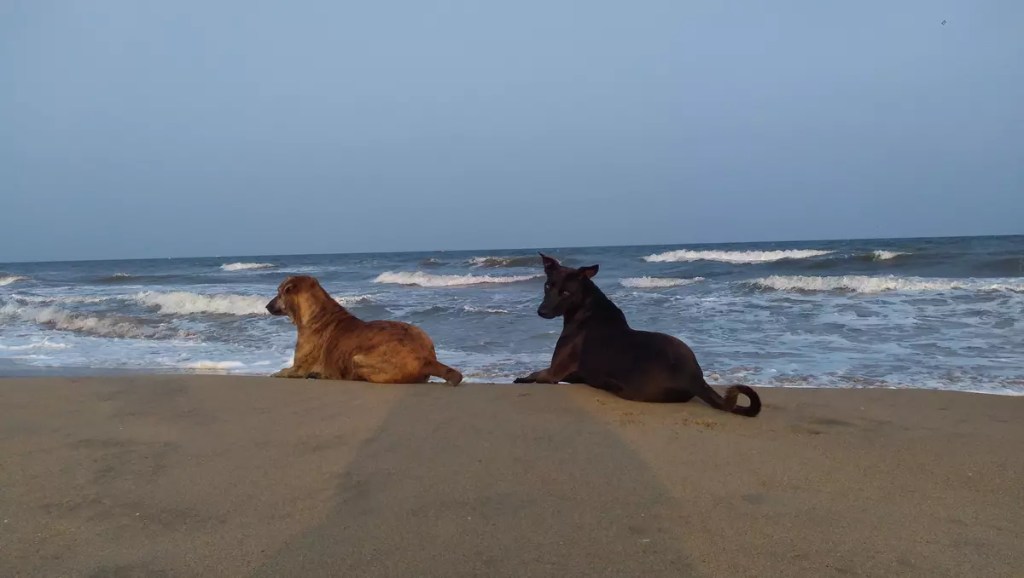
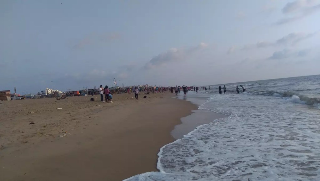
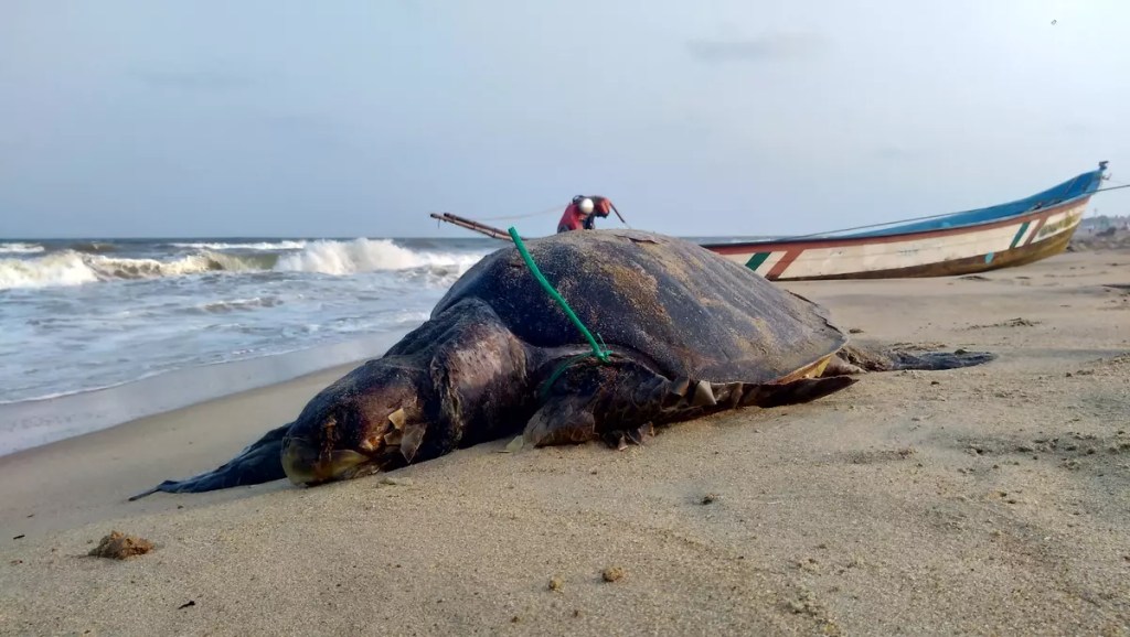
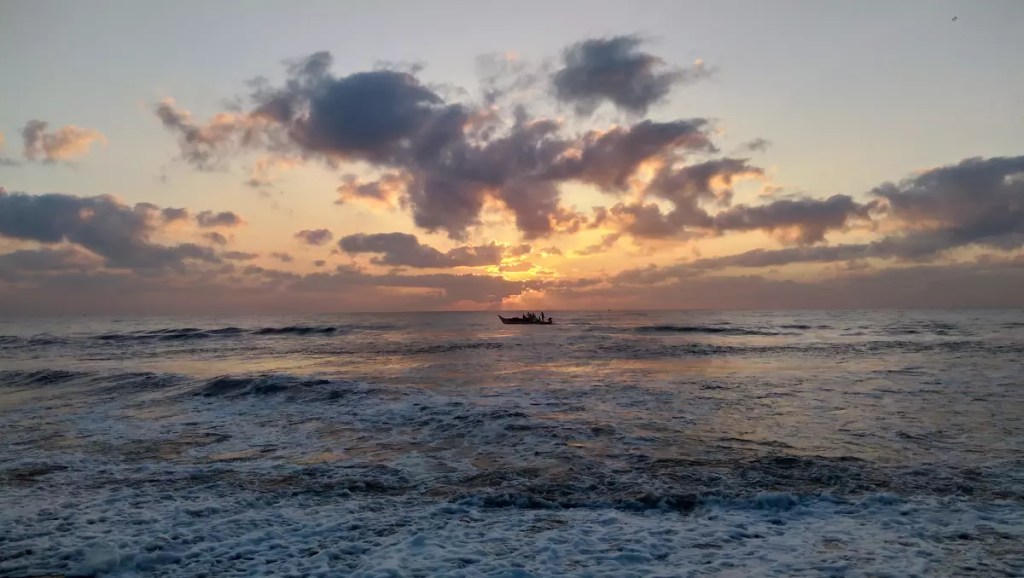
I reached Chennai on the 5th afternoon and put up at the Youth Hostel in Adyar. The hostel is just 2 km from Besant Nagar beach. Over the next four days, I spent quite some time at the beach watching the sunrise or enjoying the cool evening breeze with some seafood, bhajis and roasted bhutta (maize). During the first visit on the 5th, I ended up exploring something that is marked as Broken Bridge on Google Maps. This place towards the north of Besant Nagar Beach and near to Theosophical Society is where the Adyar River meets the Bay of Bengal. The sunset from this place is something very memorable I got to watch on this trip. This part of the beach is very less frequented.
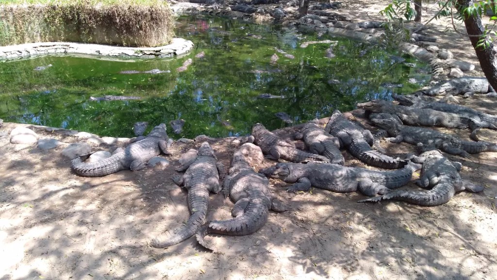
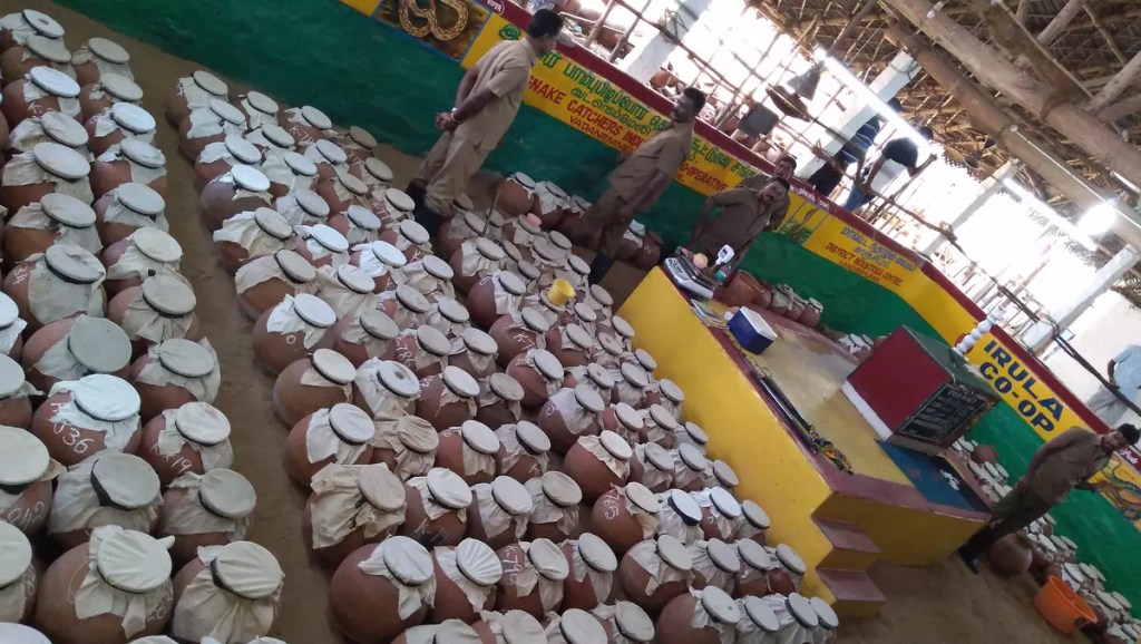
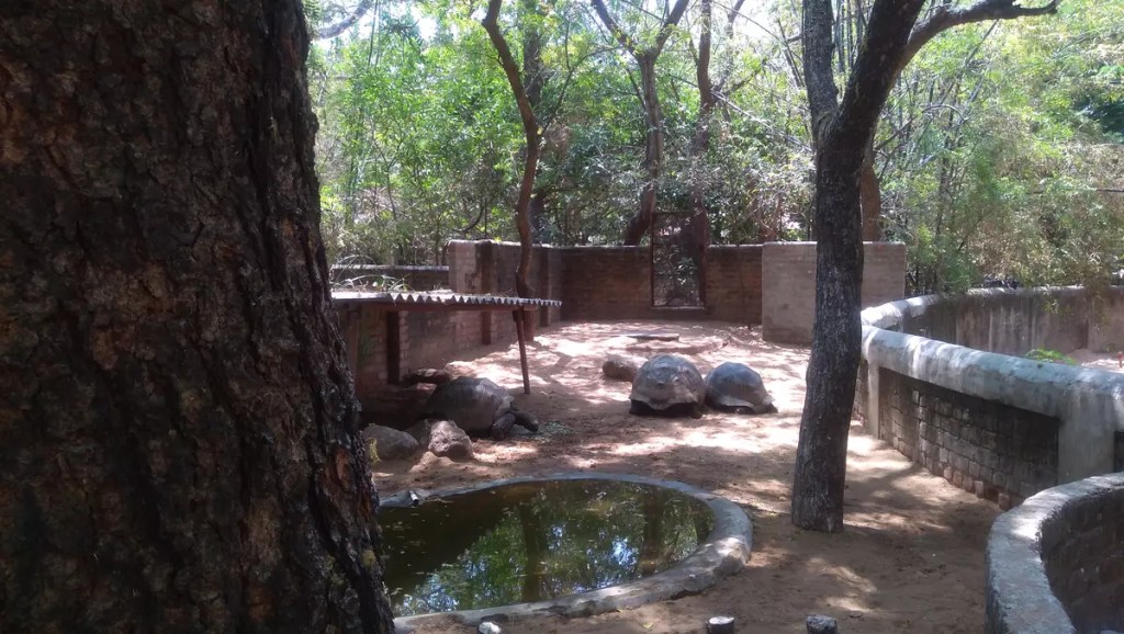
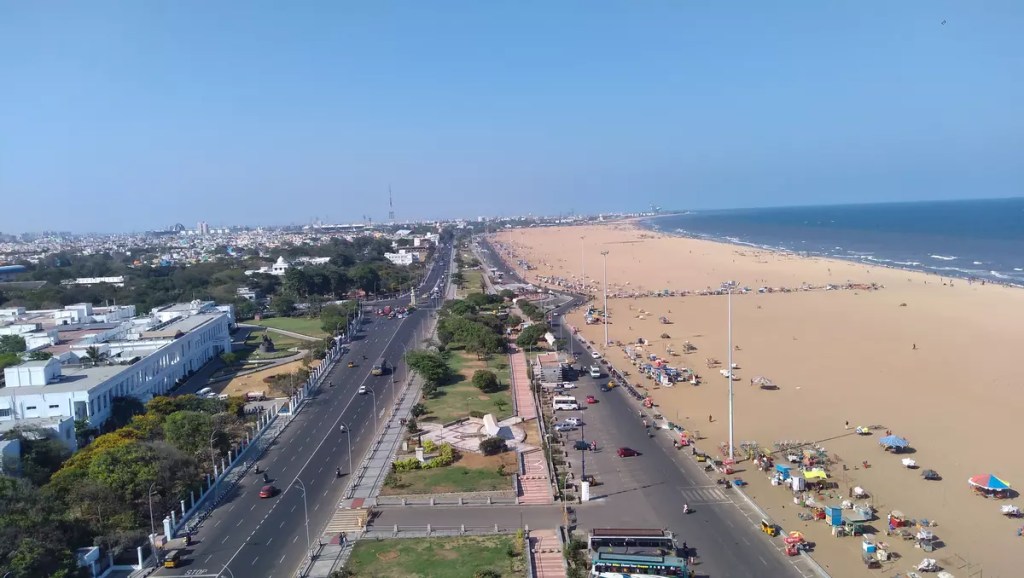
The next two days were mostly spent inside the IIT campus, a little forest within the bustling city. On the 8th I headed further down south of Chennai to visit the Madras Crocodile Bank. This is a research and breeding centre for reptiles and amphibians. They probably have the most number of crocs I have seen to date. Besides the different varieties of crocodiles, they also house snakes, tortoises and iguanas. The Irula Snake Catchers’ Industrial Cooperative Society is on the same campus. They work towards snake venom extraction for anti-venom production. For tourists, they held awareness programs including a demonstration of how snake venom is extracted. That same day evening, I ticked off one more destination of Chennai from my list – the Chennai Light House. This place gives a panoramic view of the Marina beach with the endless Bay of Bengal on the right and the Madras city on the left.
Finally, I was scheduled to exit Chennai on the 9th afternoon. As I had some time to spare in the first half of the day I went about searching for some snacks to carry back home. Thanks to suggestions from Quora and Facebook members I was able to get some of the finest banana chips and murukkus from Ganga Hot Chips, A2B and Grand Sweets & Snacks in Adyar. I reached Allahabad on the 11th and within another 11 days, Janta Curfew happened. Thankfully I am still safe. #StayHomeStaySafe
Pictures from this trip are on Instagram. Do check them out.
Note: This post is a part of my submission to a contest run by Tripoto on the topic “Experience: My last trip before the lockdown”
After being in oblivion for years, Garo Hills has started to open up to a new era. An era of TOURISM. When one talks of Meghalaya, Shillong, Cherrapunjee or Mawsynram are the probable names that come to mind. But around 300 km west of Shillong lies this hidden gem. It is only lately that tourism has started gaining pace in the hills with better road connectivity and the opening up of homestays and hotels. Frankly speaking, having been born and brought up here even I haven’t yet explored this place.
Garo Hills is one of the three hills besides Khasi and Jaintia Hills that make Meghalaya. Apart from clouds, these hills are home to the Garo Tribe. The blue-green hills are rich in biodiversity and house two national parks and two wildlife sanctuaries besides several other protected areas. The National Citrus Gene Sanctuary within the Nokrek Biosphere Reserve is also the home to Citrus indica or Indian wild orange which is considered to be the most “primitive” citrus.
Garo Hills is divided into five districts with Tura being the most important/central place in the region. Politically speaking, Garo Hills is home to former Lok Sabha Speaker and Nationalist Congress Party (NCP) and National People’s Party (NPP) founder Shri Purno Agitok Sangma.
With so much packed in this little place, Garo Hills definitely has a lot to offer to travellers and tourists. I here try to create a collection of what to do in Garo Hills and also provide a link-out to some other resources on the internet that may be handy while travelling to Garo Hills. But before we begin, I would like to request you to practice responsible tourism. Let this untouched beauty remain as it is forever and not turn it into next Shimla or Nainital or Darjeeling or Ladakh where excess and irresponsible tourism is taking its toll. Bon voyage!
Accessing Garo Hills
The National Highway 217 (formerly NH 51 and 62) is currently the primary road link that connects the major towns in this western part of Meghalaya. It branches out from NH 17 and runs from Sevoke in West Bengal to Guwahati in Assam making a loop along Garo Hills. Another proposed highway NH 127B running from Srirampur in Assam to Nongston in Meghalaya would also pass through Garo Hills. This proposed highway also includes a 19.2 km bridge over the river Brahmaputra between Dhubri on the North Bank and Phulbari on the South Bank. Currently one can avail ferry service to cross the river here to enter Garo Hills and I can bet this would be a different experience for many as it takes two to three hours to cross the river on a boat.
Though Garo Hills has its own railway station at Mendipathar (MNDP), it is not a recommended one yet as a single-passenger train runs between Mendipathar and Guwahati (GHY) daily. Instead, one can take a train to Guwahati (GHY) or Kamakhya Junction (KYQ), both in Guwahati city, and then continue to Garo Hills by road. Scheduled buses and shared taxis are available from Guwahati to reach different parts of Garo Hills like Tura, Williamnagar and Baghmara. They can be availed from Paltan Bazar and Bharalumukh in the morning and afternoon and from ISBT at night. The Lokpriya Gopinath Bordoloi International Airport (GAU) in Guwahati is the nearest airport to reach Garo Hills. A helicopter service from Guwahati to Tura provides an aerial route to enter the blue-green Garo Hills. In addition to Guwahati, New Bongaigaon (NBQ) can also serve as an interchange point for travellers coming by train as there is a daily bus/taxi service from Tura. Daily buses are also available from Tura to Shillong, Siliguri and Coochbehar.
Travelling within Garo Hills
The major towns within Garo Hills like Tura, Williamnagar, Baghmara, Ampati etc. are well connected with each other by buses plying during day time. However, it might be difficult to find transport after sunset. For moving within the town, autorickshaws are easily available. Tura also has its own public transport system (TPTS) plying within the town.
As mentioned above, tourism in Garo Hills has just started growing and hence no conducted tours are available yet like those in Shillong to visit Cherrapunjee and Dawki. Hence, it is advisable to hire cars to get around.
Sasatgre, Daribok and Mandalgre campsites by A’chik Heritage Pursuits.
Additional resources
Here is a list of resources that may help in planning your trip to Garo Hills. I must also mention that these are the primary sources of information for writing this post.
A’chik Heritage Pursuits
The Official Website of Meghalaya Tourism
Travel blogger Harish Bali (Visa2Explore) explores Garo Hills
West Garo Hills district portal
WGH through the eyes of DC Shri Ram Singh, IAS
Easy locate: This MAP can be useful to locate the places mentioned above.
P.S: Suggestions on improving this blog post are always welcome. With new incoming information, this blog post will be updated. So keep rechecking once in a while to know more about Garo Hills. Till then, enjoy this beautiful film on Tura by Mr. Will Sangma.
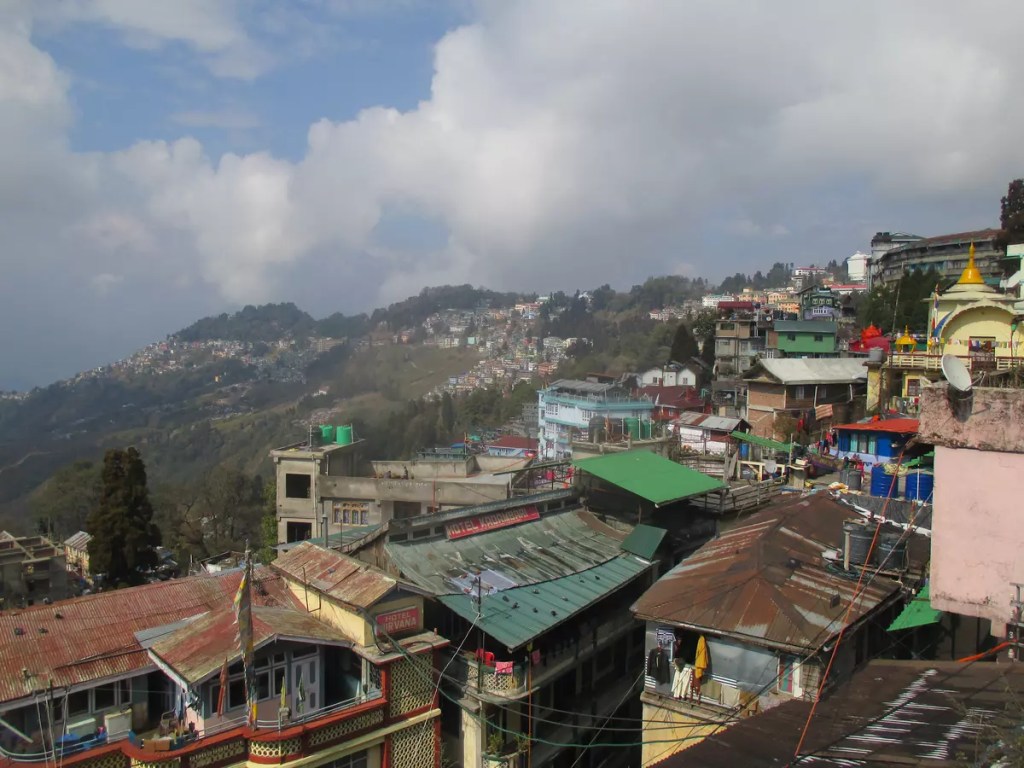
Darjeeling is synonymous with tea all over the world. No other flavour is believed to be finer than those grown here. Darjeeling, also called the queen of the hills, sits like a crown over the sweetest part of India a.k.a Bengal. The name Darjeeling has been derived from the Tibetan language and it translates to ‘land of the thundering bolt’.
For a budget traveller who loves walking around, Darjeeling is heaven. Supplemented by cheaper travel options at certain zones, this hill town has a lot to offer to a thrifty traveller. In this guide, I have tried to compile a walking circuit of the places to visit in Darjeeling. This is based on my own trip in February 2019.
Darjeeling can be visited almost throughout the year. However, it is better avoided during monsoon when landslides are frequent. Winters are pretty cold with occasional snow and excessive tourism has brought in a water crisis, especially during summers. Hence a humble request, whenever you visit a beautiful place like Darjeeling, be a responsible traveller/tourist.
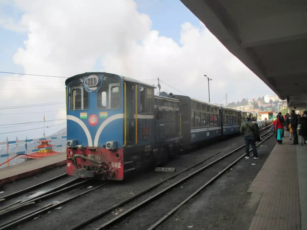
Siliguri, 63 km, is the main entry point to Darjeeling. The Hill Cart Road connects the two cities. Taxis (TATA Sumo) are easily available on a sharing basis (₹ 200/- per head) from Siliguri to reach Darjeeling. The cheaper option (₹ 103/- per head) is to travel by North Bengal State Transport Corporation (NBSTC) buses that ply every hour in the morning from Tenzing Norgay Bus Terminus in Siliguri. It takes almost three hours by either means to ascend the hills provided there is no traffic. Besides roadways, Darjeeling has its own railway head — a part of the heritage Darjeeling Himalayan Railways (DHR). The New Jalpaiguri (NJP) Jn. near Siliguri is a major railway station that has connectivity to the rest of India. The 52541 NJP DJ Passenger is the only train connecting NJP to Darjeeling daily. The journey on this narrow-gauge heritage train takes nearly seven hours (minimum fare is ₹ 1420/-). The Bagdogra airport is for those who prefer taking the aerial route.
At Darjeeling, the buses/sumos drop off at the Hill Cart Road taxi stand. In this guide, this will be the starting point of the walk for each circuit. With tourism booming, there are plentiful options at all budgets for staying in this hill town. Hotels on Gandhi Road are probably the most popular among tourists due to their central location.
Circuit #1:
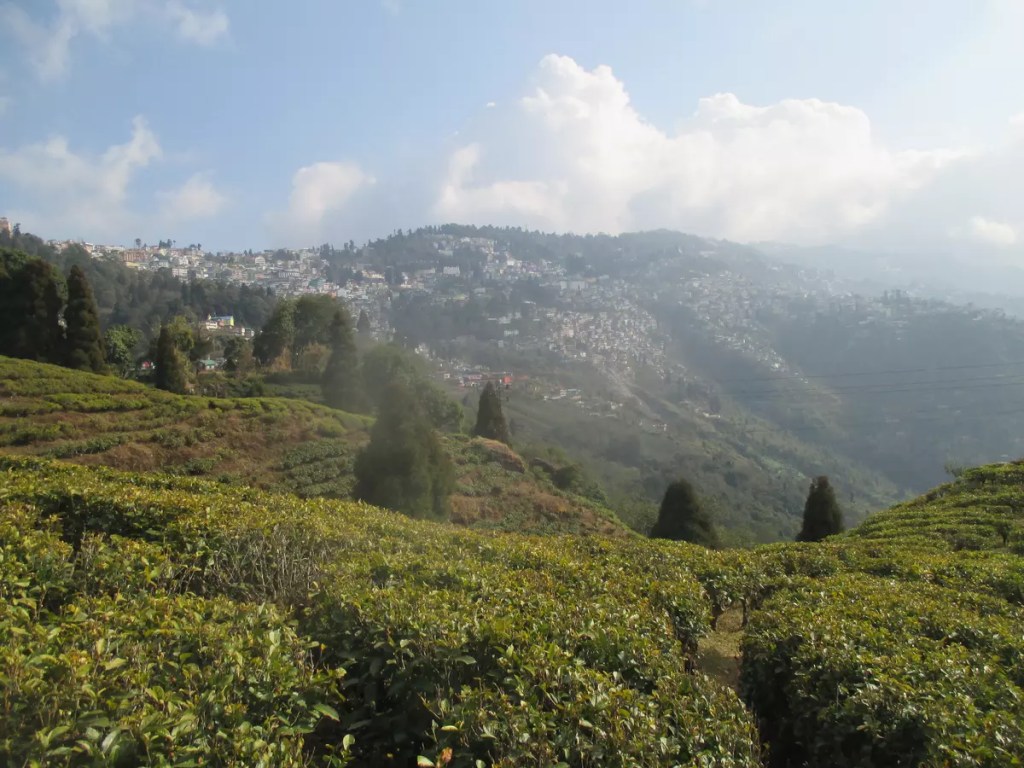
Starting from the taxi stand, walk towards Jorethang along the Lebong Cart Road for about one kilometre. The first stop on this circuit will be on your left. The Happy Valley Tea Estate is the second oldest tea estate in Darjeeling. From the Lebong Cart Road, a narrow road looping through the vast tea estate would take you downhill to their factory. The estate offers a guided tour of the tea-making process at their factory along with a session of tea tasting. The guided tour is chargeable at ₹ 100/- while it is free to go around the plantation. As a souvenir, you can buy the best of their teas from the factory outlet.
Climb back up to the Lebong Cart Road and continue a few steps forward. On the right will be the Darjeeling Old Cemetery. This cemetery is often regarded to be one of the hidden gems of Darjeeling. Rarely frequented by tourists, the cemetery is the resting place of early British settlers. The place offers a wonderful view of the Happy Valley Tea Estate below and on a clear day the snow-clad Himalayas. It is open daily from sunrise to sunset and entry is free.
Another 500 m down the same road is a tri-junction where the Robertson Road running downhill joins the Lebong Cart Road. Climb up the incline of Robertson Road and you will reach the gates of Padmaja Naidu Himalayan Zoological Park or what is commonly known as Darjeeling Zoo. This zone also houses the Himalayan Mountaineering Institute (HMI) and the Bengal Museum of Natural History (BMNH). A combined fee of ₹ /- is charged for entering this place. The zoo, spread over an area of 67.56 acres, is the largest high-altitude zoo in India and specializes in breeding animals adapted to alpine conditions. The HMI was started back in 1954 following the first ascent of Mt. Everest by Tenzing Norgay and Edmund Hilary the previous year to promote mountaineering as an organized sport in India. Today, HMI has become the hub of mountaineers aspiring to capture the heights of the Himalayas. Tourists can access only a limited area of the institute that includes a museum, activity zone and a theatre. The museum houses memoirs of Indian expeditions to several heights across the world besides mountaineering artefacts. The BMNH, as the name suggests, is a collection of flora and fauna samples from all over the state of West Bengal. From what it started in 1903 as a small museum, today it houses numerous bird and animal specimens, including skulls, horns, head mounts and skins.
After exiting from the zoo keep walking straight towards the Mall. The Shrubbery Nightingale Park is about one kilometre from the zoo. Situated in the Richmond Hill area, this oval-shaped park provides a picturesque view of the Eastern Himalayas. The park also houses a giant statue of Lord Shiva along with an associated temple.
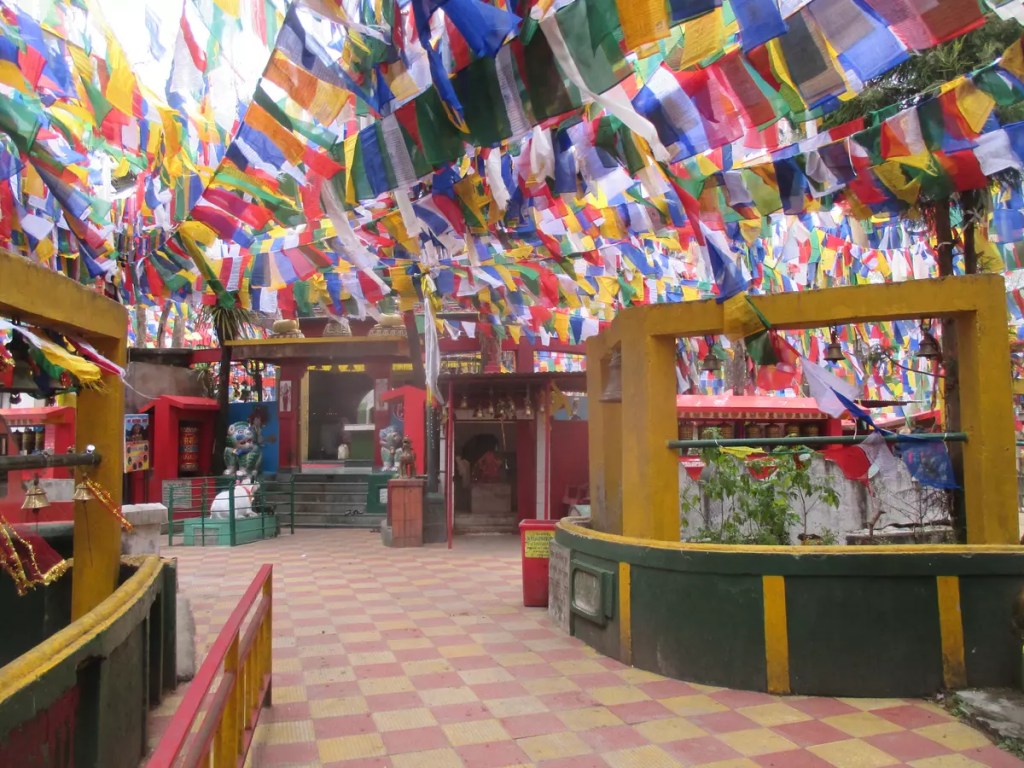
Further along, Robertson Road on the left is Raj Bhawan or the Governor’s house. Near the entrance of the Raj Bhawan is a four-point crossing. From here take the Mall road going left. This stretch of the road is a no-vehicle zone. There are a few viewpoints here where you can sit and relax along with some hot tea brewed by local women. Towards the Mall end of the road, is the entrance to Mahakal Mandir. This is one unique temple you can see in Darjeeling. Sitting atop the Observatory Hill, this temple dedicated to Lord Shiva is an amalgamation of Hindu and Buddhist religions. The sound of the temple bells along with the fluttering of the prayer flags provides a unique aura to this place.
Circuit #2:
If you have not taken a ride on the toy train yet, head to Ghoom early morning and catch the 52587 Kurseong-Darjeeling Passenger that leaves Ghoom at 8.35 am. Apart from the two daily trains mentioned earlier, DHR operates joy rides for tourists from Darjeeling to Ghoom and back with halts at Batasia Loop and Ghoom. Seats for these rides can be pre-booked online through IRCTC. The charges are between ₹ 1000/- and ₹ 1600/- depending on the type of train — steam engine or diesel engine hauled. If you are tight on a budget like me, take a taxi to Ghoom early morning and then return by the passenger train. The Ghoom railway station is itself iconic being the highest railway station in India.
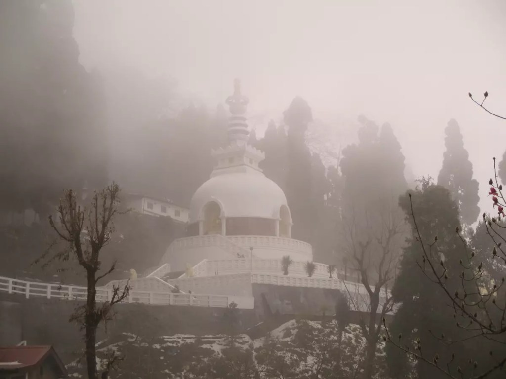
After reaching back to Darjeeling start the main walk of circuit #2. Our first destination — the Japanese Temple and Peace Pagoda. Ask for the stairs to reach the road to the Japanese Temple or alternately look for St. Columba’s church near the station. This church was built in 1894. The stairs connect Hill Cart Road to Gandhi Road. On reaching the top, take the right and move up towards Hotel Villa Everest along the Lal Kothi Road. The temple is merely 1.5 km from here but the climb may make it a bit tiring. Peace Pagodas are Buddhist stupas built to inspire peace in the world. Most of these monuments were built after World War II and the one at Darjeeling was dedicated in 1992. The Nipponzan Myohoji Buddhist Temple or Japanese Temple is a two-storeyed Japanese-style building located near the Peace Pagoda.
Enjoy the downhill walk now. Take your steps back through the Lal Kothi Road, passing via Hotel Villa Everest to Gandhi Road. At around two kilometres from the Peace Pagoda, near the Gandhi Road and Laden La Road crossing, is Darjeeling Clock Tower. The clock tower is a part of the current-day Darjeeling Municipality building. It was constructed in 1850 and served as the Town Hall of Darjeeling before being converted to a municipality office. A few meters from the clock tower is another UNESCO World Heritage site — Darjeeling Head Post Office. It was opened in 1921 and is one of the oldest post offices in the region.
From here, follow the Nehru Road up to Darjeeling Mall. The Nehru Road and Mall are one of the most vibrant areas of Darjeeling and are popular among tourists for street shopping and food. Two of the iconic restaurants – Keventer’s and Glenary’s are located here. From the Mall, we head to Bhutia Busty Monastery. As you reach the flats of the Mall through Nehru Road, the C. R. Das roads run downhill on the right and lead to Bhutia Busty monastery. This is another beautiful place unfrequented by tourists. Along the way is the Deshbandhu Museum, a two-storeyed white building on the left. This is the house where Deshbandhu Chittaranjan Das stayed during the last few months of his life.
Return to the Mall and take the NCC Road on the left of the stage to reach St. Andrews Church. This is an old Anglican church built in 1843. On the way, you will also see the Gorkha Ranga Manch (Bhanu Bhawan) on the left. The church is just opposite to it. Going further along the NCC Road would take you near the gates of Raj Bhawan.
Circuit #3:
A day for a long morning walk. Start early and head to Ghoom in a shared taxi. You would be dropped off at Ghoom Railway station. Start walking back towards Darjeeling. The first stopover en route is Ghoom monastery at nearly one kilometre. This monastery is one of the oldest monasteries in Darjeeling and houses a 12-foot statue of Maitreya Buddha.
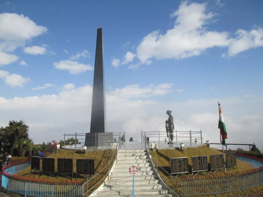
Further 1.2 km towards Darjeeling is Batasia Loop. Batasia loop is an example of an erstwhile engineering marvel. The height difference between Darjeeling and Ghoom was too steep for the steam locomotives to ascend, hence a double spiral loop was designed to negotiate the climb. The hill around which the railway track loops has a beautiful garden and houses the Gorkha War memorial at the centre. On a clear day, one can get a wonderful view of the Kanchenjunga range.
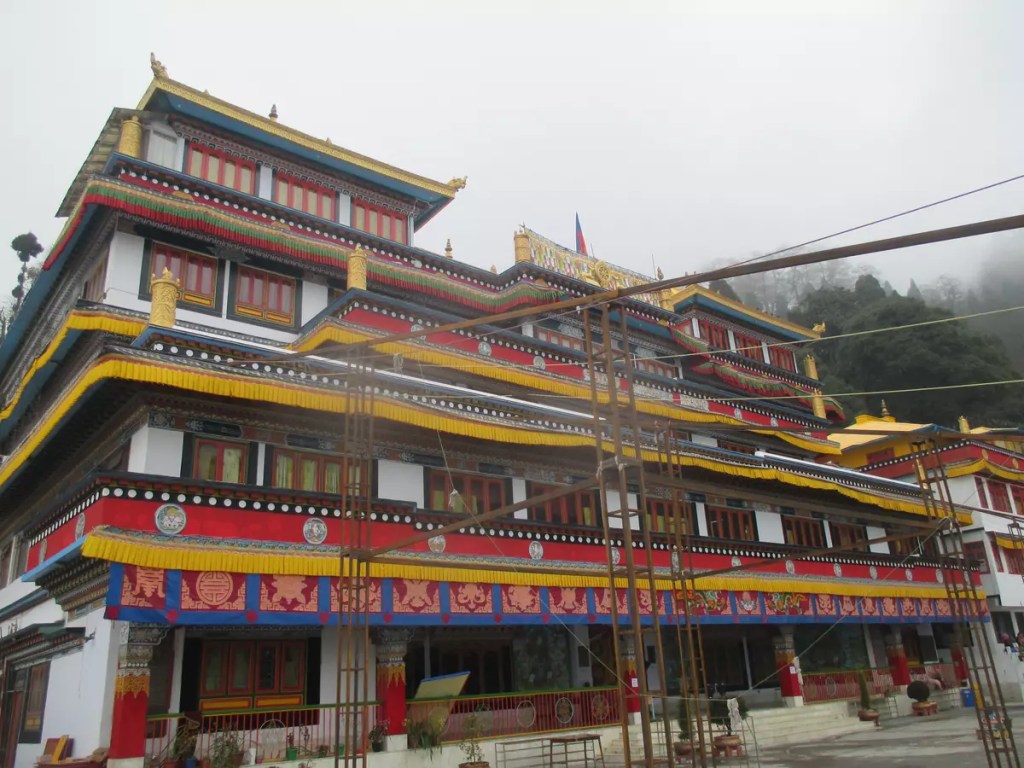
The third point on this walk is Dali Monastery, 1.5 km from Batasia Loop. The Sangag Choling Monastery (or Dali Monastery) is an ornate, colourful monastery built in typical Tibetan style along the steep hill as you enter Darjeeling. The monastery is open from early morning till evening.
Dheerdham temple, the final point on the walk is just below the Darjeeling Railway station. This temple dedicated to Lord Shiva is a look-alike of the Pashupatinath temple of Kathmandu, Nepal.
My trip:
The three circuits mentioned above are based on how I travelled over three days in Darjeeling. On day 1, I had taken the first bus at 6 am from Siliguri and reached Darjeeling by 11 am. After settling down it was almost 1 pm when I started my walk along Circuit #1. As it was an unplanned trip it took me some time to figure out the routes I should take. On day 1, I could visit only the tea estate, HMI and BMNH, Mahakal mandir and the Mall. Exploring half of the zoo is still pending. I visited Shrubbery Park on Day 2 after completing Circuit #2. On day 3, I started early and completed circuit #3 well before noon and took my return bus to Siliguri. Below is a list of several other suggested tourist places that I could not visit during my trip in February 2019 and hence could not include in the guide.
Other tourist spots:
Tiger Hill: Watching the sunrise from Tiger Hill is among the must-do things in Darjeeling. The changing colours of Kanchenjunga as the sunlight strikes the mountain is a visual treat. Tiger Hill is located 11 km from the town at an altitude of 8400 feet. It is advisable to start as early as 3.00 am from Darjeeling to secure the best spot at the watchtower.
Ava Art Gallery: The gallery established in 1965 showcases the works of one of the geniuses in the field of embroidery art, Ava Devi. It is located on the Hill Cart road between Dali Monastery and Darjeeling railway station and can be clubbed along circuit #3 walk. It is open from 8 am to 12 pm and again from 1 pm to 5 pm. There is no entry fee to visit the art gallery.
Rock Garden Darjeeling ropeway Rangeet Valley Tea Garden Tenzing and Gombu rocks
Here’s a map of the tourist places and the circuit. More pictures from the trip are on my Instagram profile @ag1805x. Use the hashtag #ag1805x_in_Darjeeling.
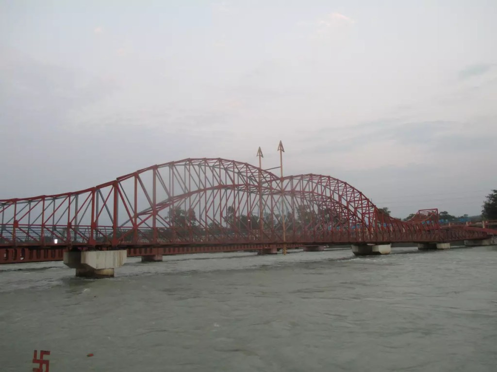
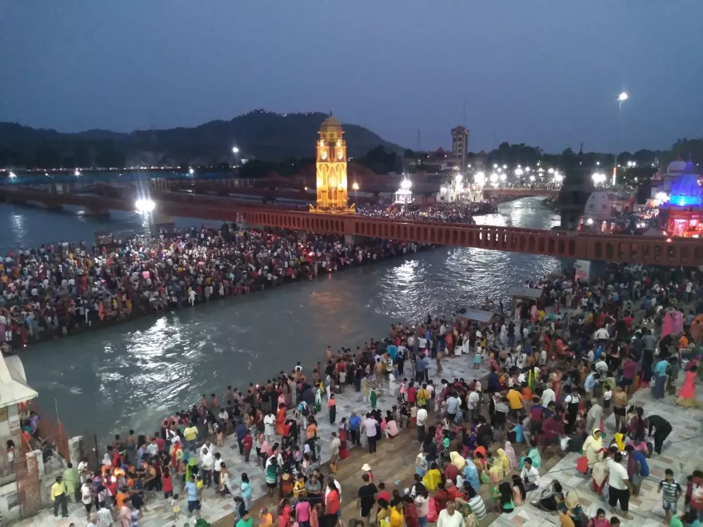
To visit places within the Garhwal circuit, including the Chota Char Dham, Haridwar is the starting point. The Haridwar Jn. (HW) on the Delhi-Dehradun route has direct trains to major cities like Delhi, Kolkata, Mumbai, Madurai, etc. The Jolly Grant Airport, 44 km from the city provides air connectivity to the rest of the country. Ample bus services are also available from the neighbouring states — Uttar Pradesh, Haryana, Punjab — to reach Haridwar.
As I was based in Allahabad, I took the 14163 Sangam Link Express, the only daily train between the two stations. This is a bit slower train and one can also board the tri-weekly 14115 Prayag Ghat (PYG) – Haridwar (HW) Express. The scheduled arrival time for Sangam Express is 10:48 hours while for the PYG-HW Express is 14:15 hours. Taking either of these trains allows enough time to explore Haridwar before heading to the higher altitudes. Additionally, with Indian Railways being well known for their punctuality, the time can be kept as a buffer to avoid delay in further plans.
At Haridwar, hotels that fit all budgets can be easily found outside the railway station and they are also available online through MakeMyTrip, GoIbibo, etc. I had put up for the night at the IRCTC retiring room at the station compound. As per the rule, it has to be booked online and there are no provisions for offline booking (₹155/-).
Haridwar to Govindghat
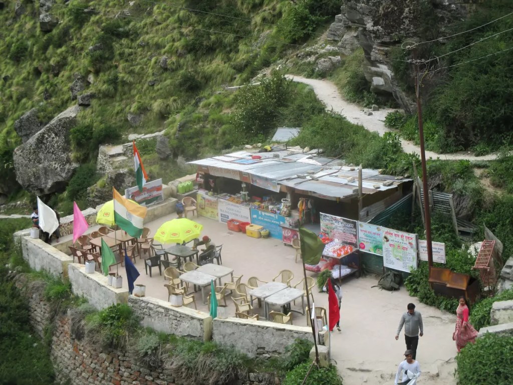
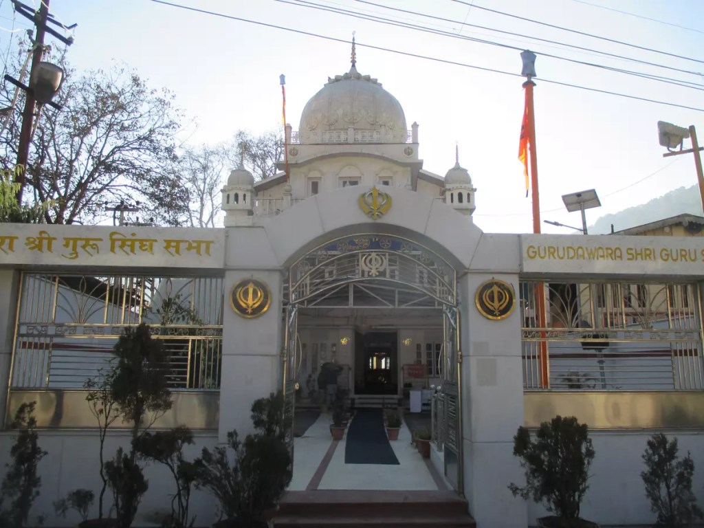
Govindghat is 295 km from Haridwar on NH-58 to Badrinath. Uttarakhand Transport Corporation (UTC) and Garhwal Motors Owners Union (GMOU) Ltd. operate daily bus service on this route. Tickets for UTC buses can be obtained online (₹560/-) while for GMOU buses it has to be booked from their office near ISBT Haridwar in advance (₹460/-). An alternate option, in case no tickets are available, is to break the journey at Joshimath. UTC bus to Joshimath leaves Haridwar ISBT at 5:30 am. I took the GMOU bus that leaves at 2:30 am (₹400/-). After about 13 hours of journey on the mountainous roads, passing through the panch (five) Prayags — Devprayag, Rudraprayag, Karnaprayag, Nandprayag and Vishnuprayag — the bus dropped me at Joshimath at 3 pm. From Joshimath, bolero on a shared basis is available to reach Govindghat (₹50/-). As this place has better hotels than in Govindghat, people often prefer to spend the night here and then continue the next day early morning. However, staying at Govindghat can save some precious time and stress the next day. Govinghat has few decent hotels besides the grand Gurudwara where I stayed. It is the preferred stay for most pilgrims and solo travellers like me and is provided on a first come first serve basis.
Govindghat to Ghangaria
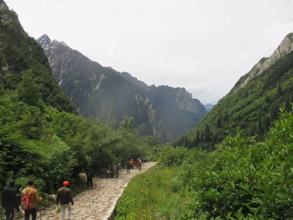
The hike to Ghagaria starts after crossing over to the left bank of Alaknanda. The initial 5 km to Pulna village has a motorable road and can be covered on TATA Sumo (₹40/-) available near Gurudwara. As there is limited parking at Pulna, it is advisable to leave your vehicle at the paid parking lot at Govindghat. From Pulna, the path is well built along the right bank of Lakshman Ganga that flows down from Hemkund and merges with Alaknanda at Govindghat. Horses and baskets can be hired from here if needed to avoid walking. The path to Bhyundar village is a mix of highs and lows and allows for a comfortable hike. After crossing over to the other side of Lakshman Ganga at Bhyundar, the hike is extremely steep and tiring. It took me about five and a half hours to cover the 9 km distance between Pulna and Ghangaria. An alternative to this tiring hike is a helicopter ride from Govindghat. The Ghangaria helipad is approximately 1 km before the village. For hikers, the same helipad offers a nice spot to relax before the final ascend. Between Pulna and Ghangaria there are several pit-stops where one can buy food and drinks. Provisions for toilets are also available. One thing that might be kept in mind during this trek is, that things get costlier as you go higher on the hills, often double or triple the MRP.
Ghangaria (10,003 ft) is the base camp to visit the Valley of Flowers and Hemkund Sahib. At Ghangaria, I stayed at the GMVNL tourist rest house dormitory (₹ 300/-). Hotels are also available here but no online booking facility. The Gurudwara also has accommodation for visitors. For food, numerous eateries are serving all varieties of taste. Recommendation: There is a man selling hot gulab jamun just after crossing the Gurudwara.
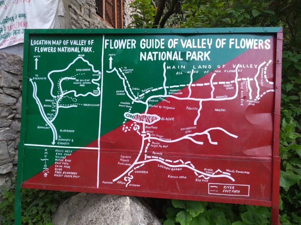
Valley of Flowers (VoF)
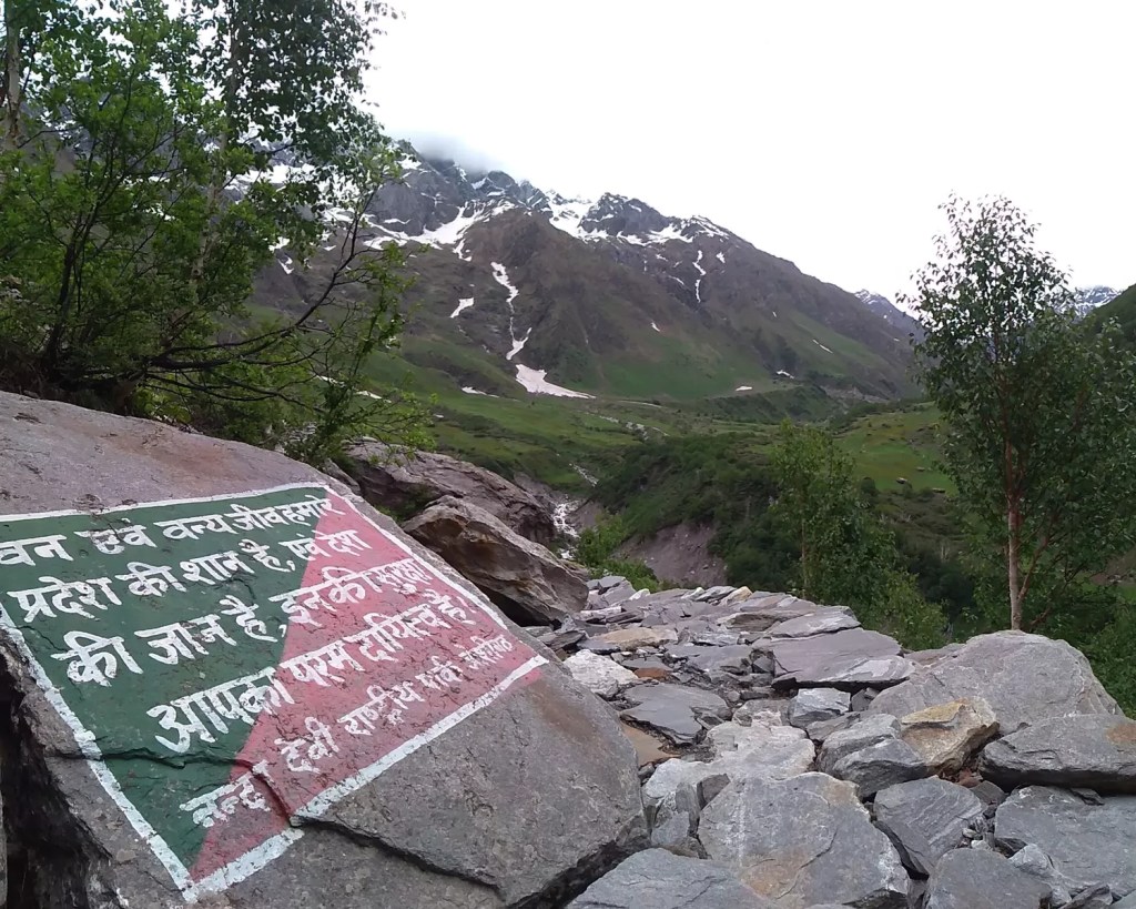
The VoF opens for tourists on the 1st of June and closes around October/November end every year. The time for the visit is 7:00 am to 5:00 pm. No one is allowed to stay/camp inside VoF as it falls under Nanda Devi National Park. At Ghangaria, start your day early to reach the checkpoint by 7:00 am. After getting out of Ghangaria, the road bifurcates into two — the way up straight to Hemkund Sahib and the one going left leads to VoF. Permission for entering VoF can be obtained from the checkpost on furnishing ID details and a fee of ₹ 150 per person. This permit is valid for three days.
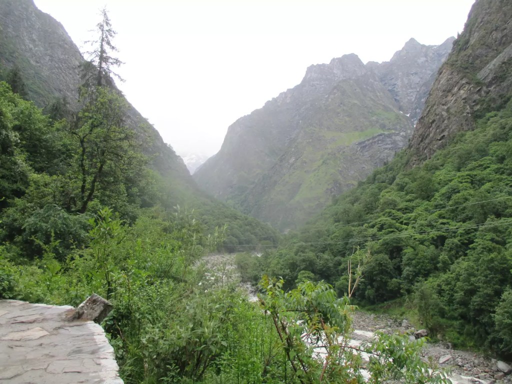
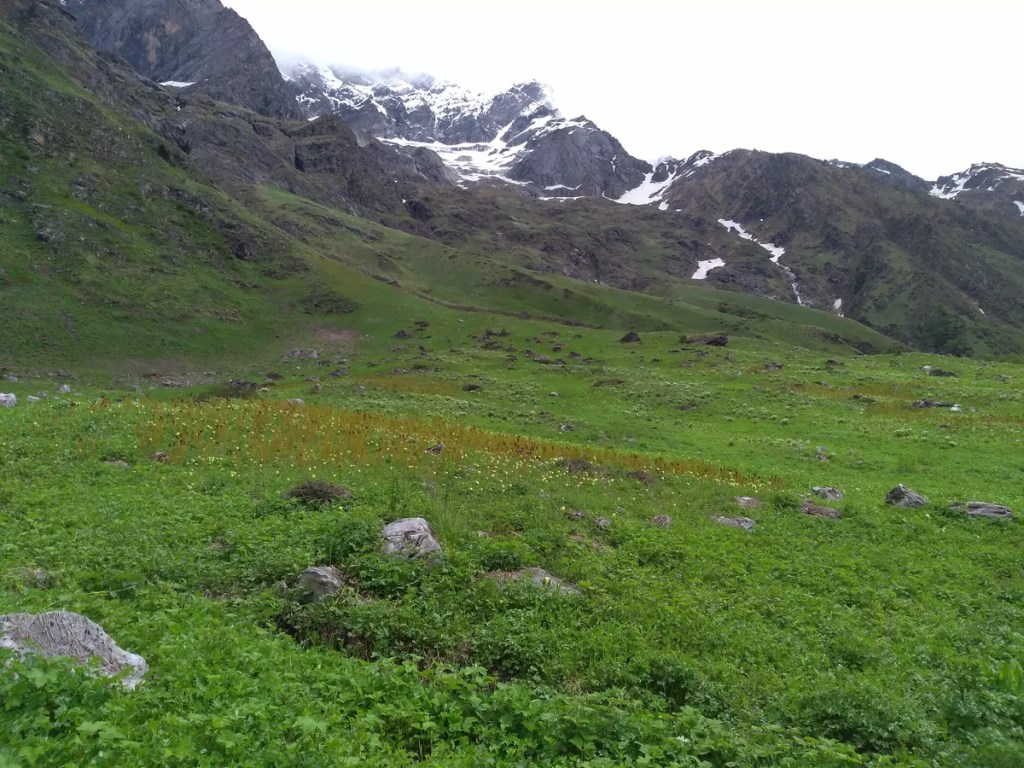
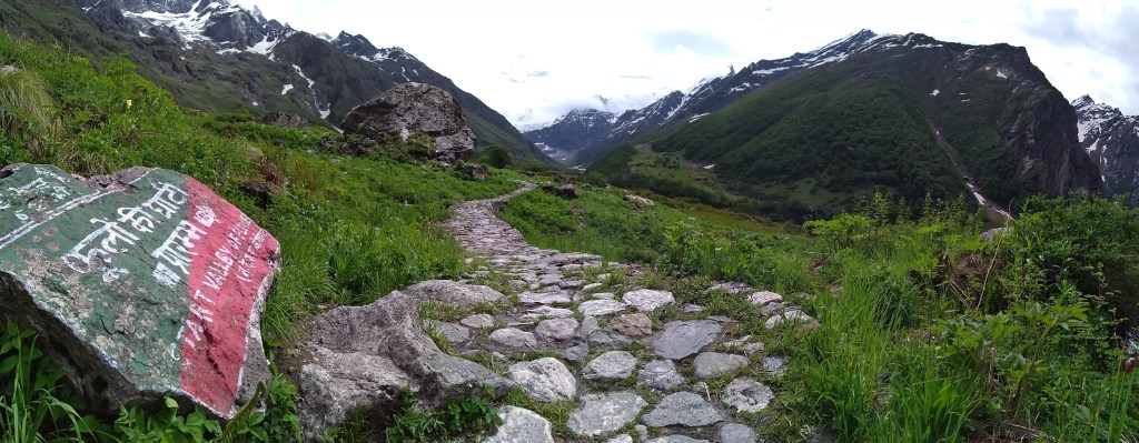
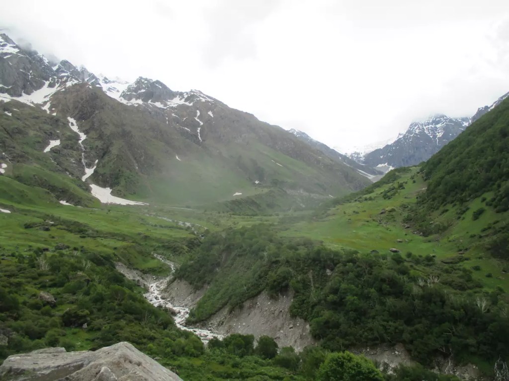
From the checkpost to the starting point of VoF is 4 km. The path initially follows the left bank of the Pushpawati River for some time and then crosses over to the right, after which is a steep climb. However, the dense forest and the chirping birds have a soothing effect. This zone is a bird-lover paradise. After reaching a certain height, the forest clears up bringing into view the snow-clad peaks and the valley below. Two glaciers on the trek are particularly challenging and pump up the adrenaline.
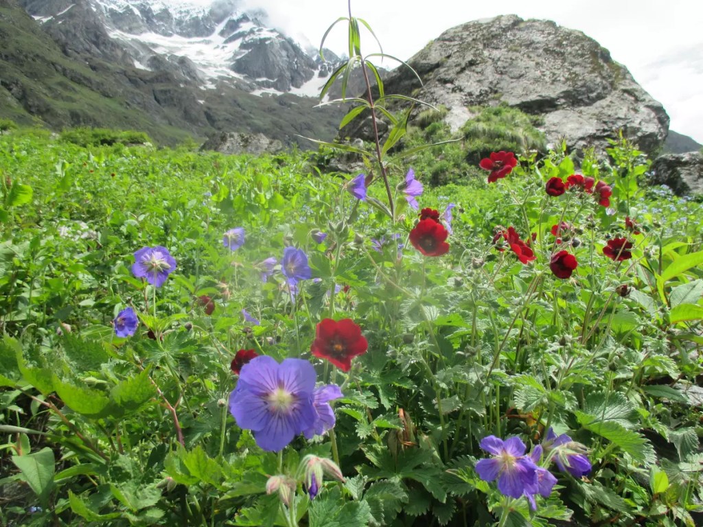
The peak season for flowers to bloom is between mid-July and mid-August. This is also the time when tourists are plenty. When visited in June last week, there were very few flowers and fewer people. In fact, I only encountered 8-10 people on the trek. The months of May and June are high time for pilgrims visiting Hemkund Sahib.
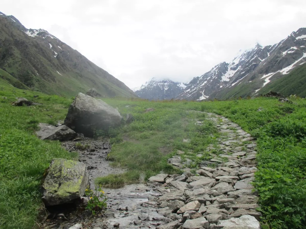
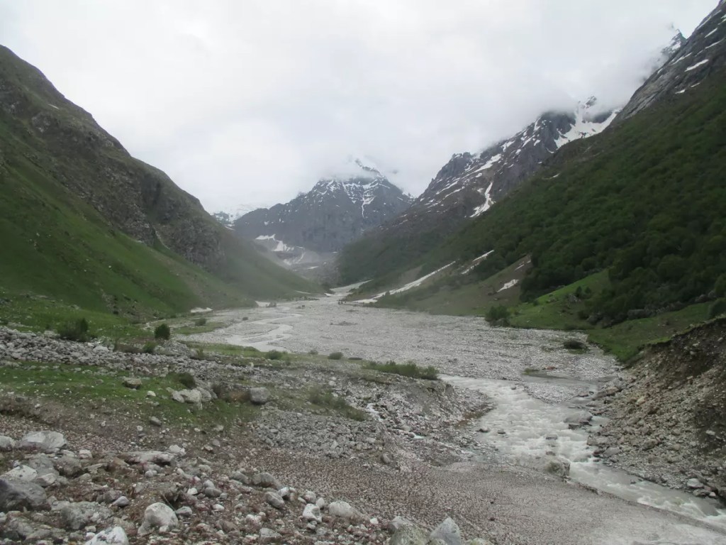
There are three main points on this trek. The first point, nicknamed picnic spot is a sloping grassland, which is at the start of the valley. According to staff, most people on a casual visit return from this point. As you go further along the marked path, it divides into two. The second point — Grave of Joan Margaret Legge, is on the track that goes down from here. She was one of the first who came here to document the flowers of this valley. However, before her work was complete, she met with a tragic accident that took her life. Surprisingly, when I visited, this was the only spot with dense blooming flowers. The Pushpawati river bed is the last point on the trek I could reach. From here, the Tipra Khark glacier, the origin of the Pushpawati River can be seen. As there are no eateries within the national park, visitors are advised to carry their food for the almost 5-hour walk one way. However, I request everyone not to litter this pristine place and bring back everything you took in.
Hemkund Sahib
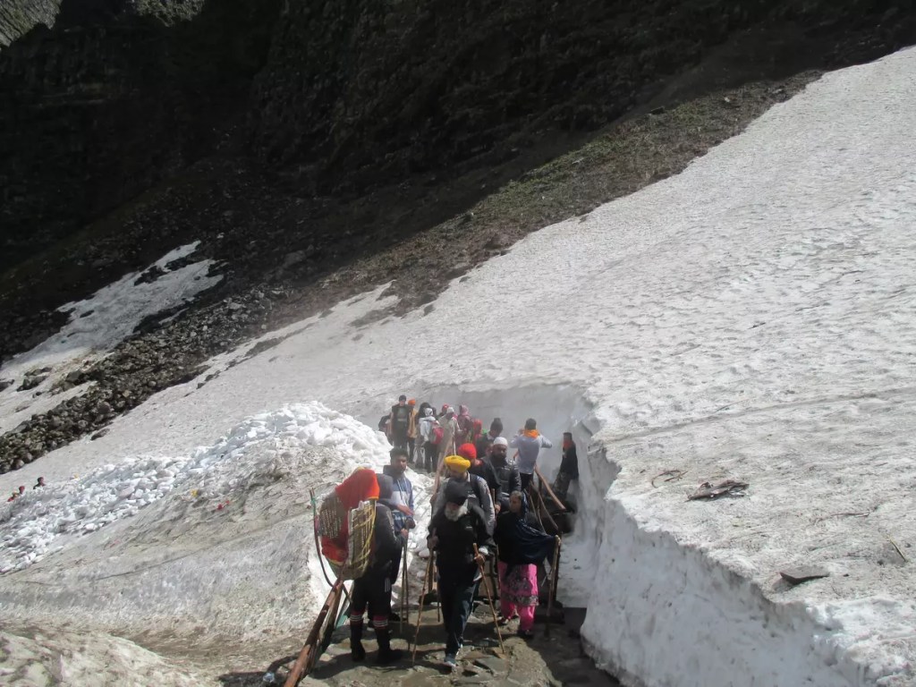
The 6 km path to Hemkund Sahib is steep throughout. However, unlike VoF, horses and baskets are allowed on this route and have eateries. In June, the final 2 km had thick layers of snow and the lake was mostly frozen.
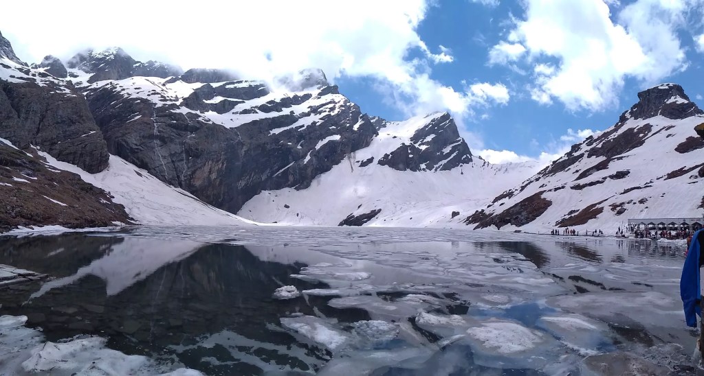
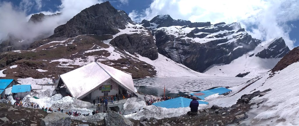
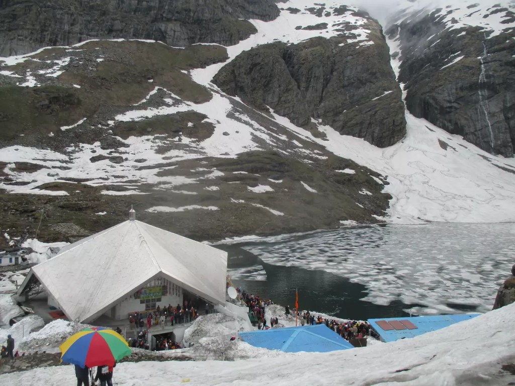
Hemkund is a picturesque glacial lake surrounded by towering mountains. It is also the starting point of Lakshman Ganga. At 15,197 ft, the star-shaped Gurudwara is one of the highest in the world. It was at this place the tenth Sikh guru, Guru Govind Singh meditated in one of his earlier births. Though this place is known to be revered by Sikhs, it is also a place of religious importance for Hindus. A temple dedicated to Lakshman is located just beside the Gurudwara. He is believed to have regained his health by meditating on the serene banks of Hemkund.
Once the ice melts, a clear reflection of the gurudwara, temple, and surrounding mountains can be seen on the lake. Apart from offering prayers at the gurudwara and the temple, things to do include taking a dip in the frozen lake and tasting the hot khichdi langar.
Mana and Badrinath
Start your descent early from Ghangaria. If you are planning a return to Haridwar on the same day, you have to be at the Govindghat bus stand by 7:00 am. Still, there would be no surety of getting a seat in the packed buses that come from Badrinath. I took it a bit easy. Started my descent at 6:00 am from Ghangaria and reached Govindghat by 9:30 am. I was again in the clutches of my mobile phone. Forgot to mention before, that only a patchy (in fact no) network of BSNL is available beyond Govindghat. For three days, I was totally out of contact but it felt amazing.
Heading to Badrinath might be trivial. Limited public transport ply on this route and often they come full from Joshimath. Taxi (TATA Sumo/Alto) can be hired or if sufficient passengers are available an arrangement on a sharing basis can be made. After waiting for some time, I got a Sumo that was headed to Mana (₹ 130/-). Mana is 50 km from Govindghat and takes two hours to cover the steep roads with sharp hairpin bends.
Mana is the last Indian village on this side. The China border is 25 km from here. Apart from this, Mana has its own place in Hindu mythology. Mahabharat is said to have been written here. Cave temples dedicated to Ved Vyas and Ganesh are important attractions here. A rock bridge known as Bheem pul is said to have been built by Bheem on their way to Swarg or heaven. 5 km from Mana is Vasundhara Falls, another crowd puller to the village and another hike.
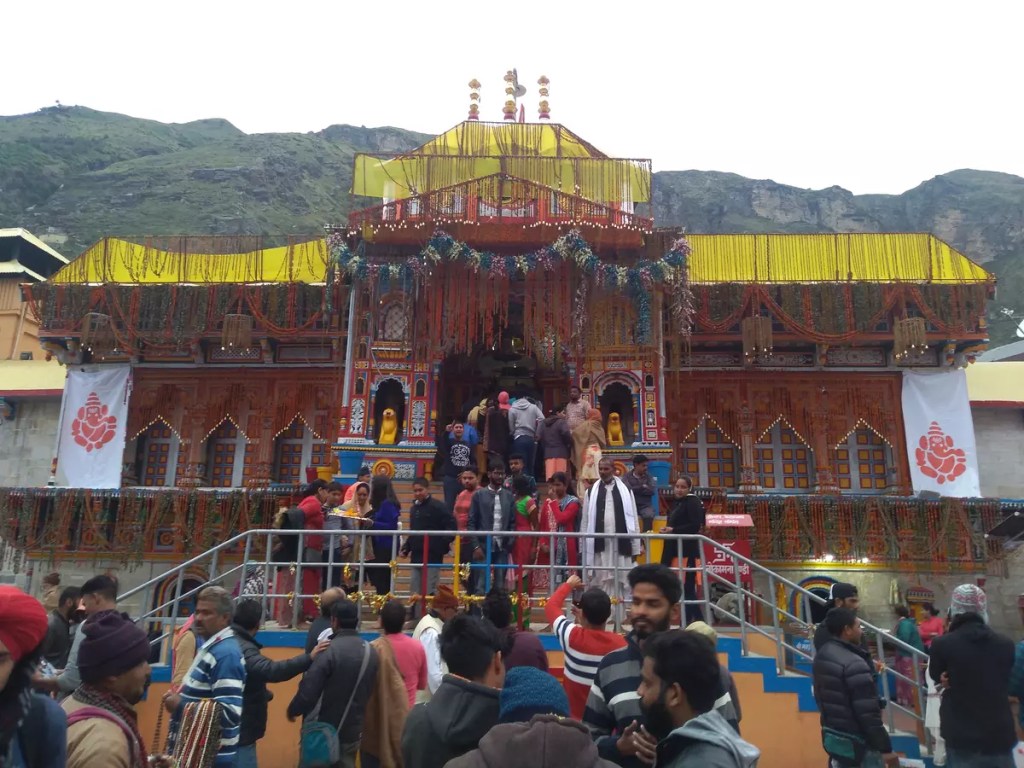
Mana is 3 km from Badrinath. The beautiful landscape literally compelled me to walk on the empty roads with my heavy backpack enjoying the view. The first thing I did on reaching the Badrinath bus stand was to secure a seat in Haridwar for the next day. At Badrinath, I stayed at the GMVNL Yatri Niwas dorm (₹ 300/-) and the evening was spent visiting the Badrinath temple and the nearby markets.
Return journey
The GMOU buses leave for Haridwar early at 5:30 am. With pit stops at Pipalkot for breakfast, near Devprayag for lunch and coping through a tyre burst, I reached Haridwar at around 6:00 pm. Next up was another challenge on how to reach Allahabad or at least Lucknow. With calculated risk, I booked a waiting list ticked on 12370 Howrah SF Express till Lucknow. On chart preparation, my WL133 luckily got converted into RAC. The next morning I was on time at Lucknow and by noon back to the 40°C of Allahabad.
This post is based on my trip to the Bhyundar Valley in June 2019. More pictures from this trip are on my Instagram profile. Do give them a visit.
“Once a year go to a place you have never been before.”
This quote by Dalai Lama has become one of my favourites in the last few years. I have even tried my best to follow it by visiting a new destination on the first day itself or at least in the first month. I was in Hyderabad during the new year 2016 and in Kerala on the Pongal holidays 2017. 2018 was a bit loose and had to wait till March to visit Gwalior. In 2019, I was back to celebrate the new year in a new destination – NAINITAL. The 2018 year-end trip was another milestone as Uttarakhand became the 18th Indian state I touched down at.
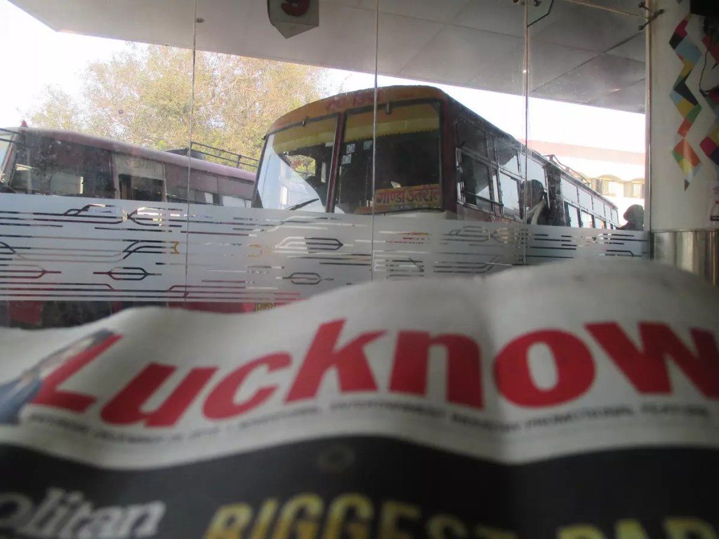
I tried hard to cut down costs by availing the Indian Railways but luck would not have it and it had to be a road trip. I started from Prayagraj at 8:00am on 28th December 2018 bound for Lucknow. After around 5 hours of smooth ride, I was dropped off at Alambagh bus station in Lucknow. This newly opened bus stand, I must say, is one of the finest I have ever seen in India. The Chennai Mofussil Bus Terminus (CMBT) must have been the same when it was opened. As it was lunch time I visited the food court on the first floor and tried their aloo paratha served with pickle. The pricing has been kept within budget. The food court serves a variety of food at pocket-friendly prices.
This time I also got to try the Lucknow metro between Alambagh and Charbagh. During the time of my visit, it used to run only on a small section, covering 8 stations and hence very few passengers used them. The pricing may be another concern. My ride cost me ₹20/-. If I guessed it correctly, in Kolkata metro, it would have been ₹5 or ₹10/-. I put my stay at Hotel Anusuiya Palace booked on GOIBIBO at an amazing discounted price.
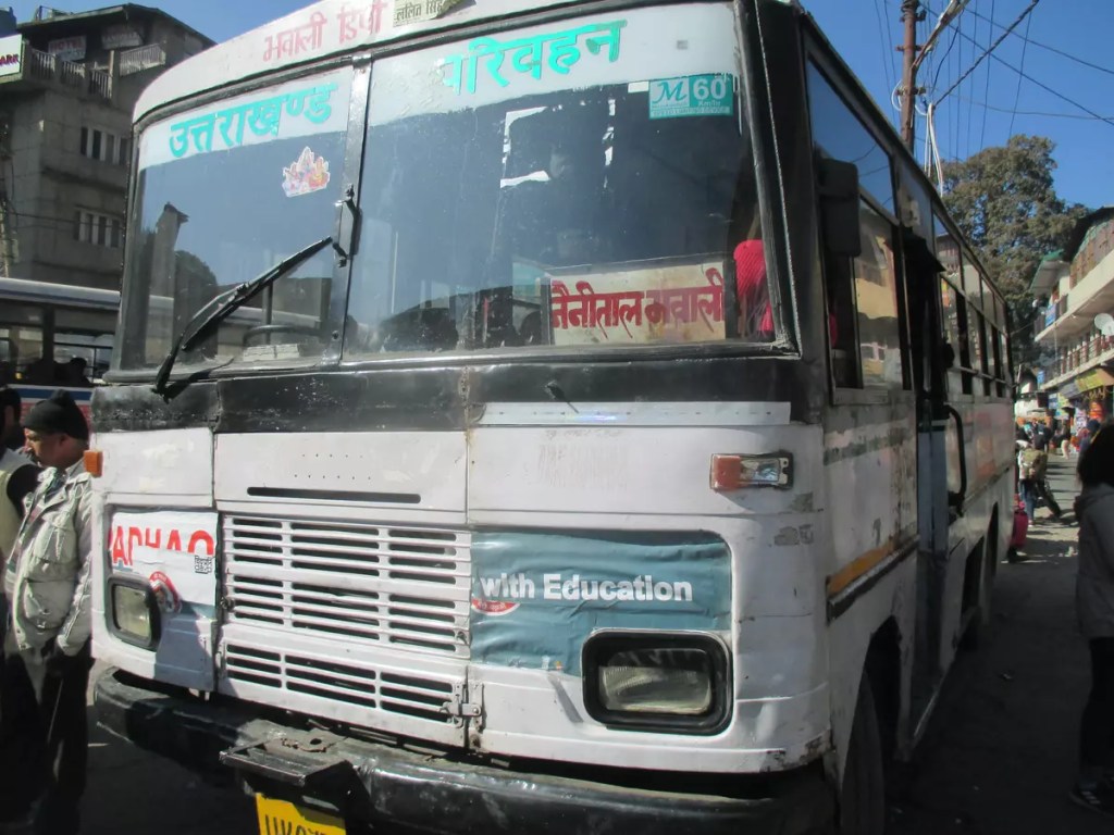
Fast forward to day 2. Post lunch I reached Kaiserbagh bus station to figure out how to reach Kathgodam. Luckily there was a direct bus at 5 pm. The Uttarakhand Transport Corporation (UTC) bus took around nine hours to reach Haldwani. Haldwani is the major bus stand in the region while Kathgodam is the railway terminus. Another UTC bus and 40kms later I finally reached my destination.
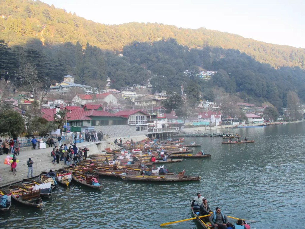
The beautiful morning sky with its beautiful orange hue greeted me. From the Tallital bus terminus in the chilly weather and a frozen foot, I started walking towards the Youth Hostel. My streak of luck finally came to a halt here. The accommodation was packed. After a lot of enquiring and walking around I reached from where I started in the morning at Tallital. I got a room at Dharmashala. Though not too luxurious, it was at par with its cheap price.
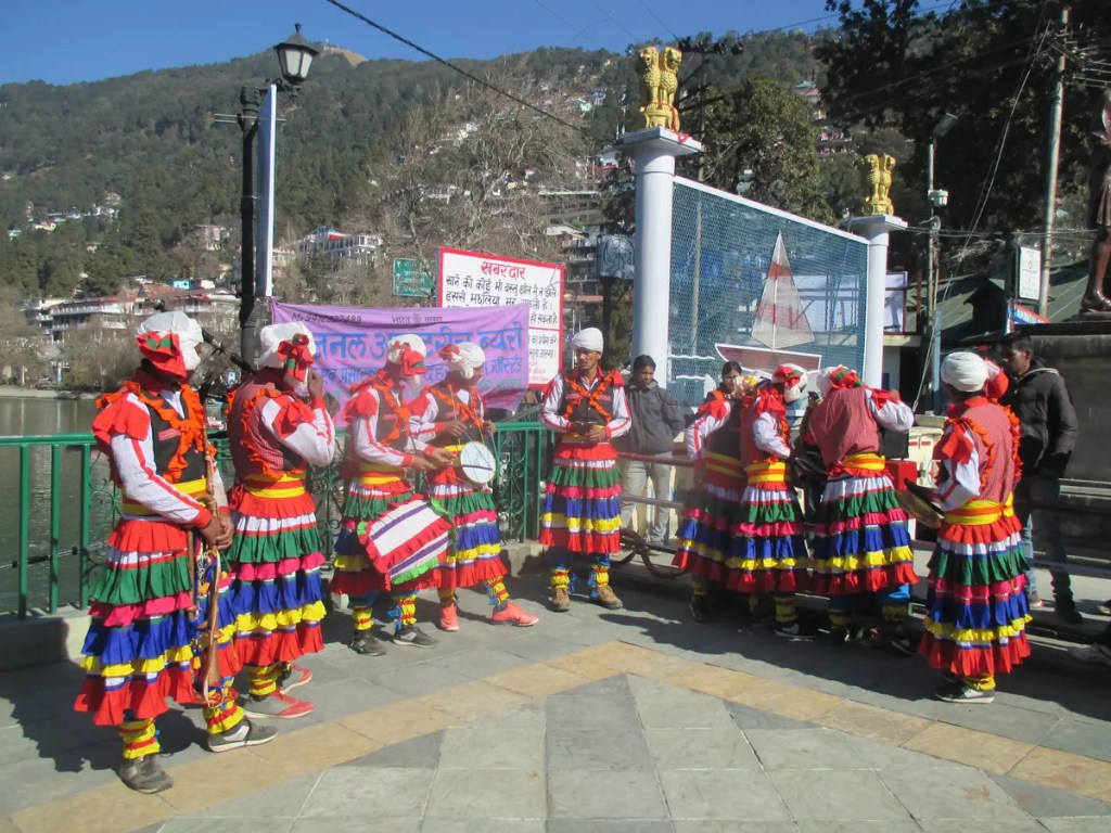
During this look around, I visited the Naina Devi Mandir and adjacent Gurudwara passing by the Flats and Jama Masjid. A walk through the opposite bank of Mall Road also sometimes called the Thandai Sarak, is just serene. I found very few people on this road. No vehicles are allowed here.
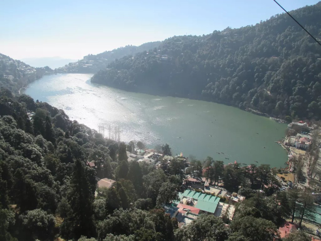
So finally after getting fresh, I started walking towards the Zoo, officially known as the G. B. Pant High Altitude Zoo. One can take a shuttle taxi that runs from Mall Road. The zoo located at the top of a hill on the eastern bank of Naini Lake gives a great view of the town below. Among other animals, the red panda is something new that I have never encountered in other zoos.
For the next four or five hours, I went walking towards the Bhowali road in search of a place called the Pines Old Cemetry which I had found on the internet. The only thing I found was a burning burning ghat down the hills.
The evening was spent window shopping at the Tibtian market and tasting some momos and coffee.
The last day of the year. My initial plan was to trek to Naina Peak, however, after walking to High Court and having a chat with the tea stall owner, I decided against it and went towards the Eco Cave gardens. One has to trek to the Naina Peak, but it passes through some forest area and the route is not well marked (at least as per the tea stall owner). The Eco Cave Gardens is a collection of six caves – Tiger Cave, Panther Cave, Porcupine Cave, Bat Cave, Flying Fox Cave and Ape Cave. Crawl and squeeze your way through them and then reach the hilltop viewpoint.
From here, I walked towards the Raj Bhavan road and started my walk towards Tiffin Top. Instead of going all the way down to Mallital from Suktal and then climbing up, a generous local guided me to a shorter route. It starts near the high court and passes through the hills on the west bank of the lake, just above the Thandi Sarak which I had visited the day before. On the Raj Bhawan road, the Db campus of Kumaon University is located. After passing this, we come to a tri-junction. Taking a U-turn towards the road that goes upwards, we pass through St. Anthonys College and then finally the Sherwood College. Amitabh Bachchan is an alumnus. The trek starts here. No cars can go beyond this point. This route is well marked and steep but the climb was worth it. The view of the snow-clad Himalayas just restores the energy. As a supplement enjoy some hot steaming coffee or momo or Maggi at the stalls there. To reach the top, there is an alternate route through Kaldungi Road from where one can take a horse ride to the top. If you are exploring Nainital by taxi, you would be taking this way.
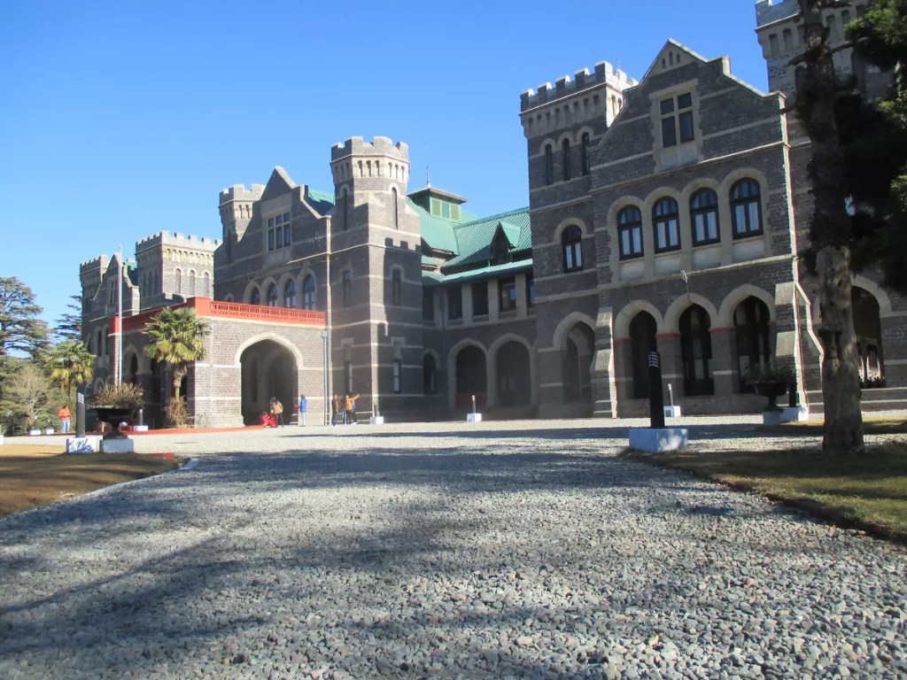
After descending, I visited the Raj Bhawan. Nainital is the summer capital of Uttarakhand. This is also the only Governor’s house in India that is open to the public. A half-an-hour guided tour of the complex is organized every hour. The building was built in 1897 and modelled on the Buckingham Palace of England.
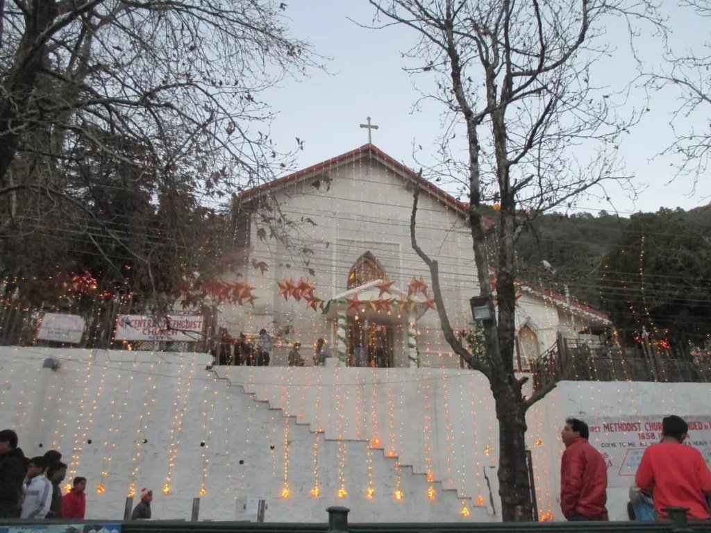
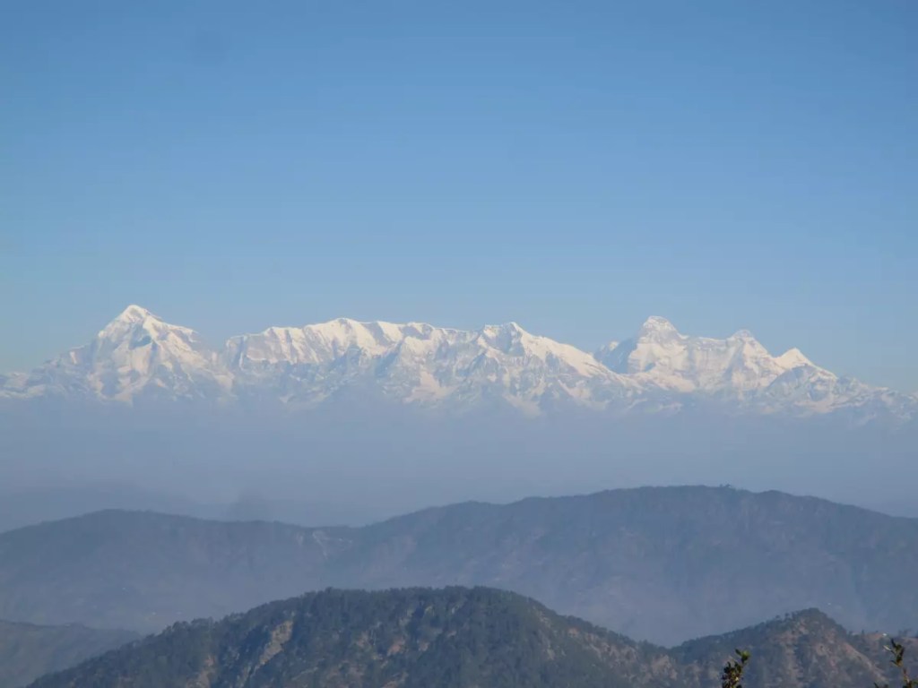
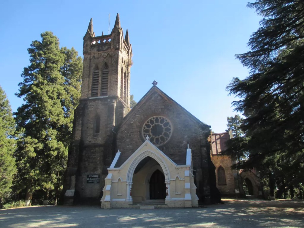
2019. Happy New Year everyone! The winter months are usually an off-season in Nainital except the few days before and after the first day of the year. The parking lots and the city get packed up for these few days. I checked out of my room early, kept my extra bag at a cloakroom near the Tallital bus stand and headed to experience the pride of Kumaon, the Nainital Ropeways. From Mallital the cable car climbs the steep hill in just about four minutes to the snow view point. From the two viewpoints here, one can get a clear view of the Himalayas. Climbing down I headed towards the final place on my list – St. John in wilderness church, a little-known church near High Court.
So finally after this, I signed off from Nainital and headed back home but with a detour via Bhimtal. From Nainital I first took a bus to Bhowali and then a sumo to Lake Bhimtal. As with Naini Lake, this one is also surrounded by hills but is larger. From Bhimtal a final four-wheeler ride to Haldawani and bus to Allahabad via Lucknow.
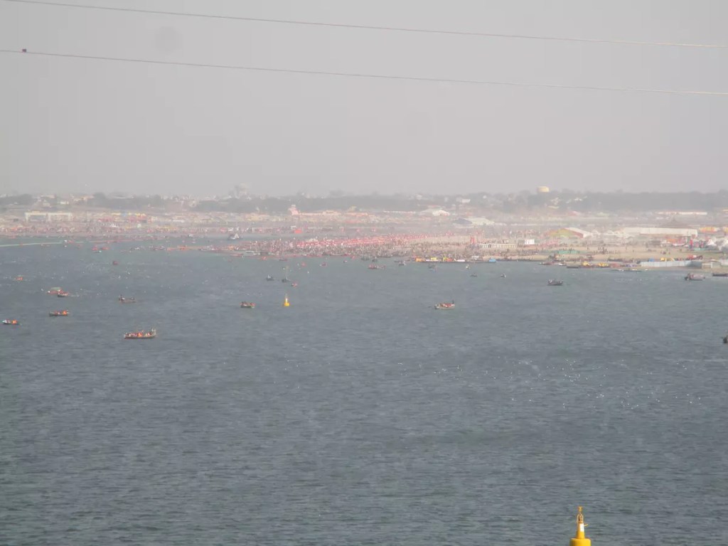
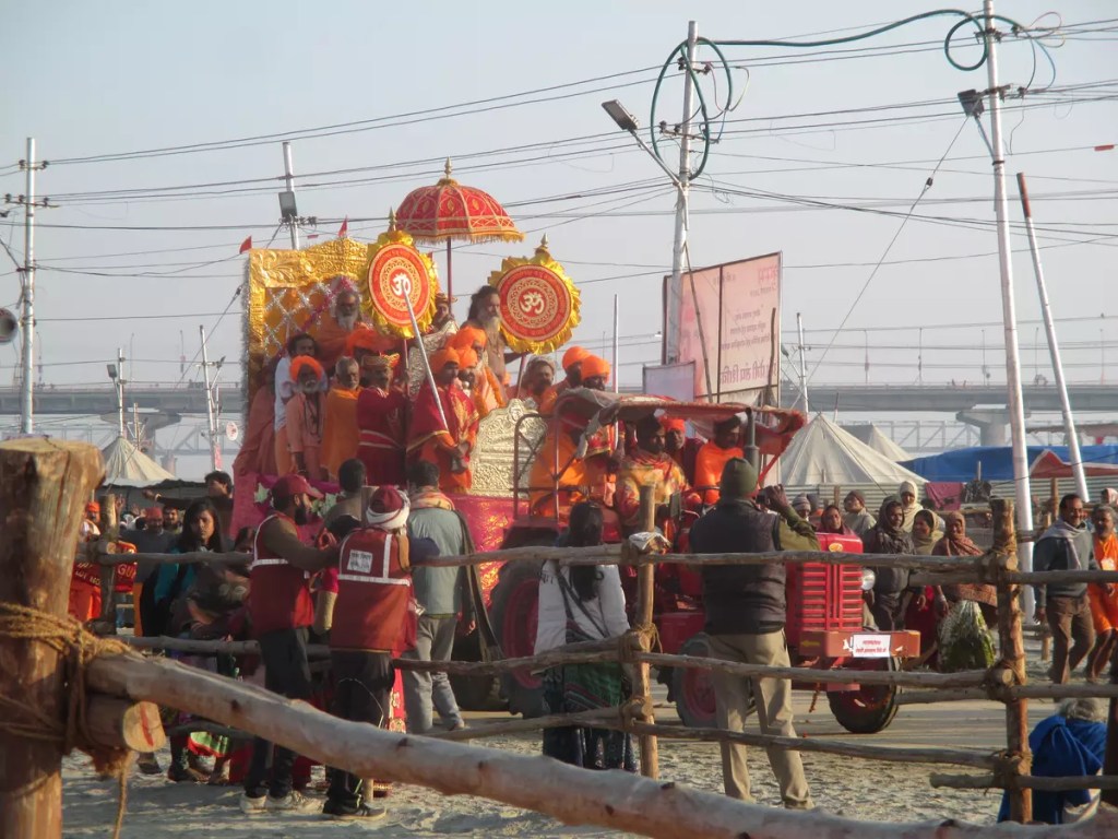
Sangam: The holy trinity of Ganga, Yamuna and the mythical Saraswati must undoubtedly be the first on this list as Kumbh is all because of this. Prayagraj is all about this. The Prayagraj Kumbh has been held at this river junction for ages.
Bade Hanuman Mandir: This is probably the only temple where Lord Hanuman can be found in a reclining position.
Akshaya Vat, Patal Puri Mandir and Saraswati Koop: Set within the fort Akbar built on the banks of Yamuna, this is another important religious place. Saraswati Koop is believed to be the last of the remains of river Saraswati.
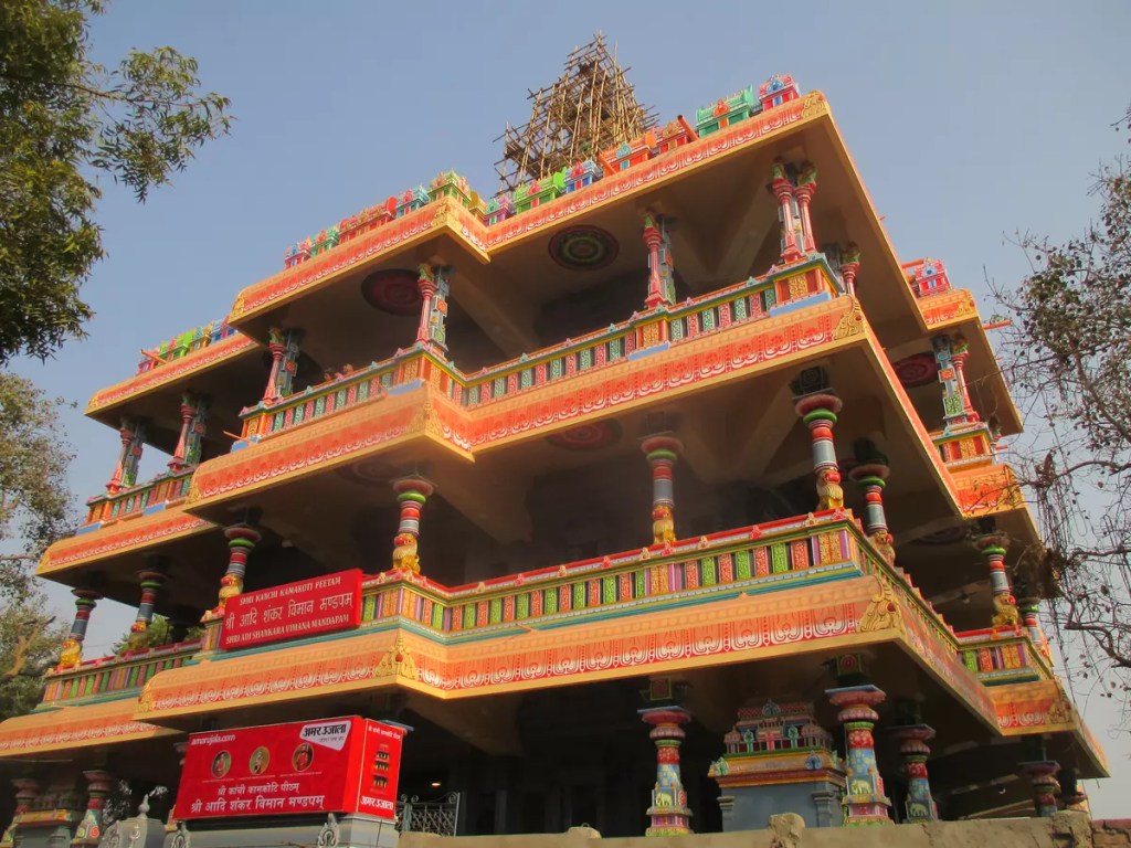
Sri Adi Shankara Vimana Mandapam: This is an important landmark in the vast floodplains of Sangam. Standing out from the remaining of the building in terms of architecture, this is the tallest structure one can see in the area.
One District One Product: This is an initiative to showcase the cottage industry of Uttar Pradesh. One prominent product from each district has been promoted here. ODOP is located at Sector 1/Parade ground near the triangular park, Chungi.
Namami Ganga: What can be a better place than Kumbh to educate people regarding the importance of the river and its protection. This camp set just beside the ODOP complex hosts several important pieces of information regarding the initiatives being taken under the Namami Gange program. Desks by the Wildlife Institute of India have been set up to create awareness about the non-human species dependent on Ganga. Apart from WII, CSIR-NEERI and Ganga Task Force desks have also been set up.
India Post: The postal department is hosting a philatelic exhibition on the theme of Gandhi.
Pustak Kumbh: Book exhibition cum sale set up in sector 1.
Sanskrit Gram: 17 galleries showcasing the different periods of India right from the Harappan civilization to the Indian independence movement. A perfect place to know and/or brush up your knowledge about Indian history.
Kala gram: If ODOP was to promote artisans from Uttar Pradesh, this zone in sector 19 is for the rest of India. In collaboration with the zonal cultural centres, handicrafts from different corners of India have been exhibited at the Kala gram.
VIP Ghat: This is the place for your official selfie.
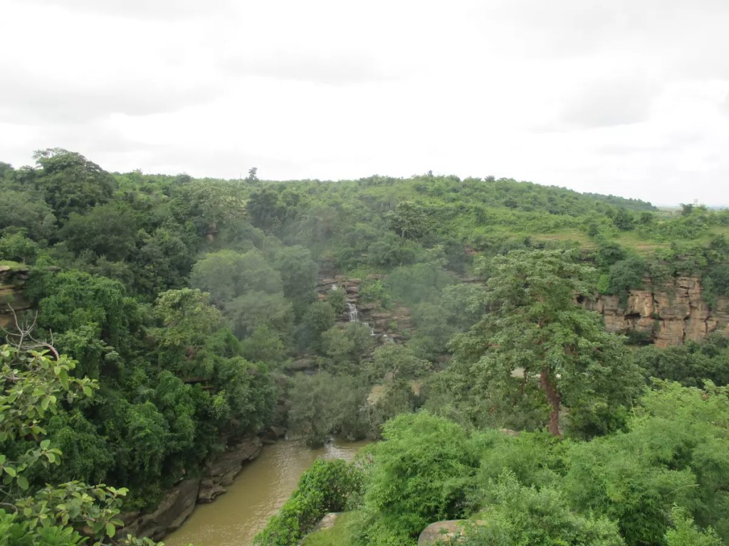
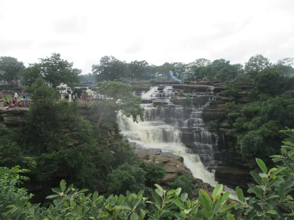
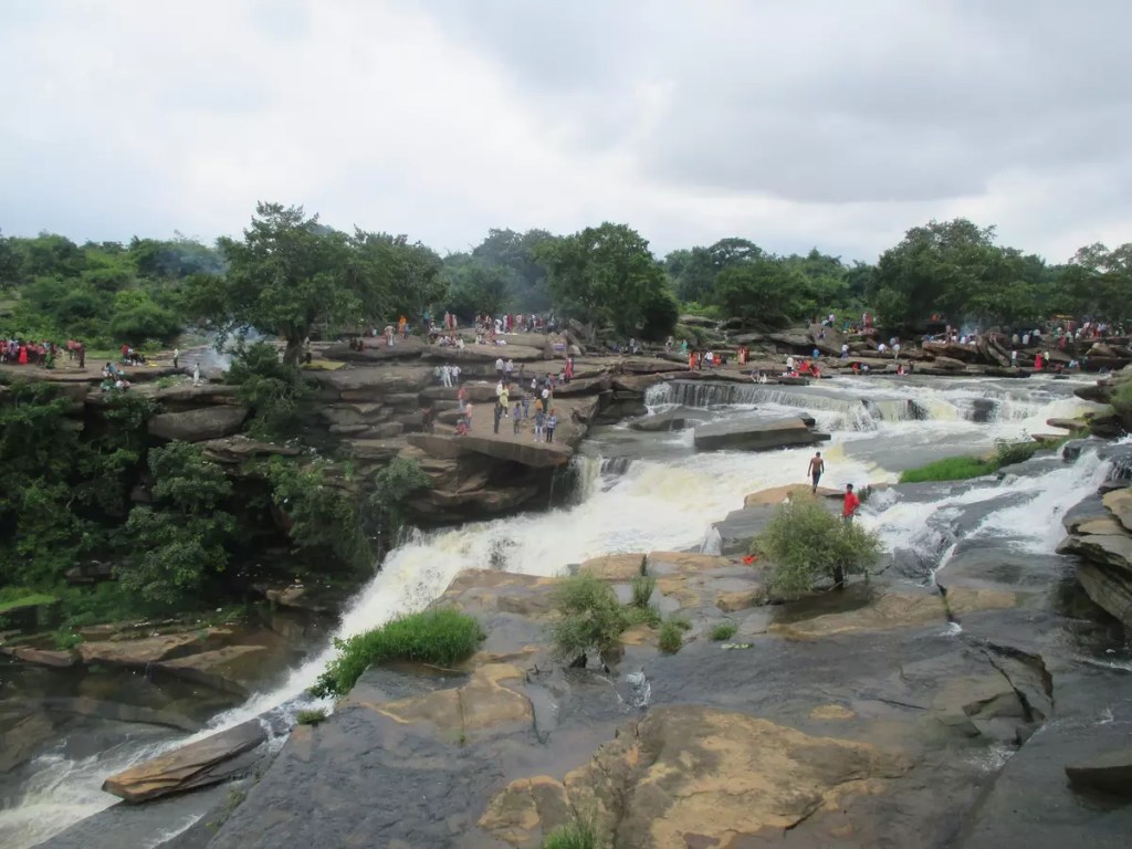
Siddhnath ki Dari, a waterfall with a plunge of about 100 ft. is one of the scenic waterfalls on the Vindhya range. It is named after Siddhinath Baba who is supposed to have used this serene place for meditation. The waterfall is located in Mirzapur district of Uttar Pradesh, about 20 km from Chunar. The falls can be accessed easily by road from both Varanasi (30 km) and Allahabad (120 km). Alternatively, one can also take a train up to Chunar Jn. or Mirzapur railway station, both of which lie on the Delhi-Howrah main line. Compared to Chunar Jn., Mirzapur railway station has more train stoppages. From Mirzapur to Chunar one can take an auto or bus (33 km, ₹30/-) and then from Chunar continue by bus till the falls (20 km, ₹25/-).
The best time to visit the waterfall is during monsoon when there is a high volume of water gushing down. However, it is advised to keep a safe distance to prevent any untoward incidents. Being popular among local tourists, this place often remains crowded on weekends and holidays. There is ample parking (paid) space for vehicles near the waterfall. Small stalls have sprouted up in the otherwise deserted area selling foodstuff. For adventure-seeking tourists, the area near the waterfall has some small hiking trails. The rock where Siddhinath Baba meditated is now a small temple across the river. One can take a walk along the rocky stairs beside this to reach below the falls.
Apart from Siddhnath ki Dari, there are several other waterfalls, forts and caves that are worth visiting if you are in this area. Chunar Fort, just 3 km from Chunar Jn. can be a short pit stop on the way. It offers a wonderful view of the river Ganga taking a swift turn. Sunrise and sunset are the best times to be here. The fort is currently under UP police and only a part is open to the public. It remains open from morning 7 am till Sunset.
If you are using Mirzapur for transit and Maa Vidhyasini temple in Vindhyachal, 10 km from Mirzapur may be of interest. Raj Dari, Deo Dari, Wyndham Falls, Salkhan Fossil Park, Panchmukhi caves, Kauva Khoh, Vijaigarh fort and Shakteshgarh fort are all nearby. Details on these places will be published once I manage to visit them. Till then please check out the links below for more information.