A solo trip to the Valley of Flowers

Flowers along the VoF trek

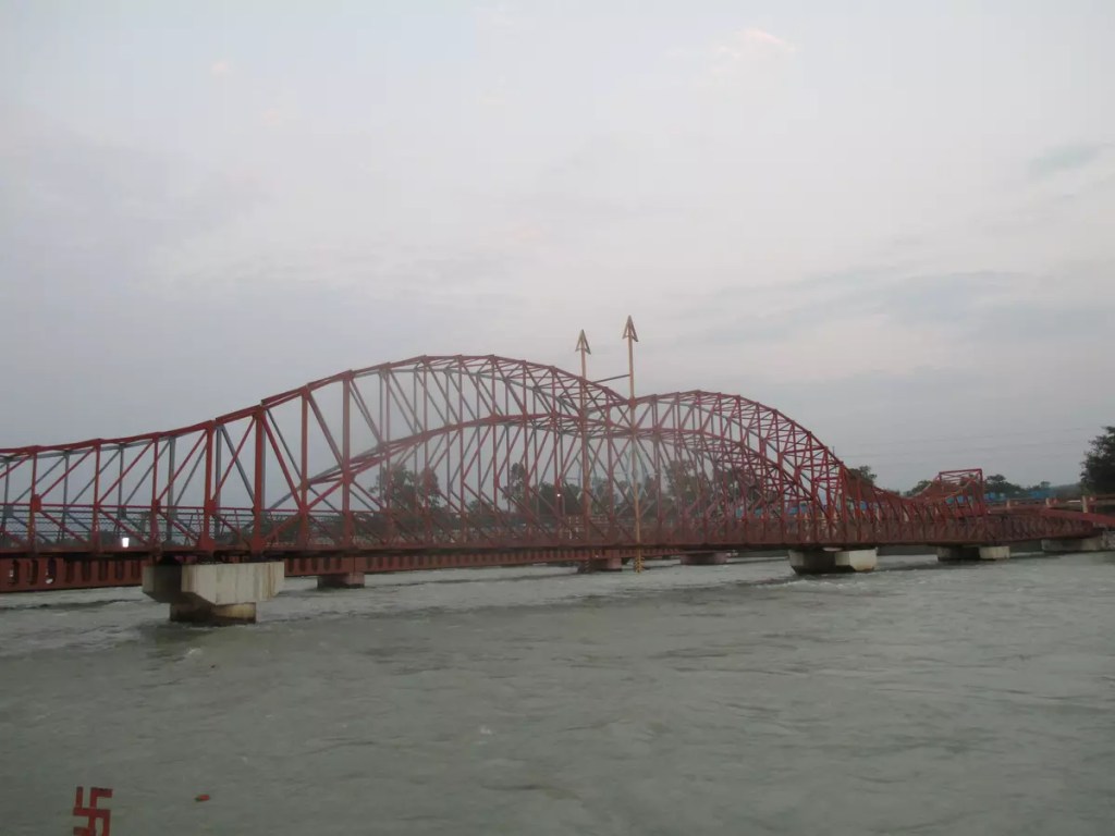
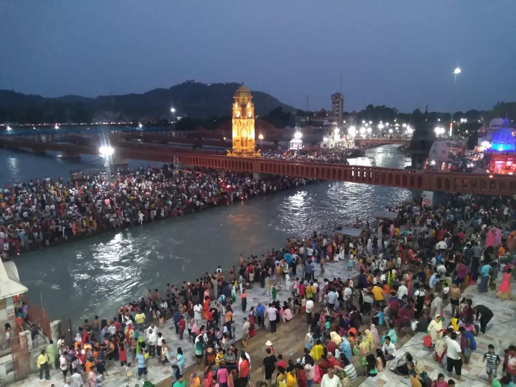
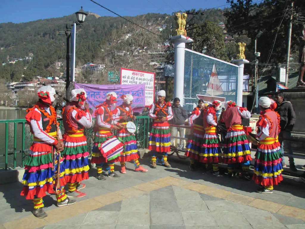
To visit places within the Garhwal circuit, including the Chota Char Dham, Haridwar is the starting point. The Haridwar Jn. (HW) on the Delhi-Dehradun route has direct trains to major cities like Delhi, Kolkata, Mumbai, Madurai, etc. The Jolly Grant Airport, 44 km from the city provides air connectivity to the rest of the country. Ample bus services are also available from the neighbouring states — Uttar Pradesh, Haryana, Punjab — to reach Haridwar.

As I was based in Allahabad, I took the 14163 Sangam Link Express, the only daily train between the two stations. This is a bit slower train and one can also board the tri-weekly 14115 Prayag Ghat (PYG) – Haridwar (HW) Express. The scheduled arrival time for Sangam Express is 10:48 hours while for the PYG-HW Express is 14:15 hours. Taking either of these trains allows enough time to explore Haridwar before heading to the higher altitudes. Additionally, with Indian Railways being well known for their punctuality, the time can be kept as a buffer to avoid delay in further plans.

At Haridwar, hotels that fit all budgets can be easily found outside the railway station and they are also available online through MakeMyTrip, GoIbibo, etc. I had put up for the night at the IRCTC retiring room at the station compound. As per the rule, it has to be booked online and there are no provisions for offline booking (₹155/-).

Haridwar to Govindghat

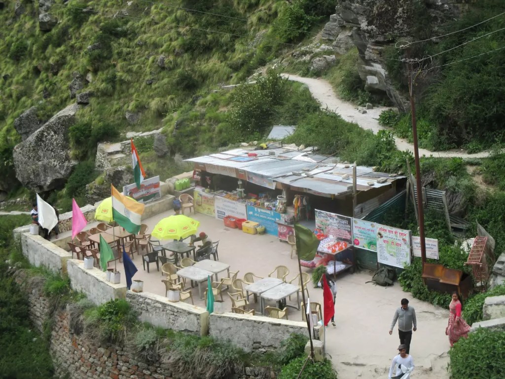
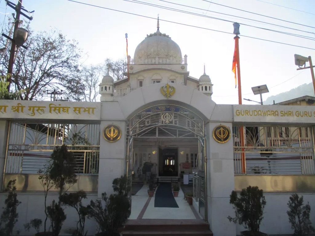
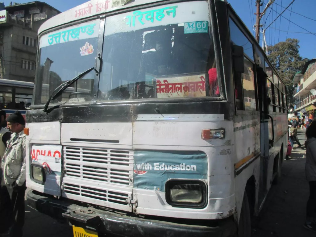
Govindghat is 295 km from Haridwar on NH-58 to Badrinath. Uttarakhand Transport Corporation (UTC) and Garhwal Motors Owners Union (GMOU) Ltd. operate daily bus service on this route. Tickets for UTC buses can be obtained online (₹560/-) while for GMOU buses it has to be booked from their office near ISBT Haridwar in advance (₹460/-). An alternate option, in case no tickets are available, is to break the journey at Joshimath. UTC bus to Joshimath leaves Haridwar ISBT at 5:30 am. I took the GMOU bus that leaves at 2:30 am (₹400/-). After about 13 hours of journey on the mountainous roads, passing through the panch (five) Prayags — Devprayag, Rudraprayag, Karnaprayag, Nandprayag and Vishnuprayag — the bus dropped me at Joshimath at 3 pm. From Joshimath, bolero on a shared basis is available to reach Govindghat (₹50/-). As this place has better hotels than in Govindghat, people often prefer to spend the night here and then continue the next day early morning. However, staying at Govindghat can save some precious time and stress the next day. Govinghat has few decent hotels besides the grand Gurudwara where I stayed. It is the preferred stay for most pilgrims and solo travellers like me and is provided on a first come first serve basis.

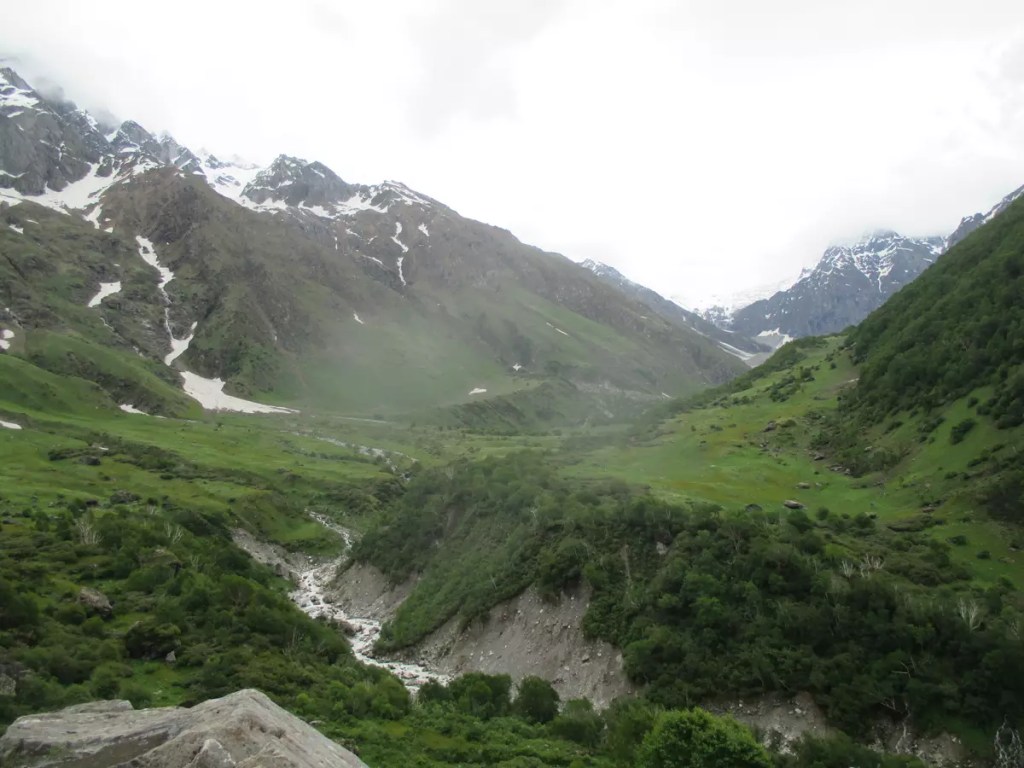
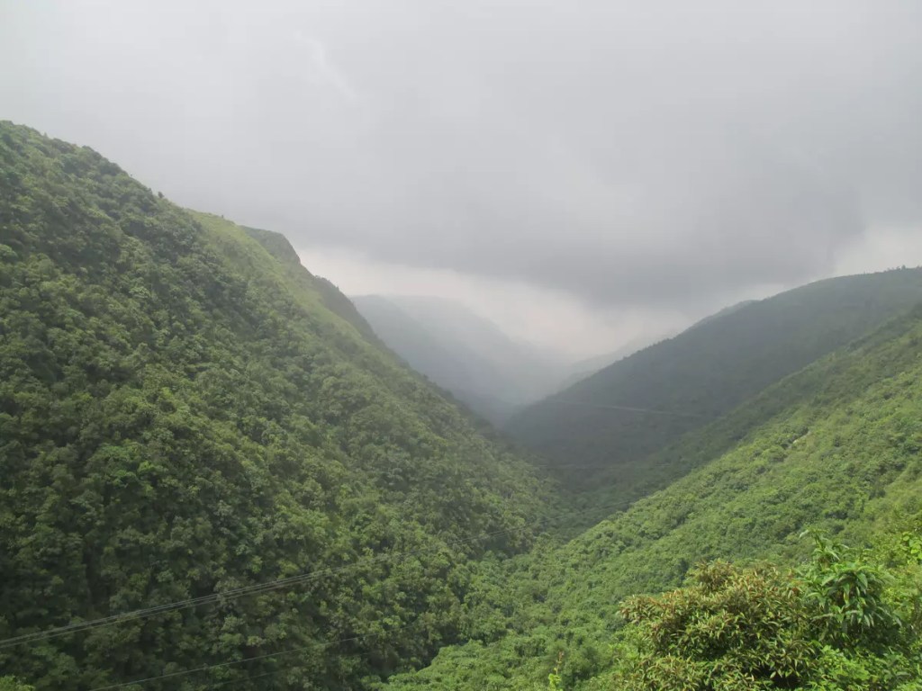
Govindghat to Ghangaria

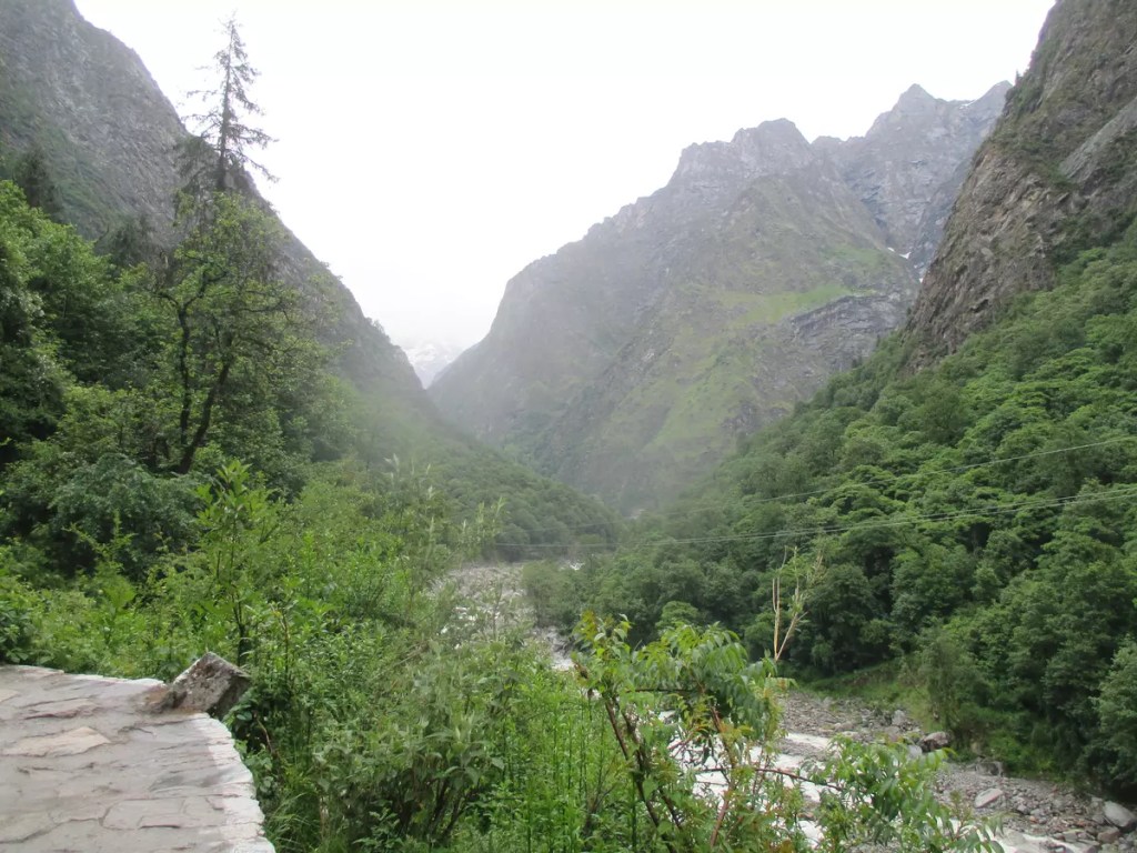
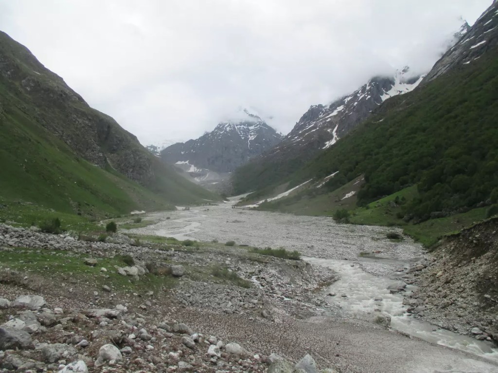
The hike to Ghagaria starts after crossing over to the left bank of Alaknanda. The initial 5 km to Pulna village has a motorable road and can be covered on TATA Sumo (₹40/-) available near Gurudwara. As there is limited parking at Pulna, it is advisable to leave your vehicle at the paid parking lot at Govindghat. From Pulna, the path is well built along the right bank of Lakshman Ganga that flows down from Hemkund and merges with Alaknanda at Govindghat. Horses and baskets can be hired from here if needed to avoid walking. The path to Bhyundar village is a mix of highs and lows and allows for a comfortable hike. After crossing over to the other side of Lakshman Ganga at Bhyundar, the hike is extremely steep and tiring. It took me about five and a half hours to cover the 9 km distance between Pulna and Ghangaria. An alternative to this tiring hike is a helicopter ride from Govindghat. The Ghangaria helipad is approximately 1 km before the village. For hikers, the same helipad offers a nice spot to relax before the final ascend. Between Pulna and Ghangaria there are several pit-stops where one can buy food and drinks. Provisions for toilets are also available. One thing that might be kept in mind during this trek is, that things get costlier as you go higher on the hills, often double or triple the MRP.

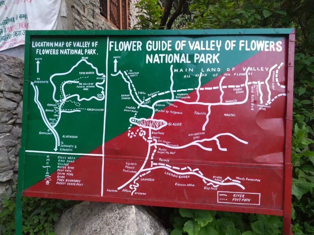
Ghangaria (10,003 ft) is the base camp to visit the Valley of Flowers and Hemkund Sahib. At Ghangaria, I stayed at the GMVNL tourist rest house dormitory (₹ 300/-). Hotels are also available here but no online booking facility. The Gurudwara also has accommodation for visitors. For food, numerous eateries are serving all varieties of taste. Recommendation: There is a man selling hot gulab jamun just after crossing the Gurudwara.

Valley of Flowers (VoF)

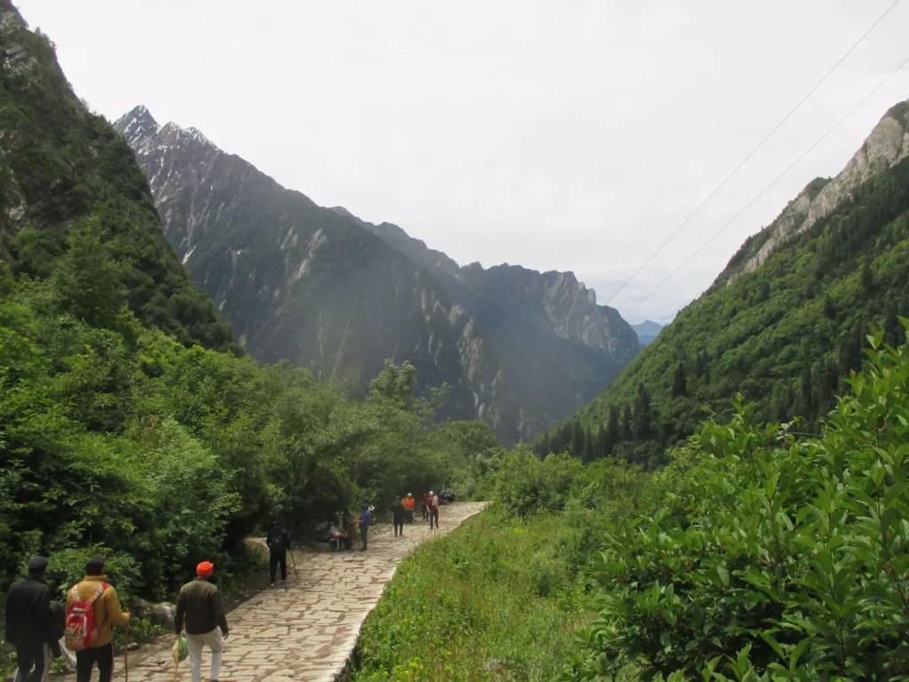
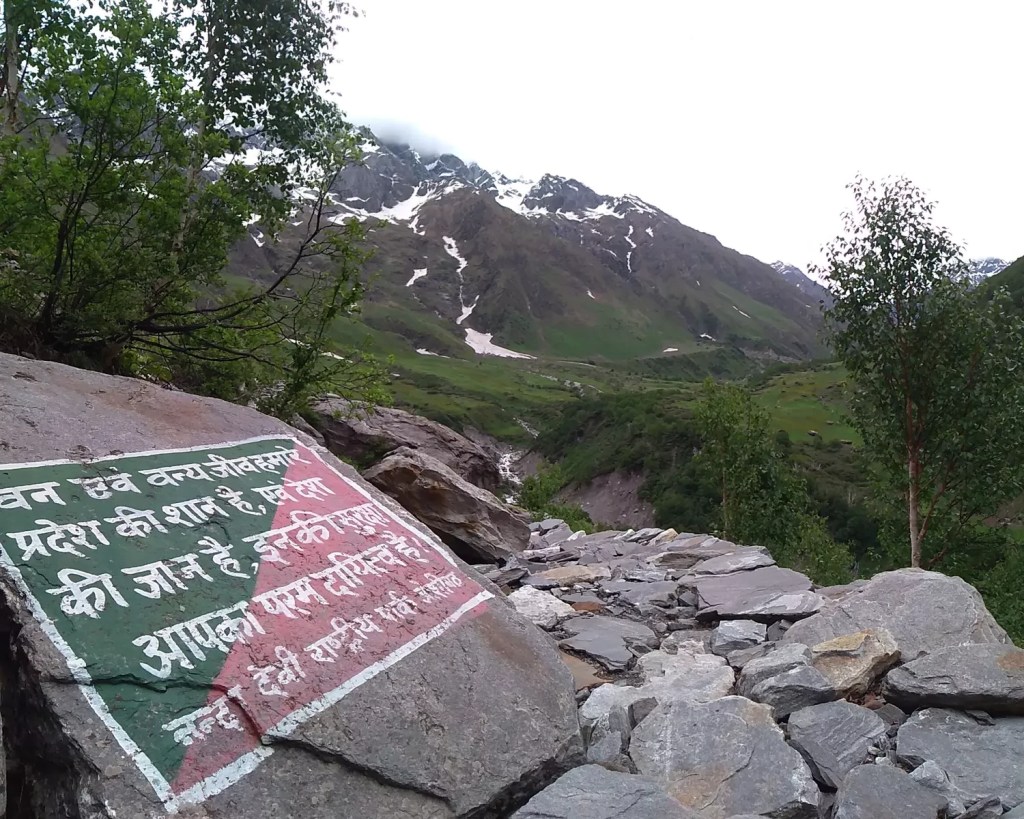
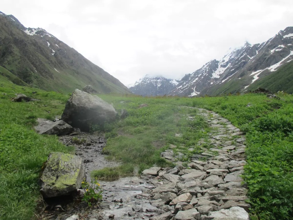
The VoF opens for tourists on the 1st of June and closes around October/November end every year. The time for the visit is 7:00 am to 5:00 pm. No one is allowed to stay/camp inside VoF as it falls under Nanda Devi National Park. At Ghangaria, start your day early to reach the checkpoint by 7:00 am. After getting out of Ghangaria, the road bifurcates into two — the way up straight to Hemkund Sahib and the one going left leads to VoF. Permission for entering VoF can be obtained from the checkpost on furnishing ID details and a fee of ₹ 150 per person. This permit is valid for three days.

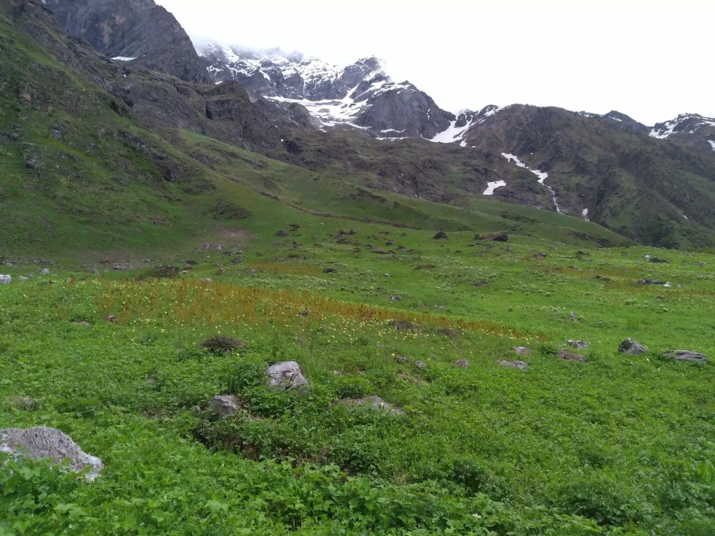
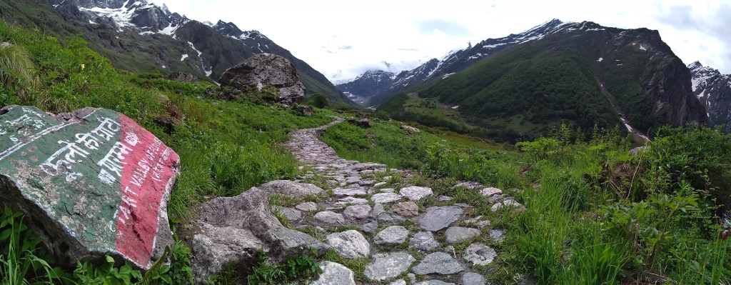
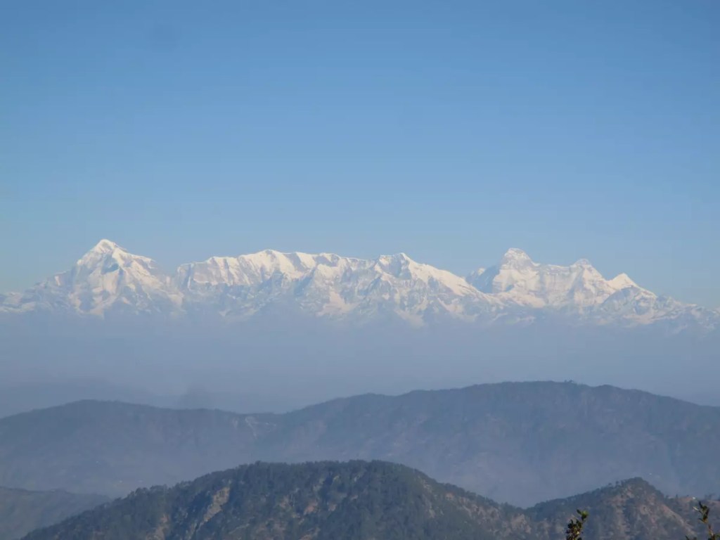
From the checkpost to the starting point of VoF is 4 km. The path initially follows the left bank of the Pushpawati River for some time and then crosses over to the right, after which is a steep climb. However, the dense forest and the chirping birds have a soothing effect. This zone is a bird-lover paradise. After reaching a certain height, the forest clears up bringing into view the snow-clad peaks and the valley below. Two glaciers on the trek are particularly challenging and pump up the adrenaline.

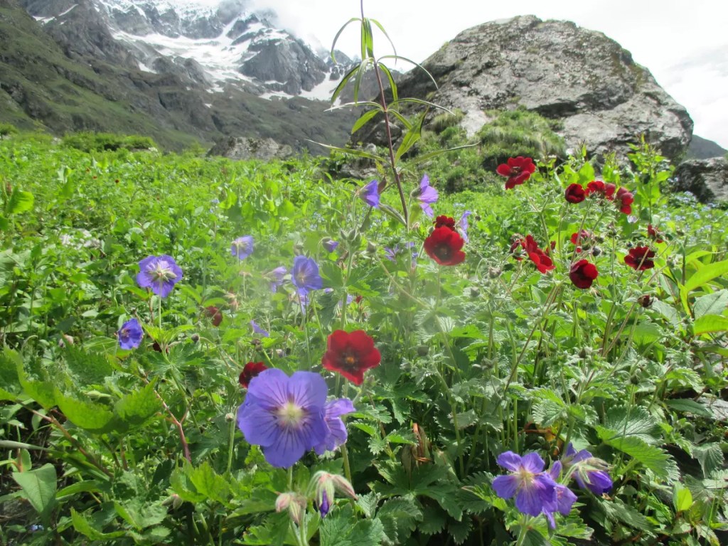
The peak season for flowers to bloom is between mid-July and mid-August. This is also the time when tourists are plenty. When visited in June last week, there were very few flowers and fewer people. In fact, I only encountered 8-10 people on the trek. The months of May and June are high time for pilgrims visiting Hemkund Sahib.

There are three main points on this trek. The first point, nicknamed picnic spot is a sloping grassland, which is at the start of the valley. According to staff, most people on a casual visit return from this point. As you go further along the marked path, it divides into two. The second point — Grave of Joan Margaret Legge, is on the track that goes down from here. She was one of the first who came here to document the flowers of this valley. However, before her work was complete, she met with a tragic accident that took her life. Surprisingly, when I visited, this was the only spot with dense blooming flowers. The Pushpawati river bed is the last point on the trek I could reach. From here, the Tipra Khark glacier, the origin of the Pushpawati River can be seen. As there are no eateries within the national park, visitors are advised to carry their food for the almost 5-hour walk one way. However, I request everyone not to litter this pristine place and bring back everything you took in.

Hemkund Sahib

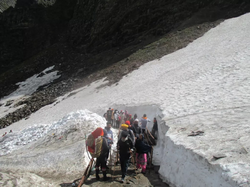
The 6 km path to Hemkund Sahib is steep throughout. However, unlike VoF, horses and baskets are allowed on this route and have eateries. In June, the final 2 km had thick layers of snow and the lake was mostly frozen.

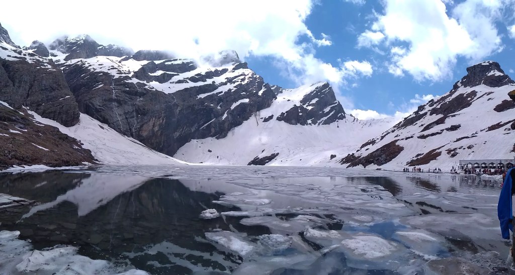
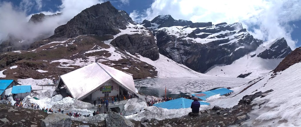
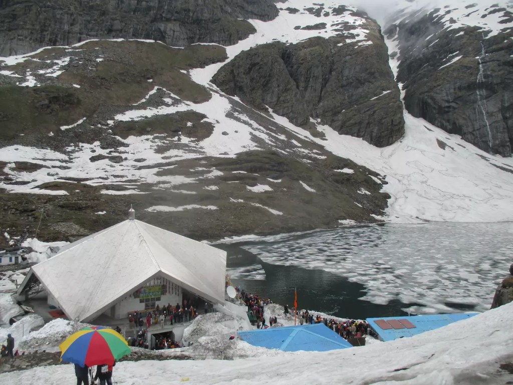
Hemkund is a picturesque glacial lake surrounded by towering mountains. It is also the starting point of Lakshman Ganga. At 15,197 ft, the star-shaped Gurudwara is one of the highest in the world. It was at this place the tenth Sikh guru, Guru Govind Singh meditated in one of his earlier births. Though this place is known to be revered by Sikhs, it is also a place of religious importance for Hindus. A temple dedicated to Lakshman is located just beside the Gurudwara. He is believed to have regained his health by meditating on the serene banks of Hemkund.

Once the ice melts, a clear reflection of the gurudwara, temple, and surrounding mountains can be seen on the lake. Apart from offering prayers at the gurudwara and the temple, things to do include taking a dip in the frozen lake and tasting the hot khichdi langar.

Mana and Badrinath

Start your descent early from Ghangaria. If you are planning a return to Haridwar on the same day, you have to be at the Govindghat bus stand by 7:00 am. Still, there would be no surety of getting a seat in the packed buses that come from Badrinath. I took it a bit easy. Started my descent at 6:00 am from Ghangaria and reached Govindghat by 9:30 am. I was again in the clutches of my mobile phone. Forgot to mention before, that only a patchy (in fact no) network of BSNL is available beyond Govindghat. For three days, I was totally out of contact but it felt amazing.

Heading to Badrinath might be trivial. Limited public transport ply on this route and often they come full from Joshimath. Taxi (TATA Sumo/Alto) can be hired or if sufficient passengers are available an arrangement on a sharing basis can be made. After waiting for some time, I got a Sumo that was headed to Mana (₹ 130/-). Mana is 50 km from Govindghat and takes two hours to cover the steep roads with sharp hairpin bends.

Mana is the last Indian village on this side. The China border is 25 km from here. Apart from this, Mana has its own place in Hindu mythology. Mahabharat is said to have been written here. Cave temples dedicated to Ved Vyas and Ganesh are important attractions here. A rock bridge known as Bheem pul is said to have been built by Bheem on their way to Swarg or heaven. 5 km from Mana is Vasundhara Falls, another crowd puller to the village and another hike.

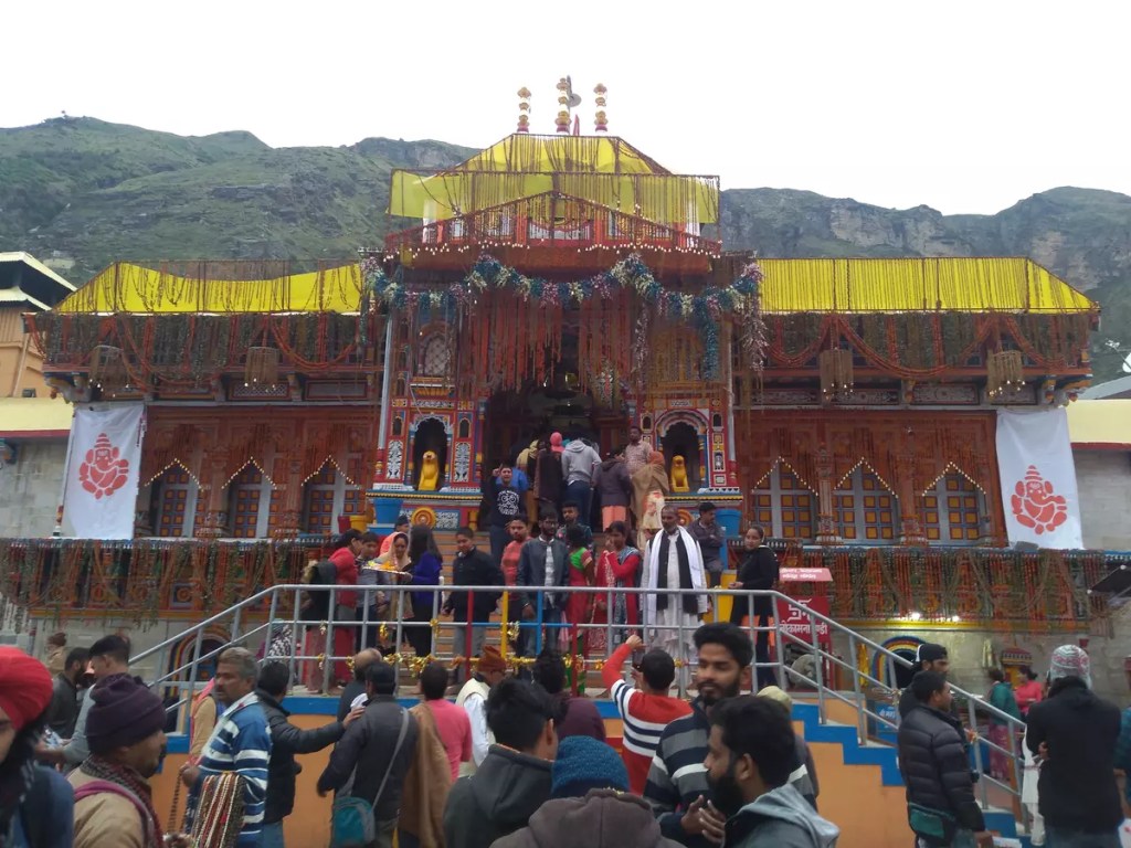
Mana is 3 km from Badrinath. The beautiful landscape literally compelled me to walk on the empty roads with my heavy backpack enjoying the view. The first thing I did on reaching the Badrinath bus stand was to secure a seat in Haridwar for the next day. At Badrinath, I stayed at the GMVNL Yatri Niwas dorm (₹ 300/-) and the evening was spent visiting the Badrinath temple and the nearby markets.

Return journey

The GMOU buses leave for Haridwar early at 5:30 am. With pit stops at Pipalkot for breakfast, near Devprayag for lunch and coping through a tyre burst, I reached Haridwar at around 6:00 pm. Next up was another challenge on how to reach Allahabad or at least Lucknow. With calculated risk, I booked a waiting list ticked on 12370 Howrah SF Express till Lucknow. On chart preparation, my WL133 luckily got converted into RAC. The next morning I was on time at Lucknow and by noon back to the 40°C of Allahabad.

This post is based on my trip to the Bhyundar Valley in June 2019. More pictures from this trip are on my Instagram profile. Do give them a visit.

  • Flowers along the VoF trek
  • Pushpawati river bed
  • Hike to Hemkund Sahib
  • Hemkund Sahib
  • Hemkund Sahib
  • Hemkund Sahib
  • Restaurants at Mana
  • Badrinath temple

Road trip to Nainital

“Once a year go to a place you have never been before.”

This quote by Dalai Lama has become one of my favourites in the last few years. I have even tried my best to follow it by visiting a new destination on the first day itself or at least in the first month. I was in Hyderabad during the new year 2016 and in Kerala on the Pongal holidays 2017. 2018 was a bit loose and had to wait till March to visit Gwalior. In 2019, I was back to celebrate the new year in a new destination – NAINITAL. The 2018 year-end trip was another milestone as Uttarakhand became the 18th Indian state I touched down at.

I tried hard to cut down costs by availing the Indian Railways but luck would not have it and it had to be a road trip. I started from Prayagraj at 8:00am on 28th December 2018 bound for Lucknow. After around 5 hours of smooth ride, I was dropped off at Alambagh bus station in Lucknow. This newly opened bus stand, I must say, is one of the finest I have ever seen in India. The Chennai Mofussil Bus Terminus (CMBT) must have been the same when it was opened. As it was lunch time I visited the food court on the first floor and tried their aloo paratha served with pickle. The pricing has been kept within budget. The food court serves a variety of food at pocket-friendly prices.

This time I also got to try the Lucknow metro between Alambagh and Charbagh. During the time of my visit, it used to run only on a small section, covering 8 stations and hence very few passengers used them. The pricing may be another concern. My ride cost me ₹20/-. If I guessed it correctly, in Kolkata metro, it would have been ₹5 or ₹10/-. I put my stay at Hotel Anusuiya Palace booked on GOIBIBO at an amazing discounted price.

Fast forward to day 2. Post lunch I reached Kaiserbagh bus station to figure out how to reach Kathgodam. Luckily there was a direct bus at 5 pm. The Uttarakhand Transport Corporation (UTC) bus took around nine hours to reach Haldwani. Haldwani is the major bus stand in the region while Kathgodam is the railway terminus. Another UTC bus and 40kms later I finally reached my destination.

The beautiful morning sky with its beautiful orange hue greeted me. From the Tallital bus terminus in the chilly weather and a frozen foot, I started walking towards the Youth Hostel. My streak of luck finally came to a halt here. The accommodation was packed. After a lot of enquiring and walking around I reached from where I started in the morning at Tallital. I got a room at Dharmashala. Though not too luxurious, it was at par with its cheap price.

During this look around, I visited the Naina Devi Mandir and adjacent Gurudwara passing by the Flats and Jama Masjid. A walk through the opposite bank of Mall Road also sometimes called the Thandai Sarak, is just serene. I found very few people on this road. No vehicles are allowed here.

So finally after getting fresh, I started walking towards the Zoo, officially known as the G. B. Pant High Altitude Zoo. One can take a shuttle taxi that runs from Mall Road. The zoo located at the top of a hill on the eastern bank of Naini Lake gives a great view of the town below. Among other animals, the red panda is something new that I have never encountered in other zoos.

For the next four or five hours, I went walking towards the Bhowali road in search of a place called the Pines Old Cemetry which I had found on the internet. The only thing I found was a burning burning ghat down the hills.

The evening was spent window shopping at the Tibtian market and tasting some momos and coffee.

The last day of the year. My initial plan was to trek to Naina Peak, however, after walking to High Court and having a chat with the tea stall owner, I decided against it and went towards the Eco Cave gardens. One has to trek to the Naina Peak, but it passes through some forest area and the route is not well marked (at least as per the tea stall owner). The Eco Cave Gardens is a collection of six caves – Tiger Cave, Panther Cave, Porcupine Cave, Bat Cave, Flying Fox Cave and Ape Cave. Crawl and squeeze your way through them and then reach the hilltop viewpoint.

From here, I walked towards the Raj Bhavan road and started my walk towards Tiffin Top. Instead of going all the way down to Mallital from Suktal and then climbing up, a generous local guided me to a shorter route. It starts near the high court and passes through the hills on the west bank of the lake, just above the Thandi Sarak which I had visited the day before. On the Raj Bhawan road, the Db campus of Kumaon University is located. After passing this, we come to a tri-junction. Taking a U-turn towards the road that goes upwards, we pass through St. Anthonys College and then finally the Sherwood College. Amitabh Bachchan is an alumnus. The trek starts here. No cars can go beyond this point. This route is well marked and steep but the climb was worth it. The view of the snow-clad Himalayas just restores the energy. As a supplement enjoy some hot steaming coffee or momo or Maggi at the stalls there. To reach the top, there is an alternate route through Kaldungi Road from where one can take a horse ride to the top. If you are exploring Nainital by taxi, you would be taking this way.

After descending, I visited the Raj Bhawan. Nainital is the summer capital of Uttarakhand. This is also the only Governor’s house in India that is open to the public. A half-an-hour guided tour of the complex is organized every hour. The building was built in 1897 and modelled on the Buckingham Palace of England.

2019. Happy New Year everyone! The winter months are usually an off-season in Nainital except the few days before and after the first day of the year. The parking lots and the city get packed up for these few days. I checked out of my room early, kept my extra bag at a cloakroom near the Tallital bus stand and headed to experience the pride of Kumaon, the Nainital Ropeways. From Mallital the cable car climbs the steep hill in just about four minutes to the snow view point. From the two viewpoints here, one can get a clear view of the Himalayas. Climbing down I headed towards the final place on my list – St. John in wilderness church, a little-known church near High Court.

So finally after this, I signed off from Nainital and headed back home but with a detour via Bhimtal. From Nainital I first took a bus to Bhowali and then a sumo to Lake Bhimtal. As with Naini Lake, this one is also surrounded by hills but is larger. From Bhimtal a final four-wheeler ride to Haldawani and bus to Allahabad via Lucknow.

And here is a short video of the trip. Enjoy !!!

For more pictures from the trip follow me on Instagram using #ag1805x_in_Nainital.

Places to visit during Kumbh 2k19

Sangam: The holy trinity of Ganga, Yamuna and the mythical Saraswati must undoubtedly be the first on this list as Kumbh is all because of this. Prayagraj is all about this. The Prayagraj Kumbh has been held at this river junction for ages.

Bade Hanuman Mandir: This is probably the only temple where Lord Hanuman can be found in a reclining position.

Akshaya Vat, Patal Puri Mandir and Saraswati Koop: Set within the fort Akbar built on the banks of Yamuna, this is another important religious place. Saraswati Koop is believed to be the last of the remains of river Saraswati.

Sri Adi Shankara Vimana Mandapam: This is an important landmark in the vast floodplains of Sangam. Standing out from the remaining of the building in terms of architecture, this is the tallest structure one can see in the area.

One District One Product: This is an initiative to showcase the cottage industry of Uttar Pradesh. One prominent product from each district has been promoted here. ODOP is located at Sector 1/Parade ground near the triangular park, Chungi.

Namami Ganga: What can be a better place than Kumbh to educate people regarding the importance of the river and its protection. This camp set just beside the ODOP complex hosts several important pieces of information regarding the initiatives being taken under the Namami Gange program. Desks by the Wildlife Institute of India have been set up to create awareness about the non-human species dependent on Ganga. Apart from WII, CSIR-NEERI and Ganga Task Force desks have also been set up.

India Post: The postal department is hosting a philatelic exhibition on the theme of Gandhi.

Pustak Kumbh: Book exhibition cum sale set up in sector 1.

Sanskrit Gram: 17 galleries showcasing the different periods of India right from the Harappan civilization to the Indian independence movement. A perfect place to know and/or brush up your knowledge about Indian history.

Kala gram: If ODOP was to promote artisans from Uttar Pradesh, this zone in sector 19 is for the rest of India. In collaboration with the zonal cultural centres, handicrafts from different corners of India have been exhibited at the Kala gram.

VIP Ghat: This is the place for your official selfie.

Siddhnath Ki Dari – A weekend getaway from Varanasi/Allahabad

Siddhnath ki Dari, a waterfall with a plunge of about 100 ft. is one of the scenic waterfalls on the Vindhya range. It is named after Siddhinath Baba who is supposed to have used this serene place for meditation. The waterfall is located in Mirzapur district of Uttar Pradesh, about 20 km from Chunar. The falls can be accessed easily by road from both Varanasi (30 km) and Allahabad (120 km). Alternatively, one can also take a train up to Chunar Jn. or Mirzapur railway station, both of which lie on the Delhi-Howrah main line. Compared to Chunar Jn., Mirzapur railway station has more train stoppages. From Mirzapur to Chunar one can take an auto or bus (33 km, ₹30/-) and then from Chunar continue by bus till the falls (20 km, ₹25/-).

The best time to visit the waterfall is during monsoon when there is a high volume of water gushing down. However, it is advised to keep a safe distance to prevent any untoward incidents. Being popular among local tourists, this place often remains crowded on weekends and holidays. There is ample parking (paid) space for vehicles near the waterfall. Small stalls have sprouted up in the otherwise deserted area selling foodstuff. For adventure-seeking tourists, the area near the waterfall has some small hiking trails. The rock where Siddhinath Baba meditated is now a small temple across the river. One can take a walk along the rocky stairs beside this to reach below the falls.

Apart from Siddhnath ki Dari, there are several other waterfalls, forts and caves that are worth visiting if you are in this area. Chunar Fort, just 3 km from Chunar Jn. can be a short pit stop on the way. It offers a wonderful view of the river Ganga taking a swift turn. Sunrise and sunset are the best times to be here. The fort is currently under UP police and only a part is open to the public. It remains open from morning 7 am till Sunset.

If you are using Mirzapur for transit and Maa Vidhyasini temple in Vindhyachal, 10 km from Mirzapur may be of interest. Raj Dari, Deo Dari, Wyndham Falls, Salkhan Fossil Park, Panchmukhi caves, Kauva Khoh, Vijaigarh fort and Shakteshgarh fort are all nearby. Details on these places will be published once I manage to visit them. Till then please check out the links below for more information.

Additional reads:

A summer weekend trip to Varanasi and Sarnath

In the hot summer of June 2018, I made another trip to Varanasi. Touching down for the third time. This time I was accompanied by a friend from my PG back in Allahabad. We started from Allahabad on Saturday at around 4 pm on board the UPSRTC bus. Thanks to the ongoing highway development projects the usual 3 hours journey to cover the 125 kms took nearly 4 hours. Yet we were not dropped at the Varanasi Cant. Bus station. The buses to and from Allahabad now terminate 4 km before the bus station ever since the disastrous accident – the collapse of the under-construction flyover took place. Next, I was to look for an auto to Dashashwamedh Ghat nearby where I had booked a guest house. We found an auto that agreed to take us for ₹20/- per person on a sharing basis. It took around 30 minutes to reach our destination. The famed Ganga aarti had just ended and a sea of people was returning from the ghat.

Olya guest house that I had booked was about 550 m from Dashashwamedh Ghat as per Google Maps. As we made our way through the crowds, I for the first time felt Google Maps was not for Varanasi. We were just about to miss the lane on which my guest house was located. It was not a proper road but within the galis or the narrow lanes of Varanasi. This particular lane that starts near the Deshbandu Chittaranjan Park on Dashashwamedh Ghat road runs parallel to the ghats. On our way, we found several guest houses, hotels and hostels lined alongside. The proximity to the ghats makes this place popular among tourists, especially budget travellers. These lanes might not be quite clean and are overpacked; but this is what Varanasi, one of the oldest inhabited cities on Earth is all about. If you really want to experience Varanasi you must stay in this area, have a chat with the friendly locals, breath the fresh air from the Ganga and also smell the cow dung. We soon reached the Bengali Tola area and what was surprising about our guest house was that it was not like any other hotel but a house. The owner has converted a part of their house into a guest house. The room usually costs ₹750 per night, thanks to GoIbibo I got it for ₹250/- for two nights. Please use my code 3872770 to sign up and get ₹3000 goCash.

By the time we had found our stay, it was almost 8.30 pm. We had our dinner in a nearby South Indian restaurant, an authentic one tucked in the alley of the Northern state. I mention this because not every South Indian food centre in North Indian is manned by people down south and so the taste differs. Post dinner we went to breathe in some fresh air at Narad Ghat, the closest one to our guest house, before finally calling it a day.

The second day morning was spent at the exam hall. After the exam, we set out to explore Varanasi. Our first destination is Kashi Viswanath temple. The temple is dedicated to Lord Shiva and is one among the twelve Jyotirlingas, the holiest of Shiva Temples. No bags, cameras, or phones are allowed inside the temple, so it is better to come prepared or go inside turn by turn. The other expensive option is to keep them in the locker facility provided by the nearby shopkeepers. They do not charge directly for the service but will force you to take prayer packages/offerings for the Gods that will cost you around ₹300/-. As you move towards the temple from here, be alert as some other shopkeepers may drop some of their products on your basket and on your return will charge a hefty amount. But that’s not the end. Once you have kept your belongings in the locker and accepted the prayer package, a priest will be assigned to you without your knowledge who on the pretext of helping you will take you around the temple saying he is an authorized priest of the temple committee. At the end of this conducted tour, he will ask for some offertory that may be anything between ₹100/- to ₹500/- or even higher. At the Annapurna Mandir, you will also be asked to make an Annadaan of ₹501/-. So visiting Kashi Viswanath Temple can shell out ₹1300/- if you are unaware of how this place works.

After visiting the temple, we headed to the Jantar Mantar. The Jantar Mantar is a scientific wonder dating back to the 18th Century. The Jantar Mantar is basically an astronomical observatory built by the ruler of Jaipur, Jai Singh in the early 1700s. The Jantar Mantar at Varanasi is one among the five built by him. The others are at Jaipur, Delhi, Mathura and Ujjain. The Jantar Mantar of Jaipur is the largest among them. The complex is maintained by the Archeological Survey of India (ASI) and ₹5/- is charged as an entry fee.

During my previous visit to Varanasi in December 2017, I had a wonderful time rowing on the Ganga during sunset. It definitely feels great to sit back and watch the activities taking place on the ghats from a distance. But for this time I wanted to take a walk along ghats. From Dashasamedh to Assi ghat is almost 3 km and covers 41 of the 88 ghats in Varanasi. Jantar Mantar is close to the former. We took an auto from Godowlia Crossing to Assi Ghat and started our journey back taking several pit stops to enjoy the views. The riverfront can be said to be the most happening place in Varanasi. Life in Varanasi is incomplete without the ghats. People come here to relax, to pray, to eat, to play and even life ends here – on the cremation ghats. For photography enthusiasts, these ghats can provide interesting subjects like the one here – wall art by @phuphi_artwork.

Another recommended thing if you are in Varanasi is to watch the Ganga Aarti held every day without fail, at Dashasamedh Ghat and Assi Ghat at sunset. This is not just a religious ceremony but a display of art. Scores of people gather every evening just to see the aarti ceremony.

Day 3. We checked out of our guest house early morning. Our plan for the day was to visit Sarnath and then return to Allahabad by night. We took a walk along the ghat for the last time from Narad Ghat to Dashssamedh Ghat. We charged ourselves with a breakfast of poori-sabji and set out on our quest. A person from the restaurant had guided us to take an auto from there to a place called Pandeypur and from there change auto for Sarnath. The total ride took around 40 minutes and cost ₹35/-. The auto dropped us near the Sarnath Temple and the driver was helpful to guide us about what to see in Sarnath.

Sarnath is the sacred place where Lord Buddha delivered his first sermon to his five disciples. This is the place where the Wheel of Law in Buddhism is said to have been set in motion. Today Sarnath is one of the most regarded sites for the Buddhists. A deer park, that still exists today as a mini zoo, is the exact place where Buddha delivered his sermon. Realizing the importance of this place, Emperor Ashoka erected several structures in Sarnath.

We started by visiting the Mulagandha Kuti Vihara. This is relatively a new temple built in the 1930s. The temple was built by the founder of Mahabodhi society and is still maintained and run by them. The temple houses a golden statue of Buddha on a marble platform while the walls are covered with murals depicting scenes from the life of Buddha. The temple is open from sunrise to sunset and entry is free; however, you may be asked to donate a small amount if you want to take photographs on the interior. One request that is hardly accepted by tourists is not a temple selfie inside the temple; however, this is something that must be respected.

The deer park cum mini zoo is located behind the Mulagandha Kuti Vihara. An entry fee of ₹10/- is charged and a separate fee for cameras. The park houses several species of birds and deer.

Towards the west of the Mulagandha Kuti Vihar is the Sarnath excavated site. The remains of the grand architecture from the era of Emperor Ashoka can be seen here. Most of the monasteries have been grounded by invasion by rulers over the period. This place was rediscovered during the 1800s. The only structure that stands tall is the Dhamek Stupa. The current standing Dhamek Stupa is a replacement of the original built by Emperor Ashoka. This place is also the site that housed the original Ashoka Pillar. The Lion Capital of Ashoka, which today serves as the official emblem of India, is kept at the nearby Sarnath Museum. Several other artefacts discovered from the excavated site can be found at the museum. Both the excavated site and the museum are maintained by ASI. An entry fee of ₹15/- and ₹5/- is charged for the excavated site and museum respectively.

As you travel towards Sarnath from Varanasi by road, one of the first things that will catch your attention is an 80-foot-tall statue of Lord Buddha. This is within the Hinaya Buddha temple or the Wat Thai Temple complex. The temple was built by Thai dignitaries in 1931. The lush green complex also houses several other statues of Buddha and Laughing Buddha.

The last spot of our trip was the Chaukhandi Stupa. This is believed to be the site where Lord Buddha and his first disciples met travelling from Bodh Gaya to Sarnath. The stupa is thought to have been built during the Gupta period and today it stands as a huge mound of bricks topped with an octagonal tower, from which the name Chaukhandi may have been derived.

As our trip was completed we headed towards Varanasi by auto followed by a 6 hours truck ride to Allahabad.

More pictures from my trip to Varanasi and Sarnath are available on my Instagram profile @ag1805x. The hashtags #ag1805x_in_Varanasi and #ag1805x_in_Sarnath will provide quick access.

This article is also available on Tripoto.

An exam trip to Varanasi

Varanasi or Benaras, situated on the bank of the Ganges is considered to be one of the oldest inhabited cities on Earth. The first time I had set foot on this holy land was in August 2017 when my train decided to change its route on its way to Delhi. I had to get down here and continue my journey to Allahabad on the bus. However, it was not long before I got my second opportunity to visit this famed city. CSIR NET December 2017. As I was staying in Allahabad, Varanasi was the closest exam centre. Though I was on a tight schedule I managed to visit a few spots within the approx. 24 hours I was in the city. So this is my encounter with the holy city.

Banaras Hindu University (BHU): This is the first place that I should mention in the list as it was the venue of the exam. BHU was founded in 1916 by Madan Mohan Malaviya as the Central Hindu College. Today BHU is a public Central University and holds the record for being the largest residential university in Asia.

Ghats of Benaras: Being located alongside the holy river, the ghats of Banaras are a major attraction. The entire city touches the river at 88 ghats of which most are bathing ghats, a few used for ceremonial purposes and two for cremation of dead bodies. Assi ghat is the southernmost ghat and is close to BHU. Ganga aarti is held every evening at Assi ghat and Dashaswamedh ghat, of which the latter is a grander affair and renowned. Manikarnika and Harishchandra Ghats are reserved for Hindu cremation rituals. I must agree that a boat ride during sunset is one of the best ways to experience these ghats. We boarded one near the Assi Ghat and rowed down to Manikarnika Ghat and back.

Sankat Mochan Hanuman Temple: This temple dates back to the 1500s and is believed to have been established by the great saint Tulsidas who also authored Ramcharitmanas. This is one of the few temples where Lord Hanuman is seen facing his Lord Rama.

Most of the facts mentioned have been taken from the internet. Read in detail here:

Walking through the temples of Khajuraho

The 19th to 22nd of October was a long Diwali weekend. I was by then well settled in Allahabad and was eagerly waiting to make a trip to the 17th Indian state on my list — Madhya Pradesh. I planned this two-day trip to Khajuraho.

Since no direct trains were available on the 19th I got a current reservation ticket to Mahoba aboard the 11108 Bundelkhand Express. The train was scheduled to arrive at 10 pm but was an hour behind in Allahabad. I reached Mahoba at around 4 am the next morning. From Mahoba I continued my journey on 22448 UP Sampark Kranti Express. The slip route from Mahoba to Khajuraho takes one across the beautiful Bundelkhand plateau. I reached Khajuraho station at around 7 am. I hopped onto a shared auto that would drop me near the Western group of temples 10 km away(auto fare is usually rupees 10 per person for a shared ride).

Khajuraho is located in the Bundelkhand region of the Central Indian state of Madhya Pradesh. The town is situated within a picturesque backdrop of the Vindhya Mountain Range and is surrounded by the Khodar River in the south and the Ken River in the northeast.

As of today, Khajuraho is well known for its ancient temples and erotic sculptures. Set within a dense forest of palm the group of temples were discovered by a British army engineer in 1830. Originally said to be 85 in total, only 22 have survived time. These temples were built between the 10th and 12th Centuries by the Chandela dynasty. The temples are dedicated to Hinduism and Jainism and have been divided into three groups: Western group, Eastern group and Southern group of temples. They are a part of the UNESCO World Heritage site.

The western group of temples is the centre of all activities for tourists visiting Khajuraho. I got settled in a hotel at walking distance from the temple. Booking via GoIbibo gave me an instant discount of around 50% — a win-win situation.

It was almost 10 am when I set out to explore the town. Since it was Diwali people from nearby Villages had come in large to celebrate. They held amazing folk dances songs and acrobatic performances on the street. To be mentioned here the roads near the Western group of temples are a traffic-restricted Zone. Click here to see the video of the street performances that I shot there.

My first destination on the list was Matangeswar Mahadev Temple. Contrary to most temples here, this is still a living place of worship. The temple is a part of the Western group of temples but is outside the enclosed area. The temple is dedicated to Lord Shiva and has an 8-foot-high lingam; the highest I have seen to date.

From here I went into the enclosed area of the Western Group of Temples. This is a ticketed premise maintained by the Archaeological Survey of India. There are eight temples within the complex spread over a well-maintained lawn. A guided path takes one to each of these temples. The first temple I encountered going through the left was the Varaha Temple dedicated to the Boar incarnation of Lord Vishnu. The body of the Boar statue is sculpted with numerous small figures. The Lakshmana temple is dedicated to the four-headed aspect of Lord Vishnu — Vaikuntha Chaturmurti. The Kandaria Mahadev Temple is the largest and the most ornate among the temples here. The chief deity of the temple is Shiva. On the same platform as Kandaria Mahadev Temple is the Devi Jagdambi Temple. Similar in architecture to the Devi Jagdambi Temple, Chitragupt Temple is dedicated to the Sun God — Surya. The next temple is dedicated to Shiva who is also known as Lord Vishwanath or “Lord of the Universe”. Facing the temple is Nandi Mandap with an idol of the Bull Nandi.

It was late afternoon when I completed the tour of the Western Group of Temples. Next, I headed to the State Museum of Tribal and Folk Art located around a kilometer from the Western Group of Temples. This place has a fine collection of tribal and folk arts and artefacts from across the state. A very few number of tourists are aware of and visit this place.

Light and Sound show is organised every evening on the lawns of the Western Group of Temples. The show takes one back to the times of the Chandela kings when the temples were first constructed. Spoiler alert: The voice-over has been done by the legend with the legendary voice Amitabh Bachan.

Later that night before settling down I went to have dinner at one of the popular restaurants in the town of Marwadi Bhojanalaya. The place, located near Shivsagar Lake is frequented mostly by tourists looking for some authentic Indian food.

The next day the turn was to visit the remaining temples. Though it is advised to take an auto or two-wheeler; I decided to the contrary and find my walk through these temples. I checked out of the hotel by 8 am and headed towards Chausath Yogini temple located behind the Shivsagar lake. This is among one of the oldest temples in Khajuraho and is dedicated to the 64 yoginis or the manifestation of the Mother Goddess Shakti. Set in an open courtyard the temple is composed of 64 small temples that are said to once contain idols of the 64 yoginis. As told by a watchman, due to the neglect over the years to the temple the idols relocated to Bhedaghat in the current Jabalpur district along the bank of river Narmada.

After this, I headed east towards the Brahma temple, a walk of 2 km from Chausath Yogini temple along the Jain Mandir road. This is a relatively small temple with minimum decoration and houses a four-faced lingam hence the name.

Around 400 m northward are the Vamana and Javari temples. Both Vamana and Javari Temples are dedicated to Lord Vishnu. Vamana Temple houses the Vamana avatar of the Lord.

From Javari temple making way through small alleys, I reached next to Ghantai temple which is a ruined Jain Temple dedicated to the Jain spiritual teacher Adinath.

The main cluster of the Jain group of temples formed by the Parsavanatha Temple, Adinatha Temple and Shantinatha Temple is another 500 m towards the east. The Parsavanatha Temple is dedicated to Parsavanatha. The entrance to this temple has an inscription of the most perfect magic square. As like the Ghantai Temple, this temple is also dedicated to the Jain spiritual teacher Adinath. The Shantinatha Temple is dedicated to Shantinath, another spiritual teacher in Jainism.

Dulhadeo Temple, the first in the list of Southern Group is around 1 km south on the banks of Khudar River.

Continuing along the road further south to the village of Jatkara where asking any local will guide you towards a farmland across which the Beeja Mandal Temple ruins stand.

From here facing south I could see Charturbhuj Temple, the last in my itinerary. The watchman there guided me a shortcut through the field track to the temple.

So my walk through the temples ended near sunset. I walked a bit more to reach Bamitha Road near the airport. My return journey started with an auto to Bamitha, then by bus to Satna and a final over-crowded general coach train ride to Allahabad.

For more pictures from my trip to Khajuraho, visit my Instagram profile and follow the hashtag #ag1805x_in_Khajuraho. The story was also published on Tripoto.

Planning your trip to the Scotland of the East

Fact check:
Location: Shillong
State: Meghalaya
Country: India
Altitude: 1525m

Reaching there

For the people coming from the rest of India and other countries, Guwahati in Assam will act as the hub. Guwahati (Maligaon) is the headquarters of the Northern Frontier Railway zone of the Indian Railway. The Guwahati (GHY) and Kamakhya (KYQ) railway stations have trains to most major cities in India. The city has Lokpriya Gopinath Bordoloi International Airport (GAU) to cater to the tourists preferring airways. Buses are available from several places in West Bengal and Bihar to Inter State Bus Terminus (ISBT) in the city.
Guwahati not only serves as a hub for visiting Shillong but all the seven sister states of North East India. The four-lane Guwahati-Shillong Road (GS road) or NH-6 connects the two cities. TATA Sumo and buses ply at frequent intervals from Paltan Bazar. From here one can also hire taxis for Shillong. The first thing that welcomes you to Shillong is the majestic Umiam Lake. It was created by damming the Umiam River in the early 1960s. Apart from the scenic beauty, this place offers water sports facilities to enthusiasts.

Stay

Hotels of every budget range are available in the city. Homestays at Sohra, Mawlynnong and other adjoining areas can give a first-hand experience of the life of the locals.

The plan

Day 1: Start your trip by exploring the places within the city limits.

Khyndailad or Police Bazar is considered the centre point of the city and this is where the exploration starts. Tourist cabs and busses can be availed from this point. The place is also a popular shopping destination and hangout for the locals. Several governmental establishments are set up in and around PB.

The first spot on the bucket list, Capt. William Sangma State Museum is a government museum that offers insight into the lifestyle of the people of the state. It is considered one of the centres for studies into the history and culture of the state.

From here you can head to Lady Hydari Park. It is a well-manicured garden with a mini zoo cum deer park attached to it.

Crinoline Falls is a cool spot within the city limits located near the park.

The Cathedral of Mary Help of Christians at Laitumkhra locality is one of the most picturesque churches in the city.

Day 2: Further exploring the city.

The Don Bosco Centre for Indigenous Cultures is a centre that focuses on the rich cultural heritage of North East India. It offers a unique fusion of all sister states under one roof.

Shillong is also home to the only known museum in India dedicated to moths and butterflies. The Butterfly Museum is located about 2 km from Police Bazar.

Nestled within tall and elegant whispering pines, the eighteen-hole Shillong Golf Course is one of the finest golf courses in the world.

Ward’s Lake near Police Bazar with a boating facility offers a serene place to relax in the evening.

Day 3: Road trip to Sohra.

56 Km from Shillong, Sohra or Cherrapunjee once held the record of having the highest rainfall in the world. The Meghalaya Tourism Department conducts bus tours for tourists daily. The bus tour can be booked in advance at their office at PB.

The first stopover of the trip is the Mawkdok Valley Viewpoint along the Duwan Singh Syiem Bridge. This is the entrance to the Sohra circuit. From here the landscape abruptly changes into picturesque deep gorges.

Mawsmai Nongthymai Eco Park built just above the Seven sister falls is the next spot on the list. As you stand on the viewpoint here, the waterfalls plunge deep down beside you. The entire waterfall can be viewed from another point while driving along the road.

The state of Meghalaya is home to some of the world’s longest caves. As of 2015, 1580 caves have been identified in the state. Mawsmai Caves have the distinction of being the only caves in Meghalaya that are lit enough to enable tourists to enjoy the natural formations in awe. Though the caves are long only a distance of 150 m is open for tourists.

Mothrop Rock or Khoh Ramhah is another major tourist attraction in the circuit. The impressive rock formation is in the shape of a giant cone. Legends have it that the stone is a fossilised cone-shaped basket of an evil spirit. However, the beauty of the place is enhanced by the flow of the stream through the rocks, which takes the shape of a rapid waterfall when seen from behind.

Thangkarang Park laid on the rocky cliffs offers a panoramic view of the plains of Bangladesh. One can also see the Kynrem Falls cascading down majestically in three stages. The park is home to several endemic plants of the region.

The Ramakrishna Mission is an important landmark overlooking the hills of Cherrapunjee. Apart from the temple, the institution houses a school and a tribal museum.

The NohKalikai Falls is a beautiful waterfall, cascading down from the top of the gorge to the mystic deep green pool below, reminding one of the tragic legend associated with it. This waterfall has the tallest plunge in India with a height of 1115 feet. Take a walk beyond the viewpoint and follow down the stairs to get a view of the waterfall from below.

Instead of returning to Shillong you may stay at Sohra and go for a trek to the Double Decker Living Root Bridge the next day.

Day 4: Living root bridge trek.

Living root bridges are a form of tree shaping common in the state of Meghalaya, especially in the Khasi and Jaintia hills region. The secondary roots of the rubber tree (Ficus elastic) are guided to grow across the river by using the hollow trunk of the betel nut tree. The bridge grows stronger with time as the roots become firmer. One of the popular living root bridges is at Nongriat near Cherrapunjee. This is a double-decker root bridge and requires a downhill trek of 2-3 three hours to reach the spot. Check out the India Hikes website for details about the trek.

Day 5: Visiting the cleanest village in Asia.

Much before the Government of India started Swachh Bharat Abhiyan this small village of Mawlynnong was bestowed the title of Asia’s Cleanest Village in 2003 by Discover India Magazine. This magical village offers a wonderful view of the plains of Bangladesh. A viewpoint atop a tree has also been constructed by the village council for the tourists.

The conducted tour by the Meghalaya Tourist Department that starts from Shillong covers several other spots en route. Kynroh Arliang viewpoint along the NH-40 provides a wonderful view of the canyon.

Riwai single root bridge requires much less effort to reach than the one at Sohra and is most frequented by tourists.

But the real magic of the place is when you cross the bridge, trek up the hill and reach the viewpoint in the village. Constructed and maintained on a private land there are two platforms – one that extends out of the hill while the other perched high on a tree, but both made of bamboo. A canyon formed by three hills opens to the plains of Bangladesh. Several waterfalls can be seen taking a silent plunge from the hills while a stream flows deep down in the gorge. This spot is not well known but has a marked trail.

The last destination of the day’s trip is the Dawki border and river. The Dawki River is famous for its crystal-clear water. One can see the riverbed as you cruise along the river. At this spot, the river bounded towering hills on both sides entering the plains of Bangladesh.

On the way to Dawki, Bophill Falls is a popular spot among tourists.

Day 6: The wrap-up.

Head to the Shillong Peak viewpoint to get a bird’s eye view of the city of Shillong.

The Elephant Falls or the three steps waterfall is another majestic fall set in the dells of fern-covered rocks. A walk along the well-paved footpath can take you to two other small falls Wei Iaplam Falls and Wir Phang Falls.

The Laitlum Grand Canyon is virgin when compared to other tourist spots here. At Laitlum one can see breathtaking gorges and steep winding stairways that snake their way down to the lush valley. ‘End of hills’ as Laitlum translates, will make you fall in love with Meghalaya all over again.

The best time to visit

Throughout the year. Monsoon is the best time to see the waterfalls but there may be cloud cover. In winter the views may be good but the amount of water in the falls streamlines. Routes for trek may be slippery during monsoon.

References

End note

This is not an exhaustive list of places to visit in Shillong. A detailed list can be found on the official tourism website.