I do not know if this is still a hidden gem, but when I visited in December 2021, it seemed like an oasis amidst the overcrowded, touristy towns. Having come from Rovaniemi, the place gave an utterly opposite vibe. While there were black and red or blue winter suit-clad, penguin-looking tourists everywhere in Rovaniemi, there were hardly any people there. Saariselkä, about 15 km north of Kiilopää, is where you would find most winter tourists visiting this region. So, if you ask me, ‘How did I end up here?’ it was thanks to a nice hostel that was part of the Hostelling International network and one of the few in Lapland accessible by public transportation. Additionally, it provided affordable accommodation for one person, even during the peak tourist season. Read on to know more about this hidden gem of Finland.
Why visit Kiilopää?
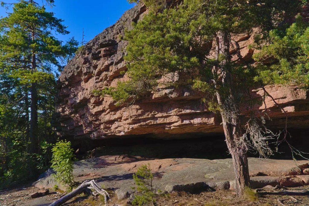
Before we move ahead, I should clarify this: I will probably not be able to categorise Kiilopää as a village or town. It is rather a fell in Finnish Lapland. At its base is a hiking centre operated by Suomen Latu, the Finnish Outdoor Association, where I spent a few days of winter. Kiilopää is one of the gateways to the wilderness of Urho Kekkonen National Park. So if you are seeking wilderness adventures, irrespective of the time of the year, this might be the place to visit. The rolling hills here are a distinct geography that you can experience in Finland.
How to reach Kiilopää?
Kiilopää is located close to the European route E75, which runs vertically through Finland. At the time of writing this blog, at least three buses on their way further north to Ivalo and Karasjok from Rovaniemi take a detour from the highway to visit Kiilopää. It takes about 3.5 hours to cover the 250 km distance from Rovaniemi. The updated schedules for the buses can be found on Matkahuolto.fi and Perille.fi. The nearest airport is located at Ivalo (45 km), which happens to be the northernmost airport in Finland. It is serviced by year-round FinnAir flights from Helsinki and seasonal (read winter) flights from other European cities.
Where to stay and eat in Kiilopää?
The Suomen Latu Fell Centre offers both hotel and hostel accommodations. As mentioned, their Hostel Ahopää is part of the Hostelling International network and has shared dorms for up to eight people in each. For food, you can cook at the shared kitchen in the hostel or enjoy local delicacies at the Fell Centre restaurant. I still remember having one of my best traditional Finnish Christmas dinners in this restaurant. The Fell Centre also has a small store from which you can purchase snacks and canned food; however, the nearest full-stocked grocery store is located in Saariselkä.
Apart from the Suomen Latu Fell Centre, several other resorts and cabins can be found in the area, including the Kakslauttanen Arctic Resort. It is one of those places you might have seen on Instagram reels, with rows of glass igloos. These resorts usually have a restaurant that you can drop by for food. While exploring the area on a bike, I came across the Laanilan Savottakahvila, which seemed like a nice pitstop to warm up in the cold weather. Another cafe that I discovered while writing this blog is at Luulampi, a junction for several hiking and biking routes in the area. Located inside the Urho Kekkonen National Park, the cafe can only be accessed on foot or by cycle and is open only outside the winter season.
What to do in Kiilopää?
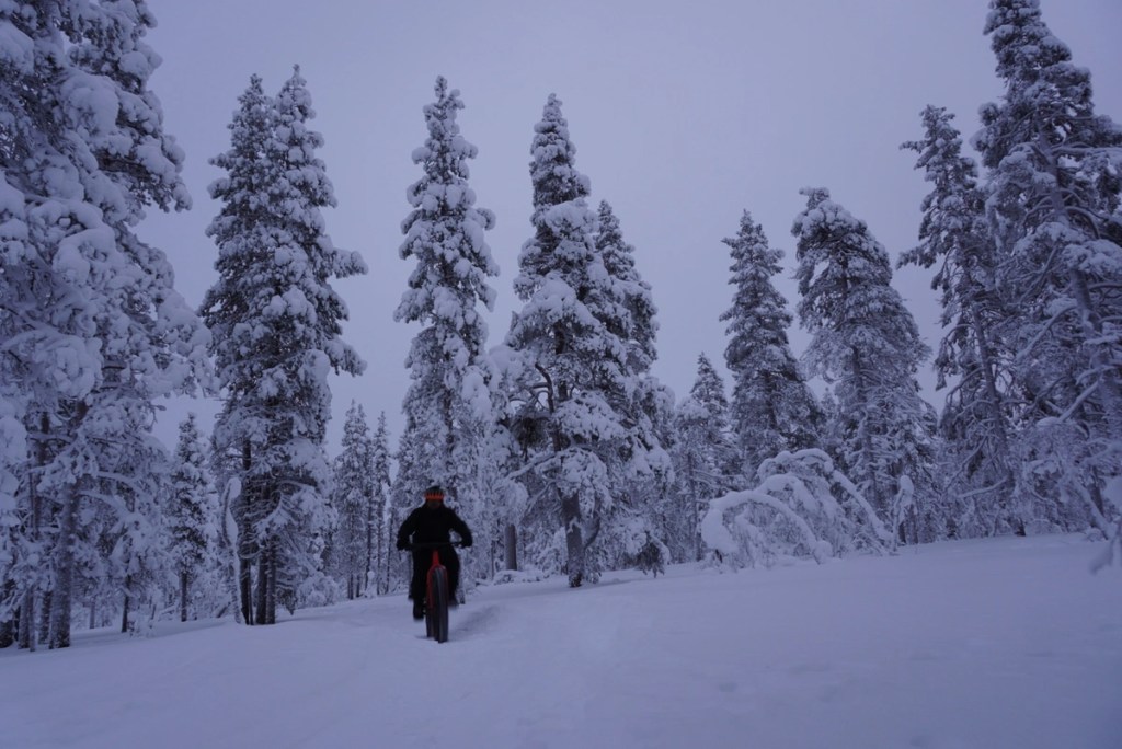
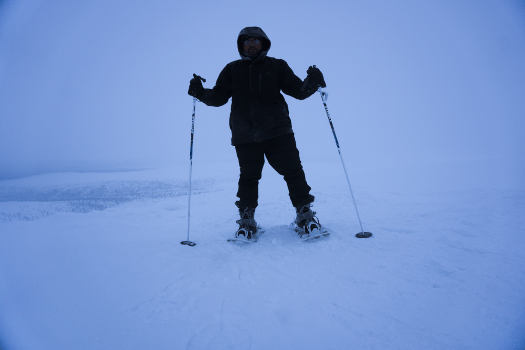
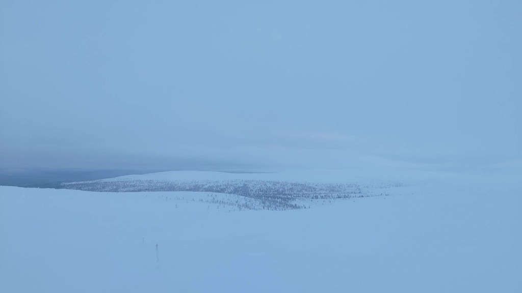
Hike – Bike – Ski – Sauna!!! I suppose that sums up the things that you can do here in Kiilopää. According to the Luontoon.fi website, Finland’s centralised information source on outdoor activities, the Saariselkä, Kiilopää and Kakslauttanen area has approximately 200 kilometres of hiking trails, of which approximately 80 kilometres are located in the Urho Kekkonen National Park. Although these trails are primarily accessible in summer, at least some of them double up as ski and snowshoeing trails in winter. The hike to the summit of the Kiilopää fell would be one of my recommendations if you are visiting Kiilopää. On a clear day, the summit offers great views of the rolling hills that form a vast expanse of the national park. The hike is part of the 5.7 km Kiirunapolku Circle Trail and is usually considered an easy hike. In winter, however, a snowshoe might be essential as the latter part of the trail is not as frequented as the climb to the top following an anti-clockwise direction. Besides hiking trails, the area also has several marked cycling routes, including those that are also maintained in winter. You can ride a fat-bike all the way to Saariselkä and back through the snow-covered forest. The Kiilopää Adventures rental shop, located on the premises of the fell centre, rents out the necessary equipment/gears for hiking, biking and skiing. They also offer guided tours and are the point person for ground-level guidance for planning your own adventures. During my visit, they helped me chart out my snowshoeing and biking routes, and to date, it was one of my best winter experiences. However, there was one thing that I missed experiencing and would not recommend others make the same mistake. The Kiilopää Smoke Sauna is mentioned to be ‘one of the five must-experience saunas in Finland’. After you have soaked in all the adventures for a day, you can rejuvenate yourself by relaxing in the sauna, followed by a dip in the river Kiilopuro. The autumn and winter pictures I have seen of the sauna and the pool are one of the reasons that would take me back to this place, even if for a day.
A random view while fat-biking in the winter wonderland.
Fatbiking through the snow covered forests.
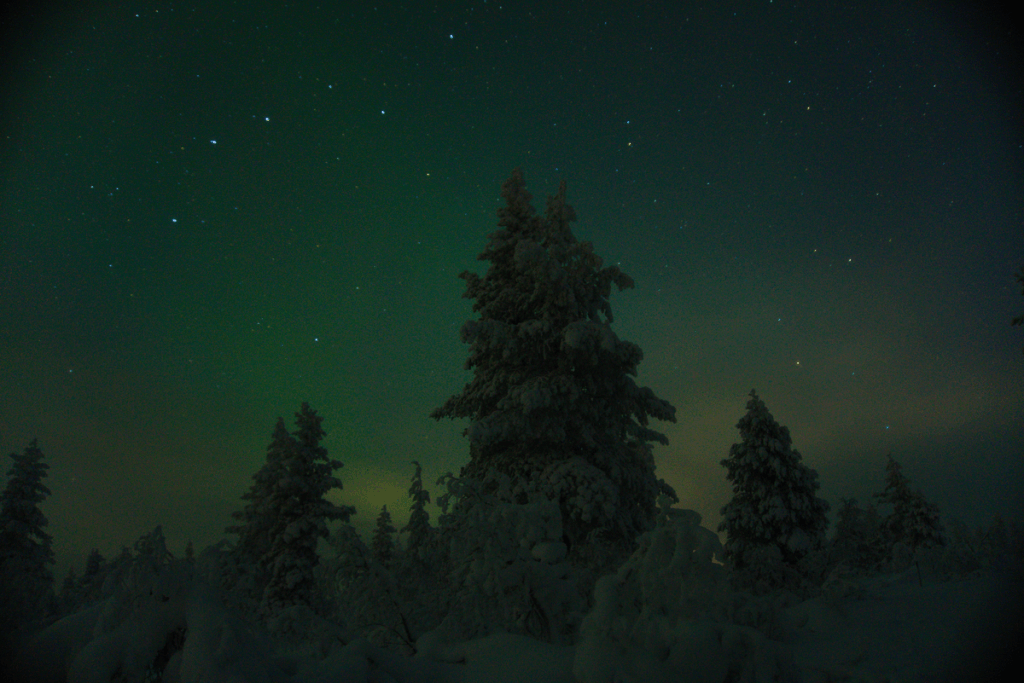
Chasing the auroras.
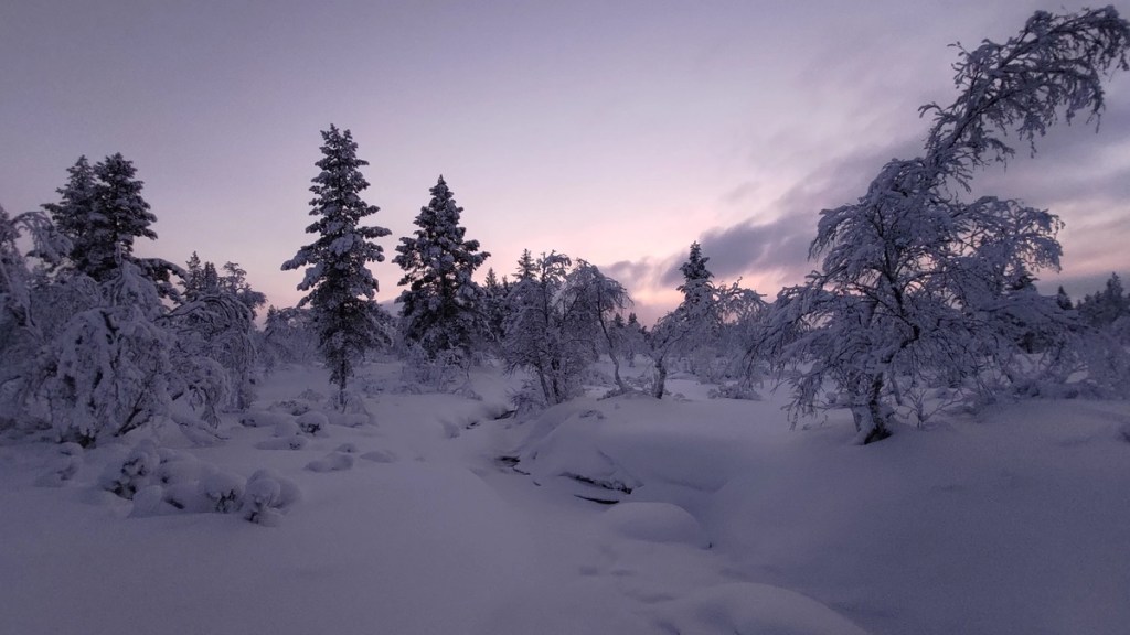
Back into the forest.
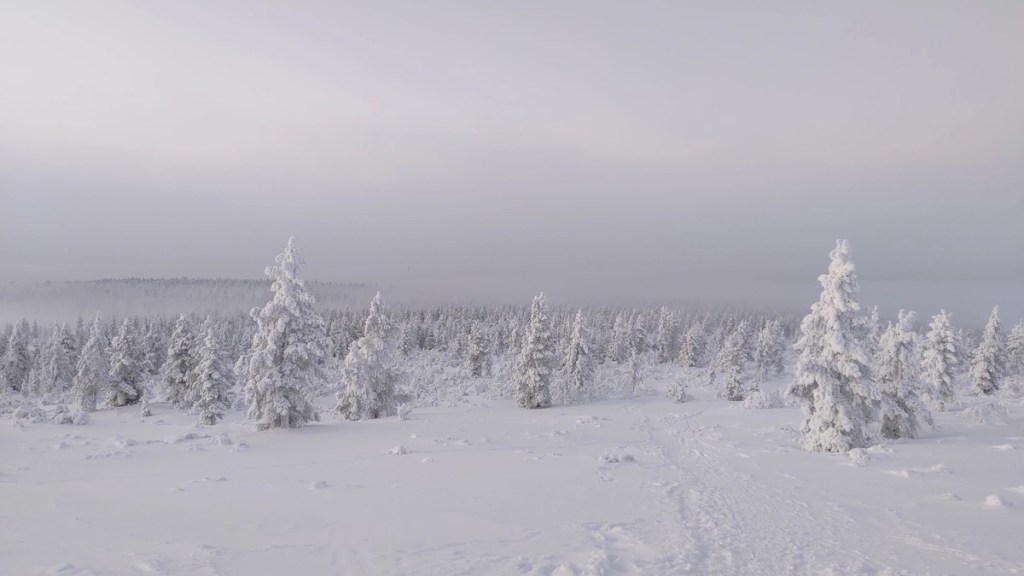
Moving past the tree line on the way upto or down from the Kiilopää fell.
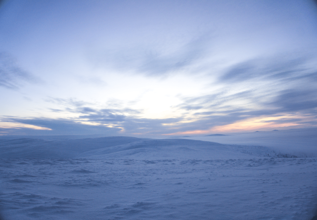
Snowshoeing along the Kiirunapolku Circle Trail. The wind speed rose and the visibility dropped low just as I reached the top of the Kiilopää fell.
View along the Kiirunapolku Circle Trail.
View from the top of the Kiilopää fell. I made a second attempt on my last day there and was rewarded with a better view.
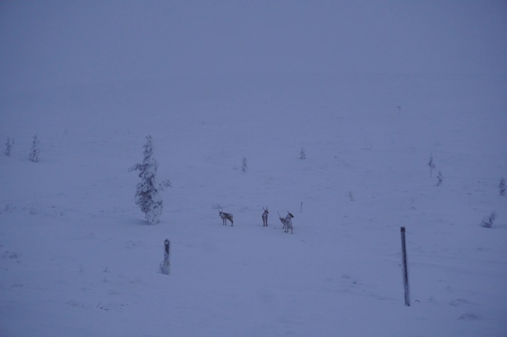
Luckily spotted some reindeer roaming in the wild.
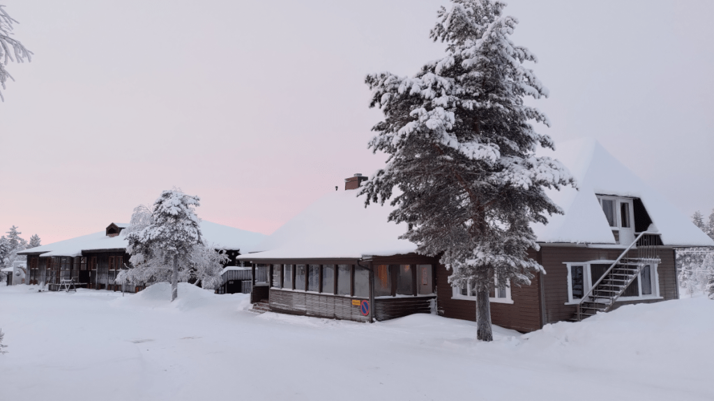
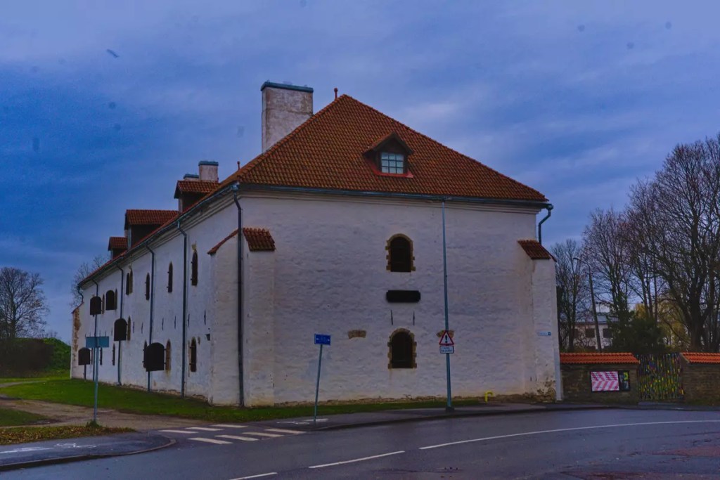
The Hostel Ahopää (Kiilopää) building
For more pictures from this trip and my other trips in Finland, please visit my Instagram and 500px.com pages.
Assuming you enter Finland through Helsinki, Cheap Sleep can be where you spend the first night in the country. It is part of the Hostelling International network and is probably the cheapest hostel in Finland, with prices starting from EUR 20 per night in a 24-bed dorm. The number 24 here might scare off people, but unlike in several hostels, you get a better space for the price. Also, it usually fills slower than the lower-capacity rooms. The dorms have bunk beds with personal lockers, reading lights, and plug points close to the bed. In most of the rooms, each set of bunk beds is separated by partition walls for privacy. If you are into cooking your own meals while travelling, they have a well-equipped common kitchen. Alternatively, you can always grab a snack from the 24-hour grocery store located on the ground floor of the same building or the restaurants nearby during their opening hours. The hostel also offers ample common areas to sit and relax. You can browse through the books available on the common bookshelf or enjoy a session of board gaming. They also host board and arcade gaming nights as part of their weekly activities which also include a movie night and a party night. If I remember correctly, I also saw a couple of massage chairs in one of the corners of the hostel. This might be something you would like to try after a day of exploring the Finnish capital. The bus and tram stops are located within 100 m of the hostel. The bus route 600, which runs between Helsinki Central railway station and Vantaa Airport throughout the day, passes through this stop. Thus making this hostel a perfect base to start and end your Finnish adventures.
Hostel Cafe Koti (Rovaniemi)
The Finnish word ‘Koti’ translates to ‘home’ in English. I suggest making Hostel Cafe Koti your home during your visit to the ‘Official Hometown of Santa Claus’. But beware, Rovaniemi has two faces — it is a tranquil retreat during the summer solstice but a bustling tourist town in winter. The Santa Claus village and the northern lights are a major tourist magnet of this town, located close to the Arctic Circle. Thus, it is advisable to book early to secure a cheap stay in this town. The Rovaniemi railway station and the bus station are located less than 2 km away from the hostel. The local bus number 8 might be the best option to reach the hostel from either place if you hate walking. The bus connects the railway station to the Santa Claus Village and has a stop near Koskikatu, which is the most important shopping street in Rovaniemi. The hostel is just a few hundred metres from this bus stop. The price of a dorm bed in this hostel starts at EUR 30 but can double during peak season. The dorms are composed of bunk beds with access to personal lockers, reading lights and electric sockets. Here you would be sharing the room with nine other persons; however, there are curtains between each set of bunk beds for privacy. The hostel has a common kitchen and TV lounge for use by the guests. There is also a sauna, but it may be accessible only during specific hours. As the name suggests, the hostel operates a cafe on its premises, offering buffet breakfast and lunch. If you are staying at the hostel, you can enjoy a hearty breakfast at the cafe at a discounted rate before heading out to explore the most popular destination in Finnish Lapland.
This was a real hidden gem I discovered during my 2021 winter trip to Lapland. Kiilopää is located 200 km north of Rovaniemi and 15 km before the more touristy ski resort of Saariselkä. The hostel is part of the Hostelling International network and is one of the northernmost hostels in Finland, easily accessible by public transport. Two buses from Rovaniemi on their way further north in Lapland take a detour from the highway to make a stop at the Kiilopää Fell Centre. Hostel Ahopää is conveniently located at one of the entrance points to the Urho Kekkonen National Park, making it an ideal base camp for wilderness adventures throughout the year. If you are familiar with Finnish folklore, you might have heard of Korvatunturi — a fell along the Finnish-Russian border where Santa is believed to have his secret workshop. Korvatunturi is part of the Urho Kekkonen National Park and is on the opposite side of where Ahopää is located. So if you happen to get lost while exploring this vast wilderness area, you might end up meeting the real Joulupukki himself. The hostel has dorms that can accommodate up to eight people and is priced at EUR 30 per bed. Here, you would be sleeping on cosy wooden bunk beds housed in a traditional wooden building. The dorm building has a common kitchen and a few toilets, but no showers. The shower is located in the main building, which also houses the Fell Centre reception and restaurant. The area has no grocery store, and the nearest one is located at Saariselkä. However, the Fell Centre has an equipment rental shop on its premises that can satisfy your hunger for adventure. You can easily rent the necessary equipment, including fat bikes, skis, and snowshoes and set out on an adventure of your own along the vast marked trails and routes or go on a guided excursion. Also, while you are here, try their smoke sauna followed by a dip in the Kiilopuro River (especially in winter). It is recommended as one of the five must-experience saunas in Finland due to the scenic landscape that surrounds it.
The Hostel Ahopää (Kiilopää) building
Dorm room in Hostel Cafe Koti (Rovaniemi)
For more pictures from these hostel cities, visit my Instagram or 500px.com page.
Disclaimer: This is not a sponsored post. The content is based on my personal experiences in staying in these hostels, although not on a single trip.
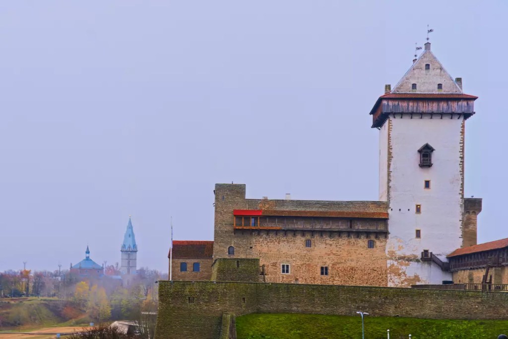
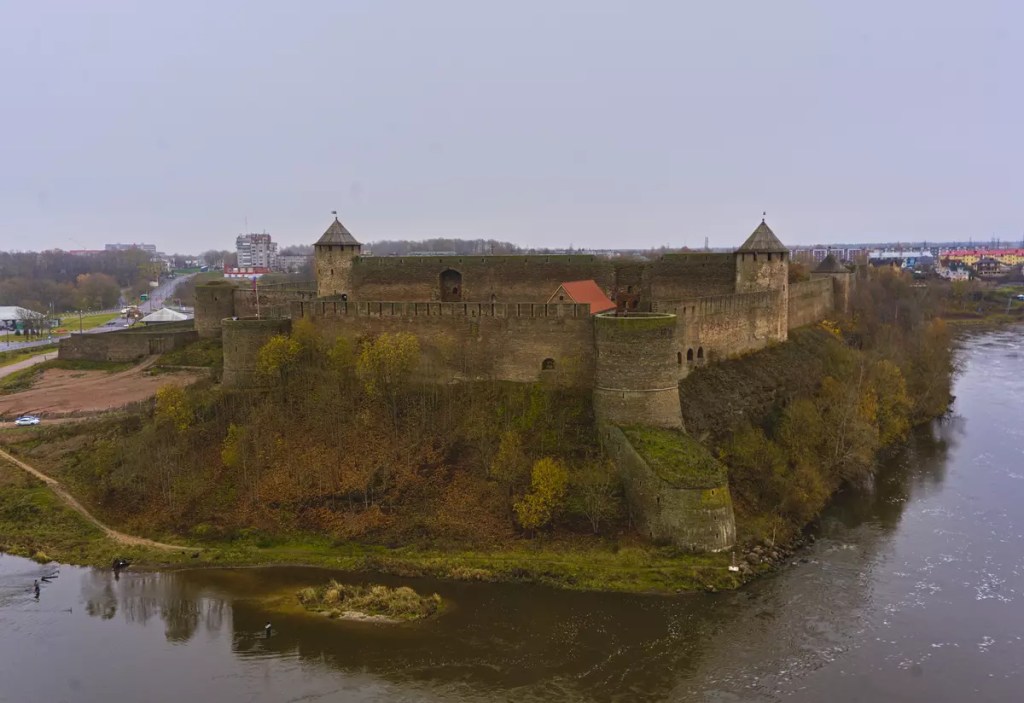
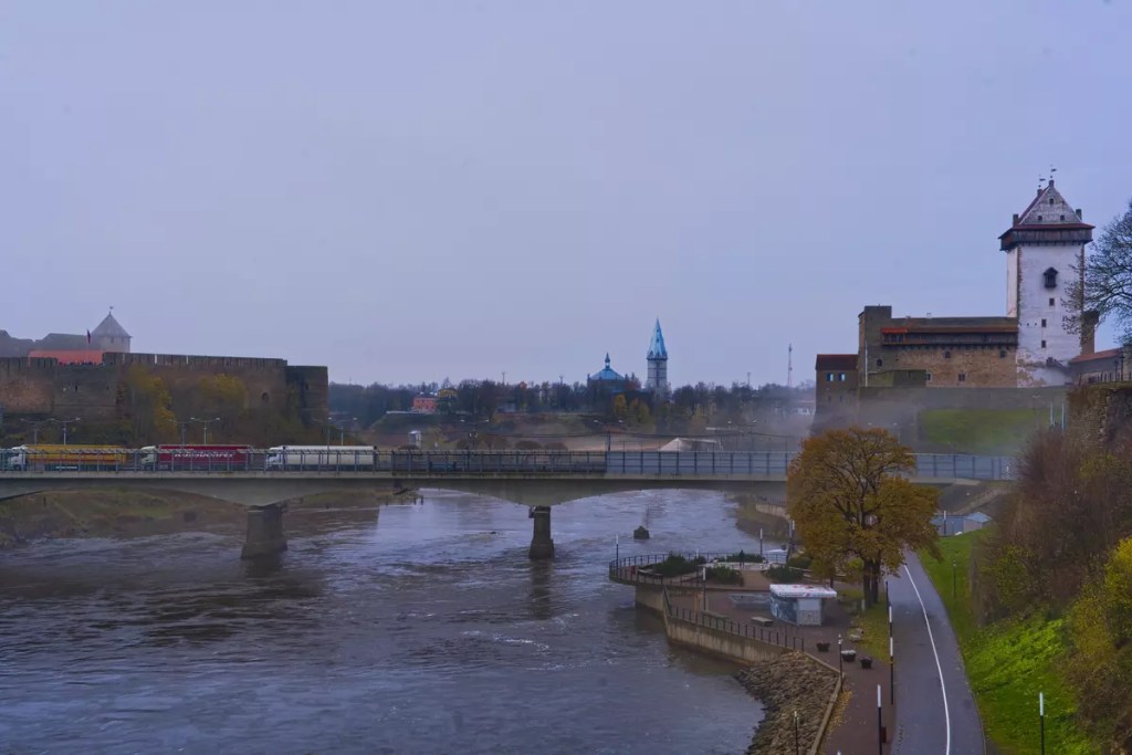
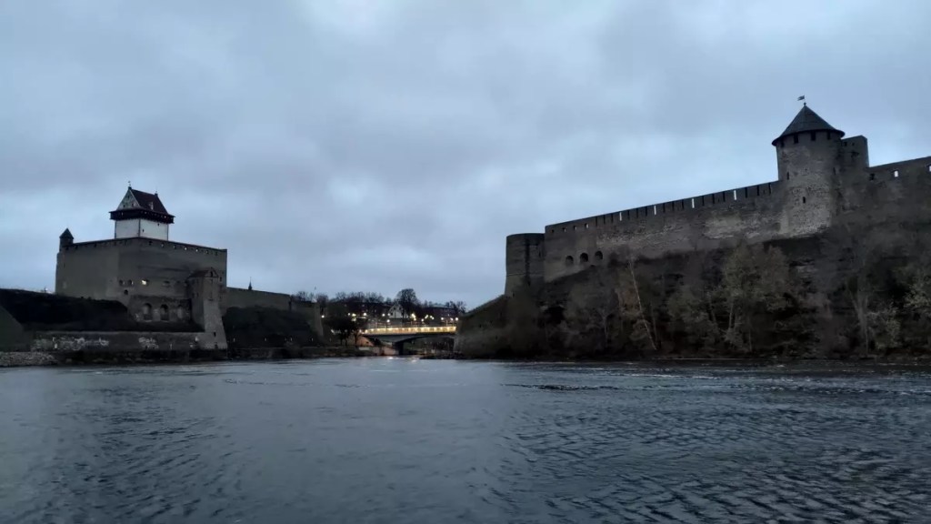
Have you ever visited a place where castles/fortresses from opposing groups face each other? If not yet, then you might want to add Narva to your bucket list. Narva is a town along the Estonian border with Russia. Geographically, it is the easternmost town of Estonia. The Narva River separates the two countries here before draining into the Baltic Sea. On either side of the river are two impressive buildings — the Narva Castle and the Ivangorod Fortress. The Narva Castle or the Hermann Castle was established in the 13th century when the area was part of the Danish Realm. On the other hand, the Ivangorod Fortress was established in the 15th century by the then Grand Prince of Moscow Ivan III. However, archaeological findings indicate that the earliest settlement in this area was in the 5th to 4th millennium BC. Today, Narva is the third largest city in Estonia after Tallinn and Tartu. Narva is connected to Ivangorod in Russia through a ‘Friendship Bridge’ making it possible to visit the two historic buildings in one trip, provided you have the necessary documents and the borders are open.
How to reach Narva?
Narva lies on the European route E20 that connects Shannon Airport in Ireland to Saint Petersburg in Russia. From Tallinn, the Estonian capital, Narva is 216 km towards the east and is connected by both busses and trains. The buses, which ply more frequently than trains, take about three hours while the latter takes a half hour less. Tickets can be booked on the T-pilet and Elron websites for the buses and trains respectively.
What to do in Narva?
Visit the Herman Castle: The obvious thing that you would do if you are drawn to this town is to visit the castle which is currently a museum and presents the detailed history of this area. My favourite part was the audio-visual presentation of how the earliest settlements came to be in this place and how the place developed to be the town we know today. You can also climb up the castle tower to have a look at the Ivangorod Fortress on the other side of the river.
Walk along the Narva River: The Narva Riverfront offers the best places to put the two castles in a single frame. The promenade, which is in the immediate vicinity of the international border, stretches between the Narva Harbour in the north and the Narva Joaoru recreational area in the south. The northern stretch of the promenade is overlooked by the walls of the Bastion Victoria on the Estonian side while the southern stretch follows the walls of the Ivangorod fortress on the other side of the river. It is along this stretch where you can find the remains of the oldest known fortified settlement in Estonia dating back to 1000 BC.
Explore the Narva Bastions: The 17th-century Narva fortifications consisted of seven bastions that protected it from enemy attacks. When I visited, only six of them were preserved and could be visited. Of these, the Victoria Bastion was the most powerful one with a 16-metre-high front wall facing the river. It is today possible to explore the interiors of the Victoria Bastion on guided tours but must be pre-reserved during the off-season. An unlikely attraction that you might encounter inside is the bats. These local bats including some rare species call the bastion casements their home, especially during the winter months. The top of this Victoria Bastion and the nearby Pax Bastion has been converted into a public park and is accessible at all times.
Where to eat?
I would like to specifically mention two places that I visited during my trip. The first one is Ravintola Petchki-Lavotchki at the Fama Keskus which serves traditional Russian food. I had seen some recommendations for this restaurant on the internet but it was the interestingly decorated exterior that attracted me inside. If I can recall correctly, I tried stroganoff for the first time here and it definitely did not disappoint. The other was a cosy cafe called Bublik. Cafe Bublik is recommended for its pastries and mouth-watering dumplings. Here, I tried Pelmini and would recommend you too. If you haven’t heard the name before, it is a meat-stuffed dumpling of Russian origin and is often regarded as the ‘heart of Russian cuisine’.
Bonus:
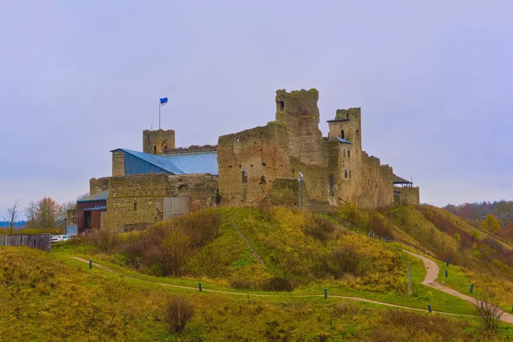
Rakvere castle: If you happen to be visiting Narva from Tallinn or heading towards it, you could potentially make a stopover at Rakvere midway and visit another medieval castle. The Rakvere Castle is ideally a small theme park representing everyday life in the 16th century. Among other things, here you can explore a medieval torture chamber, a death room and even hell.
View of Herman Castle from Bastion Pax. In the background is Alexander Lutheran Church.
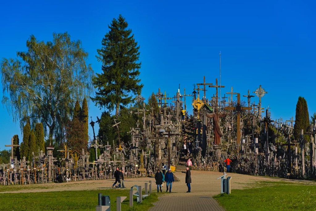
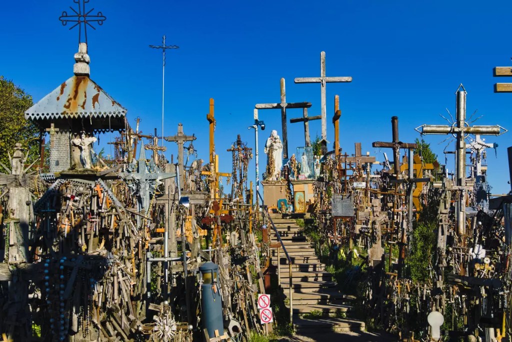
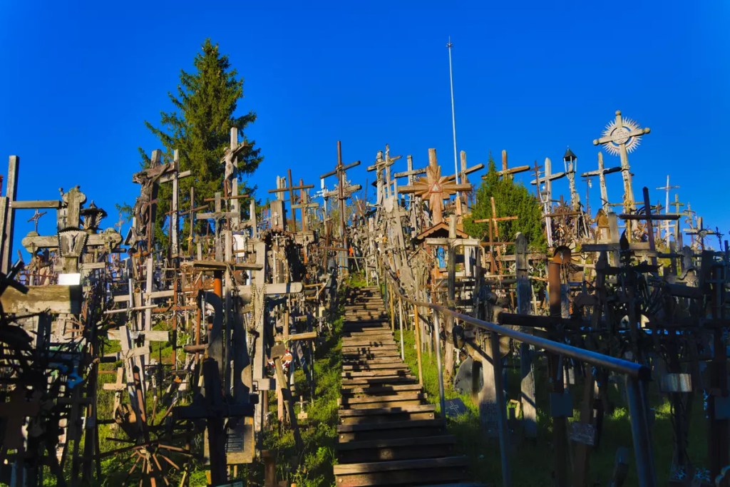
This is one of the day trips that is made possible due to the free travel agreement within the Schengen area. A day trip that takes you across the border. From Latvia to Lithuania. From Riga to Šiauliai. Šiauliai is located in the northern part of Lithuania and is about 220 km from the capital city of Vilnius. It is the fourth-largest city in the country and the sixth-largest in the Baltic states. While the Vilnius-Trakai-Kaunas axis might be the most popular tourist destination in Lithuania, Šiauliai has found a place due to a unique attraction just outside of the city called the Hill of Crosses. It is located on the highway from Šiauliai to Riga making it closer to Riga than Vilnius. In addition, it was the timing of the available public transport that made it feasible to visit the Hill of Crosses from Riga during my 20-hour stop-over at RIX (Riga International Airport) while flying with Air Baltic.
What is the Hill of Crosses?
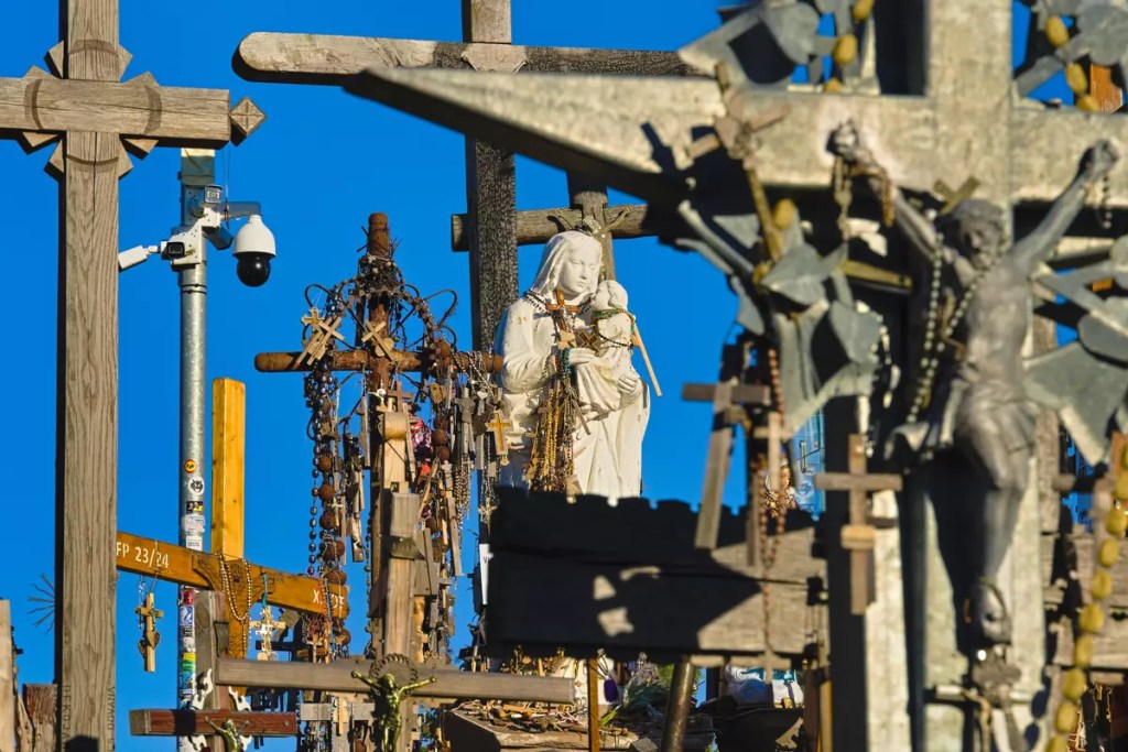
The history of the Hill of Crosses is believed to date back to the Polish–Russian War of 1830-31 although its first mention could only be traced back to writings from 1850. The first cross was supposedly placed at what was earlier the Domantai hill fort by the relatives of the victims of the rebellion. The number of crosses is understood to have increased further during another rebellion in 1863. Over the next few decades, the site became a symbol of the peaceful endurance of the Lithuanian people. This was however seen as a sign of resistance against the totalitarian government for the years following the Second World War when Lithuania was under Soviet occupation. During this period, the crosses at the hill were destroyed several times in an attempt to suppress any uprisings. When Lithuania finally regained its independence in 1990 and following the visit of the Pope in 1993, the place became a world phenomenon and the number of crosses exploded. Today there are an estimated more than 100,000 crosses on the hill with more being added every day and some withering with time.
How to visit the Hill of Crosses?
As mentioned earlier, the Hill of Crosses is located along the European route E77 in the direction of Riga from Šiauliai. From Šiauliai, you can take the bus that goes towards Joniškis and get down at Domantai bus stop. The Hill of Crosses Information Centre is 1.5 km from the bus stop. The bus runs at roughly one-hour intervals with possibly fewer trips on weekends. You can check the updated schedule on the autobusubilietai.lt website. It is possible to purchase tickets for some trips online while for others you will have to buy them from the driver with cash only. It is also possible to cycle from the city to the Hill of Crosses. There is a separate cycle and pedestrian route to the Domantai bus stop. City bikes can be rented from the Šiauliai Tourism Information Center located at the Šiauliai Boulevard.
The best and cheapest way to reach Šiauliai from Riga would be to use the FlixBus. There are usually a couple of departures every day and takes about two and a half hours. I took the one that left Riga Airport at 12:10 and returned from Šiauliai on the 21:40 departure. An alternate way to reach Šiauliai from Riga is on the LTG Link train service. However, there is seemingly only one service per day and is an expensive option. The train can be a better option if you are visiting Šiauliai from Vilnius as it takes about an hour less compared to the bus which takes about three and a half hours. The schedules for the trains and busses are available on the LTG Link and autobusubilietai.lt websites respectively.
A note of caution. If you are required to cross your border during your trip, it might be a good idea to carry your passport or other identification documents as there might be a random check.
What to do in Šiauliai?
I visited Šiauliai on a Saturday and had a few odd hours between 18:00 and 21:30 to explore the city exclusively. This, as you might guess, is not the best time to go sightseeing in a small city. Yet there are two things I could suggest doing to spend the hours before hopping on the bus to Riga.
Walk along the boulevard: The website of the Šiauliai Tourism Information Center mentions Šiauliai as the third city in Europe after Rotterdam and Erfurt to reclaim a part of street from the vehicles and turn it into a pedestrian boulevard. A short walk from the bus station, this is the part of the town where you would expect to see most people on a weekend. The nearly 1.2 km stretch of the Šiauliai Vilniaus Street, built in the 18th century, is today a place of leisure, recreation, entertainment and trade. The street has several cosy cafes and restaurants to explore.
Eat traditional Lithuanian food: Straight up I would like to recommend Restaurant Žemaitis if you are looking to try traditional Lithuanian food. This was one of the few places that was recommended to me by Google search and was open during my visit. If I had to rate it, I would give it 10/10 on all three aspects — food, atmosphere and service. I tried their soup kharcho and apkepti cepelinai. Cepelinai is regarded as the national dish of Lithuania. It is a grated or riced potato dumpling filled with ground meat and is served boiled or fried. Either way, it is a must-try when visiting Lithuania.
Hill of Crosses
Hill of Crosses
Hill of Crosses
Hill of Crosses
Check out more pictures from this trip on Instagram.
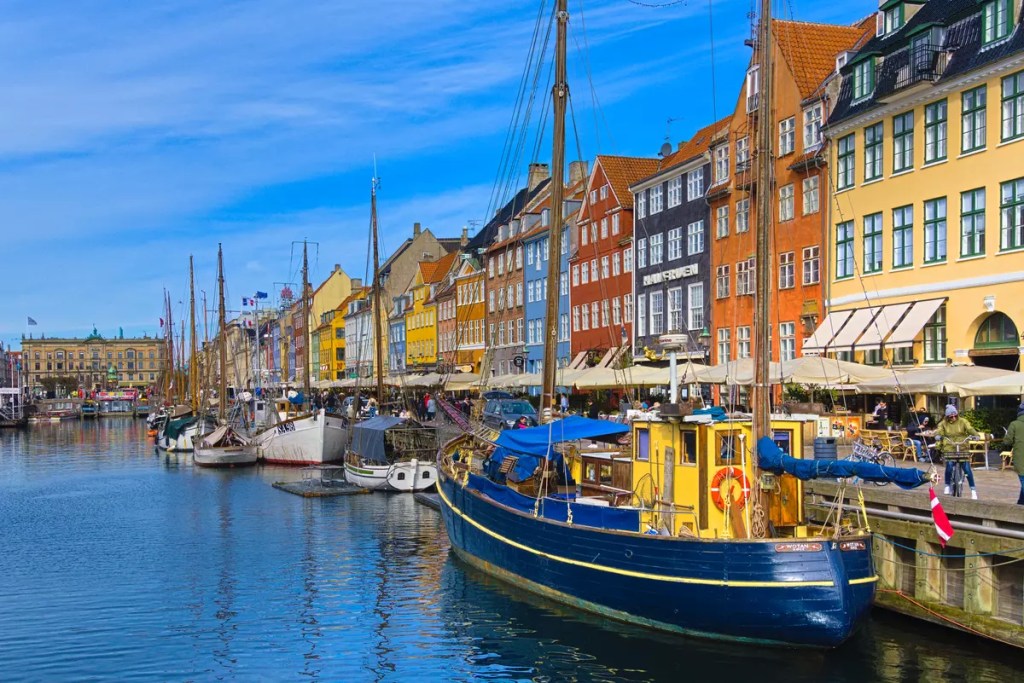
This is the place from the classic picture of Copenhagen on Google search. The street with colourful buildings and canals and boats in it. Nyhavn is the Danish word for new harbour. The area dates back to the 17th century and was built as a gateway from the sea to the old inner city. Today, except for the sightseeing canal cruises no big ships enter this area. However, as a reminiscence of the old days, several historical wooden ships are harboured here. The other thing that adorns Nyhavn are its colourful buildings including one where the famous fairytale author Hans Christian Andersen lived. Most of these buildings now serve as restaurants and cafes spicing up the Copenhagen food scenes.
Reffen
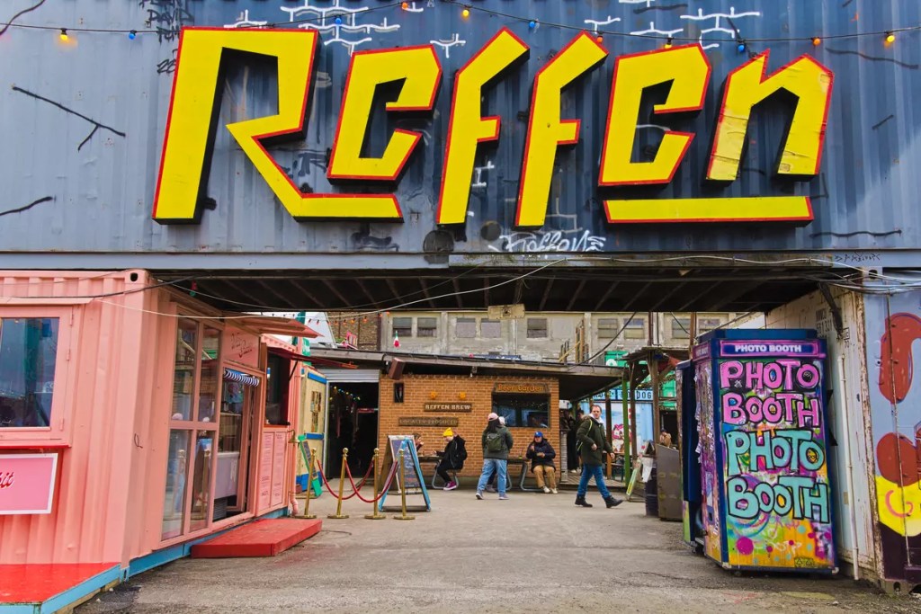
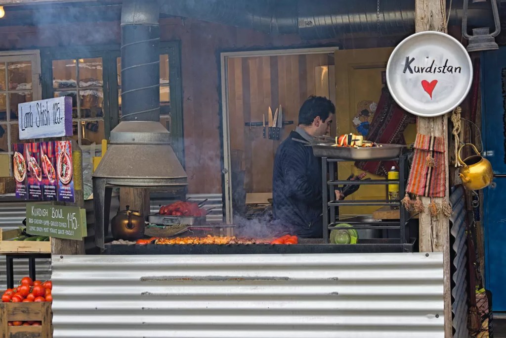
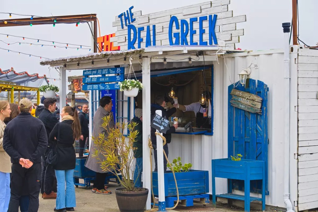
Talking about Copenhagen food scenes would be incomplete without Reffen. Reffen is the largest street food market in Northern Europe. It is a true melting pot of world cuisine. The spices have literally turned the old shipping containers and warehouses into a delicious must-visit place in Copenhagen. While in summer, you would be naturally attracted to the waterside open sitting area, in winter you can still enjoy the tasty foods inside its newest indoor sitting hall. Reffen is easily reachable from Copenhagen Central Station by bus number 2A. My top pick here that I would recommend to others is shish kebabs from a Kurdish stall called Gosht. Apart from this, the momo from Everest, BBQ and Bao from Manila Street and parmesan fries from Quick Bites were also worth a try. These were just four of the several stalls that I could taste during that one afternoon while leaving the rest for another trip.
Freetown Christiana
Between Nyhavn and Reffen is a place quite unlike the rest of the city. The Freetown Christiana is an independent commune that was started by a group of anarchists and hippies by taking over an abandoned military base in 1971. The Christianshavners, as the residents of this area would call themselves, are guided by their own rules and flag. Though this ‘social experiment’ was legalised in 2011, it has always remained in controversy due to the growing crime in the area. The commune is one of the largest tourist attractions in the city partly owing to the creative architecture of the houses here and partly due to Pusher Street, an area infamous for its open trade of otherwise illegal cannabis. However, as of April 2024, Pusher Street has been closed by the actions of the residents in an attempt to bring down organised crime. While visiting Freetown Christiana, you can opt for a guided tour of this alternative society by one of its resident members or go about a self-exploration of the creative housing, workshops, and eco-restaurants in the area. Please refer to the Visit Copenhagen website for more details of the guided tours.
Bonus:
If you feel that you still have an appetite to explore more of Copenhagen, then here are another three sets of places that you could visit.
Bakken and Tivoli: Copenhagen boast of some of the oldest still operational amusement parks in the world. Bakken has been in operation since 1583 while Tivoli was founded in 1843. The Tivoli Gardens is located right next to the Copenhagen Central Railway Station while Bakken is about 15 km from the Tivoli and can be reached by the C route of S-trains. Bakken operates on a pay-per-ride ticket. On the other hand, you will also need to pay to enter the Tivoli Gardens besides the tickets for the rides. The main attraction of Bakken, as far as I could say, is the nearly 100-year-old wooden roller-coaster. Would you dare try it?
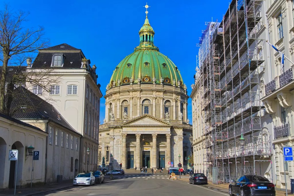
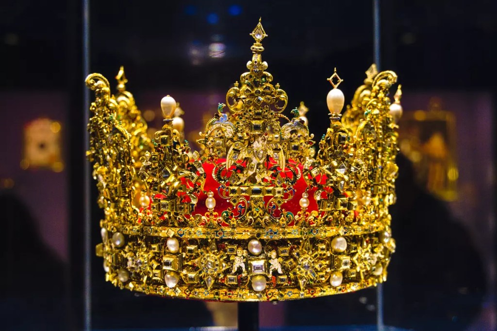
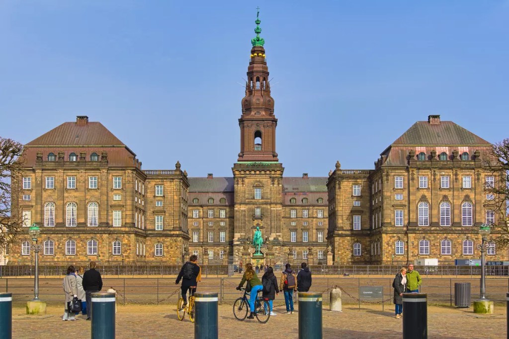
The Royal Triangle: Denmark is a constitutional monarchy and Copenhagen has been its capital since the early 15th century. Over its thousand years of history, it has grown from a small Viking fishing village to a modern metropolitan city of today. Traces of this long history are scattered around the city, especially in the form of its two palaces and a castle that I can call the Royal Triangle. The Rosenborg Castle built in the early 1600s as a pleasure castle is currently the home of Danish crown jewels. The 18th-century Amalienborg Palace is the official residence of the Danish royal family. The more recently constructed Christiansborg Palace is the seat of the Danish parliament. While each of these three places has a primary official function today, they also house a museum that tells the story of this historic city. Adjacent to the Amalienborg Palace is the iconic Marble Church whose blue dome is a distinct feature of the bird’s eye view of Copenhagen. If you are at the Amalienborg Palace at noon 12 o’clock you will be able to witness the changing of guards ceremony.
7-Eleven: I might have bragged about Reffen a bit too much here. I must admit that it is not just Reffen that has good food in Copenhagen. Even the humble 7-Eleven stores that can be found in every corner of the city have great baked delicacies to offer. During my stay, I tried a couple of different items from a couple of different 7-Eleven stores and each pick was a hit even though now I cannot recall the names of the things I ate. So if you are looking for a quick snack while exploring Copenhagen, head to your closest 7-Eleven store. (Note: this post is not sponsored by 7-Eleven!)
Pictures from my visit to Copenhagen are available on 500px.com and Instagram.
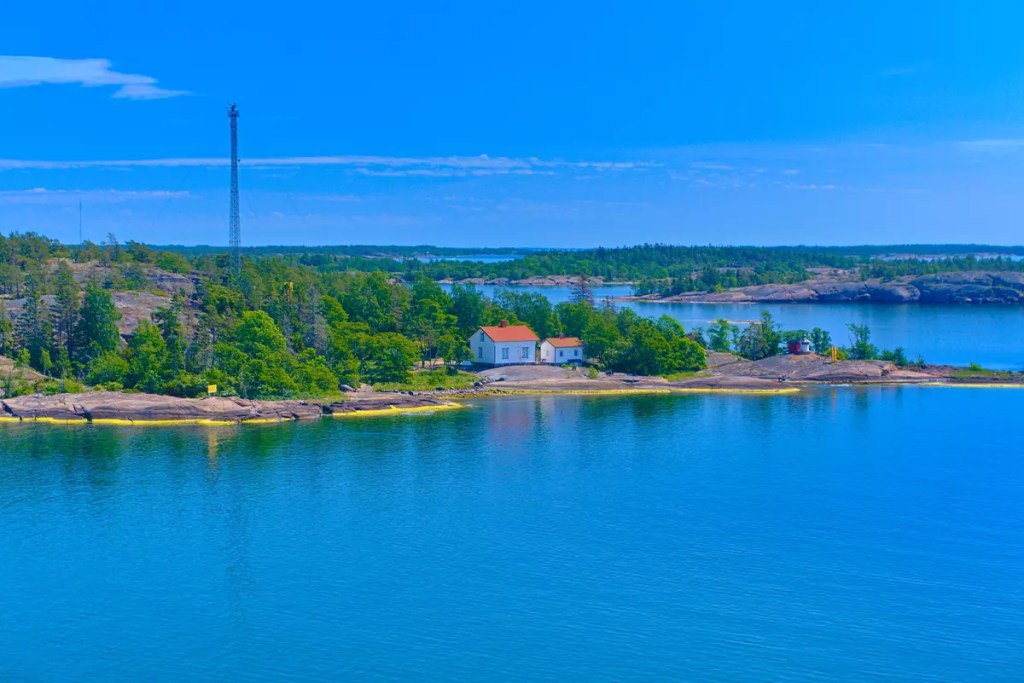
Åland Islands is a cluster of islands between Finland and Sweden in the Baltic Sea. Given its strategic location, it has found its place in the pages of history books. Today, it is an autonomous and demilitarised region of Finland with a predominantly Swedish-speaking population. The island cluster, especially those on the eastern flank, is a popular biking destination. Many often choose to ferry hop through the islands while going from Finland to Sweden or the other way around. Besides the endless natural attractions, there are only a handful of touristy sightseeing places. During the mid-summer weekend of 2023, I planned to visit the island and explore the place on my bike. But instead of ferry hopping between the small islands, I visited the four corners of the main island. This is my take on #BikExploring Åland under the midnight sun!
Mariehamn
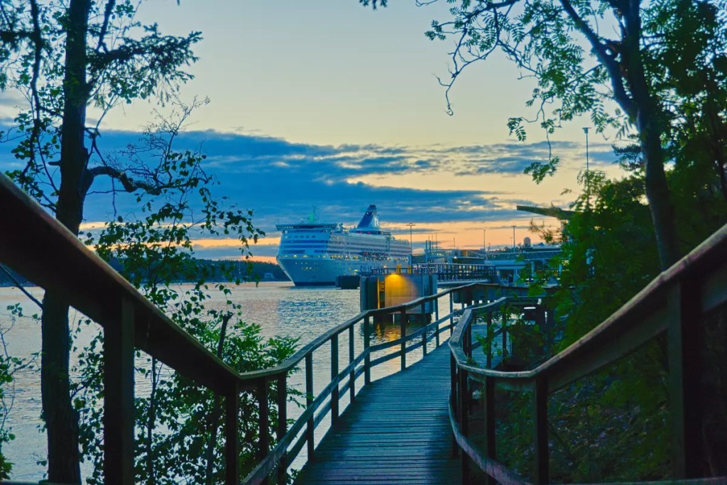
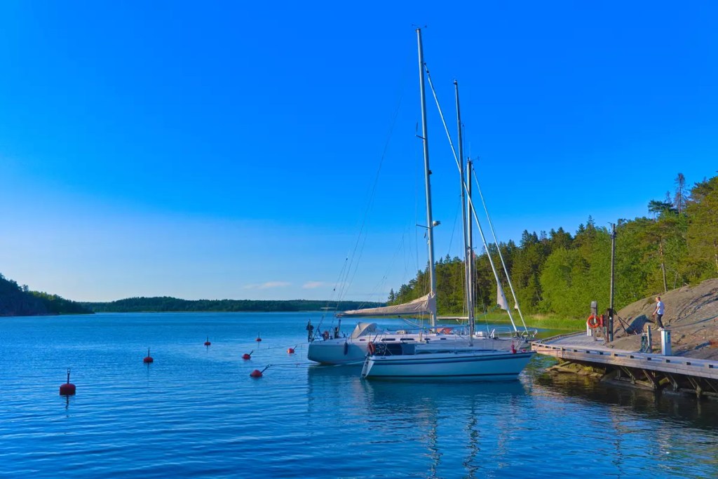
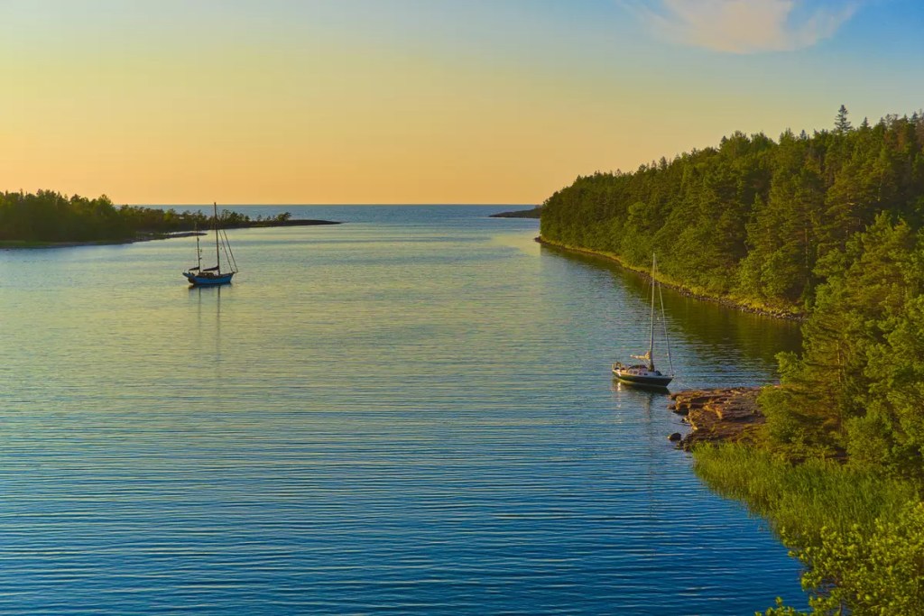
Mariehamn is the capital of Åland. It is one of the gateways to the main island of the Åland Islands. I started and ended my journey from this port. I literally sailed with (or rather on) the Vikings. The Viking Line is one of the operators that sail cruise ships between Finland and Sweden with a stopover at Åland. The journey from Turku to Mariehamn took me about six hours. Geographically, the city is located on a peninsula with sea on three sides.
At Mariehamn, I set up my first camp at the Gröna Uddens Camping. This is on the east side of the city and close to the city centre. Yet, the camping ground has a peaceful setup amidst nature. The area is actually close to a protected nature area. You might catch a glimpse of free-roaming peacocks or deer nearby if you are lucky. The best thing about pitching my tent here was that both the forest and the sea were less than 100 m away. Since it was the midsummer weekend, the site was buzzing with people. There was also live music to enjoy at the restaurant during the evening besides good food and alcohol.
Being the capital of Åland, Mariehamn has its fair share of cafes and restaurants to visit. One that is often recommended and that I have visited is Café Viktor. It is housed in a 19th-century wooden building close to the central square. Apart from the food scenes, the natural scenes are also great around Mariehamn. Among the places I would suggest are Vista Point and Strandpromenaden. Both of these are located on the western side of the peninsula offering amazing views of the sunset and the interplay of colours thereafter. While it is possible to bike to the first point, the second one is more of a walking path along the harbour. From Strandpromenaden you can have a closer look at the ships heading to dock at the Mariehamn harbour. Other key places to visit in Mariehamn are the Åland Maritime Museum and the Museum ship Pommern both of which tell about the maritime history of the island.
Bomarsund
On the east end of the Åland main island is a historical place. After Åland and Finland came under Russian occupation following the Finnish War in 1809, the then Rusian emperor ordered to building of a fortress within the current Sund municipality of Åland. However, the fortress never achieved its planned glory. Rather, in the 1850s during the Battle of Bomarsund, even the completed structures were demolished. Among the erect structures remaining today are the walls of the fortress that are always open to visitors. There is also a museum where one can learn more about the history of this otherwise peaceful place.
Bomursund is 35 km from Mariehamn. I would say this was the most relaxing day of the trip not only for the short distance but also for the places to visit in between like the St. Olaf’s Church at Jomala just 8 km into the ride. After another 13 km of hustling I reached Uffe på berget, a cool cafe at Godby. This was suggested to me by an Instagram acquaintance. Here, you can enjoy their delicious Åland style pancakes served with whipped cream and plum jelly. I would also recommend their berry pie to satisfy the sweet tooth. The cafe is located on a hill so you can have a panoramic view of the surrounding areas while having your food. Adjacent to the cafe is a 30-meter-high observation tower if you need to seek what lies in your path ahead.
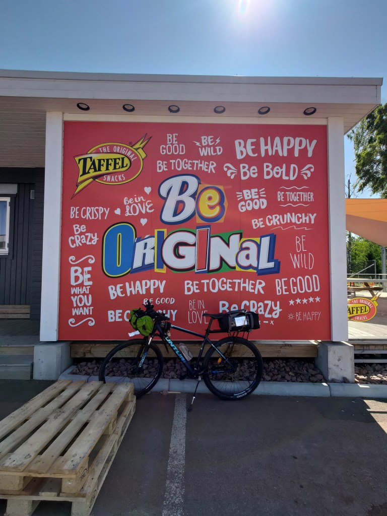
The Taffel Factory Shop is actually what lies on the path next and is a must pitstop. If you have spent time in Nordic grocery stores, you might be familiar with their savoury snacks. Here you can collect them in bulk at a discounted rate for the rest of the trip. About 3 km from here is the Kastelholm village which houses a medieval castle and one of Åland’s greatest historical attractions. This 14th-century castle is one of the five medieval castles still standing in Finland. While at Kastelholm, you can also visit the prison museum Vita Björn and the Jan Karlsgården open-air museum. Collectively, the two museums tell a story about life at opposite ends of the social spectrum — one as a prisoner and the other as a free man. If the three exhibitions here have overloaded you with information, you can choose to relax at the Åland Distillery restaurant sipping their finest products.
After Kastelholm, the ride is on the Åland Highway 2 until the next camping site about 10 km away. The Puttes Camping ground is located within the ruins of the Bomarsund fortress area. In fact, when you first reach the campsite by road, you will encounter the honeycomb-patterned remains of the fort wall. The camping ground is a long stretch of green field between two hills. It was among the planned sites for the fortress buildings that were never constructed. On top of the hills are the remains of the watch towers but even today they offer amazing views of the area. The north end of the camping ground opens into the sea and has a guest harbour. Bomarsund is along the old postal route biking trail that stretches from Hummelvik in the east to Storby in the west bifurcating Åland into two halves.
Geta
After visiting the eastern corner, it is time to head north. You have the option to either trail back along the highway to Godby and then head north along Åland Highway 4 or go via the Finby-Vivastby-Sibby-Brännbolstad-Sund-Rangsby-Saltvik route. As this is not a major road, the traffic is even quieter allowing a peaceful rendezvous with the villages of Åland. At Saltvik you re-enter the mainstream of traffic flow and continue on an uneventful road till Geta. The only interesting thing I recall from this stretch is riding along apple orchards. There is a bistro at Västanträsk where you can stop by to refuel yourselves. Unfortunately, during my visit, it was closed but this bistro run by Grannas Äppel is a recommended place to visit.
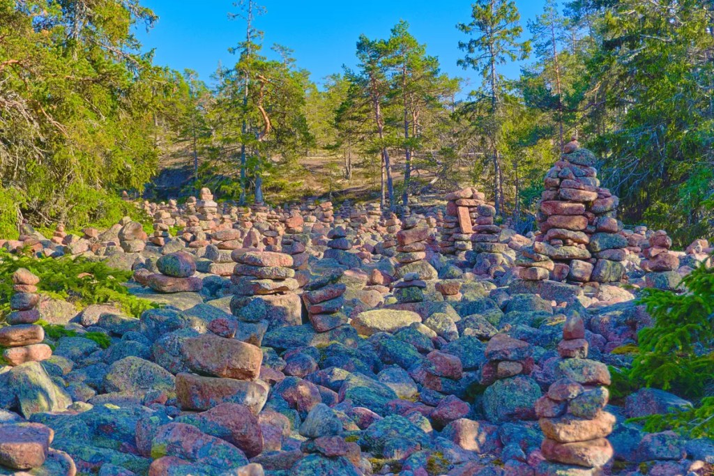
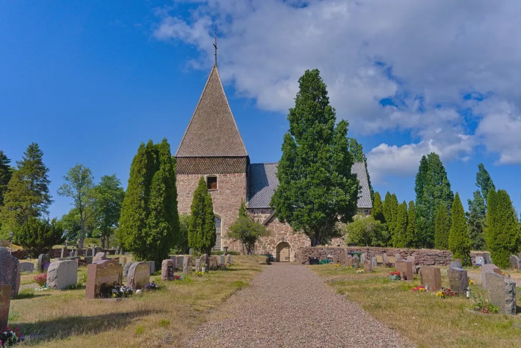
Geta is a sort of hidden gem in Åland. It is about 42 km from Mariehamn and 45 km from Bomursund along the aforementioned route. The place is known for its hills, gorges and caves. The rock formations in the area are attributed to the events of the Ice Age. Currently, the area is a popular rock-climbing and bouldering destination. Djupviken Bay, towards the north, is among the most photographed landscapes in the region. Along the hiking trail that follows the rocky paths to the cave and the bay is an interesting place filled with rock cairns. Although the cairns have been made recently, the rocks date back to 5000 years ago. Besides this, Geta has a beautiful church and I suggest you do your prayers before you start your uphill ride to the campsite.
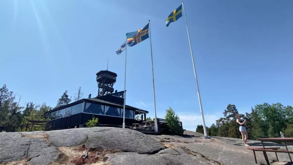
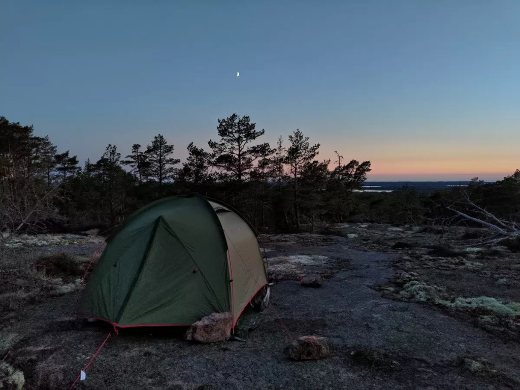
The Soltuna campsite is located high up on a hill. Once I reached here, pushing my bike along the road, it took me a bit of time to realize that there were no grassy campgrounds that I was used to. I literally had to pitch my tent on the rocks. And since this place was at a high altitude and close to the sea, it was pretty windy. I had to secure the lines of my tent with heavy rocks to prevent it from flying away. But unlike other campsites, there were hardly any people here. Most were here on a day visit to the nature trails or the disc golf park. I must mention here that the campsite has a nice restaurant where you can enjoy a ‘meal with one of the most beautiful views that the Aland islands can offer!’.
Eckerö
Another spot of geological interest is on the west coast of Åland in Eckerö. Close to the photographic old fishing harbour is a hiking trail that leads to a rocky landform that forms the breakwater to the natural harbour. The Rapakivi granite landmass, I would say, is a great location to enjoy the setting sun. But before you can enjoy that pretty sunset, you have to bike about 50 km from the Soltuna campsite. The first part of the ride is a short 6 km ride to Snäckö to hitch the ferry between Snäckö and Skarpnåtö. This is a limited service offered especially for the bikers. So confirm the schedules while planning your trip. While at Snäckö waiting for the ferry, you can enjoy a good seafood brunch at the Lolo’s Seaside Café & Restaurant.
Once on the other side at Skarpnätö starts the actual hustle. It was a decently warm day and riding on the tarmac with limited tree cover was quite tiring. The first stop however came at 9 km from the Skarpnätö ferry pier. The Sålis Battery lookout tower gives a great view of the surrounding archipelago. The tower sits at the site of a demolished coastal artillery battery dating back to the First World War. The next lap is about 14 km long till another historical church on the island. The Eckerö church is believed to be standing there since the 13th-century church. For people island hopping between Finland and Sweden, the Eckerö Port has ferry services to Grisslehamn in Sweden to continue their journey.
I pitched the last tent of my trip at Hummelvik Camping further 7 km from the church. While Eckerö has a more popular and busy Käringsund resort and camping ground, this one was less crowded and comparatively peaceful. However, unlike my previous three campsites, this one had no restaurants on site. Fortunately, the town had a couple of restaurants including a buffet restaurant called Bettys i Eckerö to top up my energy to the max. The restaurant also had a small convenience store attached to get some post-meal snacks.
Nåtö-Järsö-Granö
The final leg of the trip is the return to Mariehamn covering a distance of about 35 km. The journey starts by trailing back along the same route we had taken while coming to Eckerö until Karlholm at 9 km. From here, most part of the ride follows the Åland Highway 1. At the 11 km point, you can find Hugos Livsmedel, a supermarket, to grab a quick snack for the rest of the ride. This was, as I recall, the last store to grab food and drinks along the route before Jormala. If you are interested, you might take a detour to visit the Fire Brigade Museum of Åland about 1.5 km from Hugos Livsmedel. Also along the route to Mariehamn and about 2 km from the supermarket is Hammarland Church. I missed noticing it as it was hidden behind trees and might take a good sight to spot while riding on the other side of the road. Two other stops that I could recommend along the route are the Långträsk rest stop and the road alongside Ramsholmen. The bike track near Ramsholmen is close to the Marieham airport, so you can spot flight take-offs or landings if you schedule your ride accordingly.
This time instead of spending the night at Mariehamn I headed further 12 km south towards Järsö. This bike trail is a recommended route if you are looking for a short ride along the archipelago while staying at Mariehamn. The Nåtö and Järsö nature trails in the area are popular among day trippers and nature lovers for their wooded meadows. A lucky eye might even spot free-roaming deers in the area. Seemingly there was hardly any space to legally camp in this area as they were primarily marked as nature reserves or private land. So I ended up booking a small cabin at the Fågelvik B&B sufficient to spend the night. The place was by the sea where you can either go for a swim or just sit by the shore and enjoy a pizza. By now if you have fallen for Åland style pancakes, then you should stop over at the Nåtö Kiosk while riding along this route.
As mentioned earlier, this post is based on my solo bikepacking adventures in Åland during the week following the midsummer day of 2023. Parts of the post were first published on www.frsthand.com as a part of the ‘Camping is trendy again’ call in September 2023. You can see more pictures from the trip on my Instagram and 500px.com profiles.
Sailing past the Turku archipelago
Mariehamn Strandpromenaden
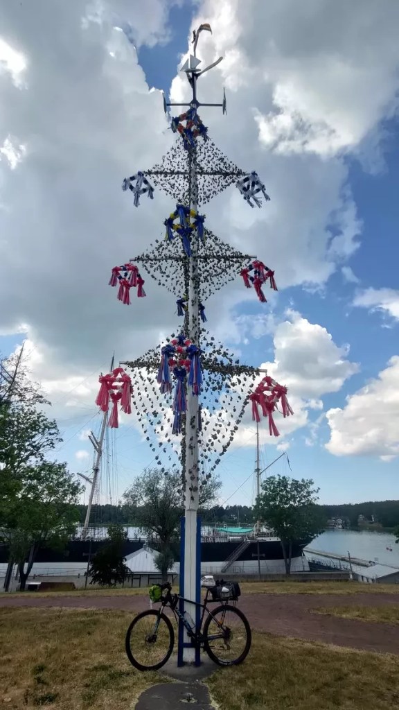
Midsommar maypole at Mariehamn
Uffe på berget
Åland style pancake at Uffe på berget
Taffel factory store
Bomarsund ruins
Bomarsund guest harbour
Camping on the rocks at Geta
Rock cairns at Geta
Grottstigen Caves
Djupviken Bay
Sunset from Soltuna golf course
Smoked salmon platter at Lolo’s Seaside Café & Restaurant
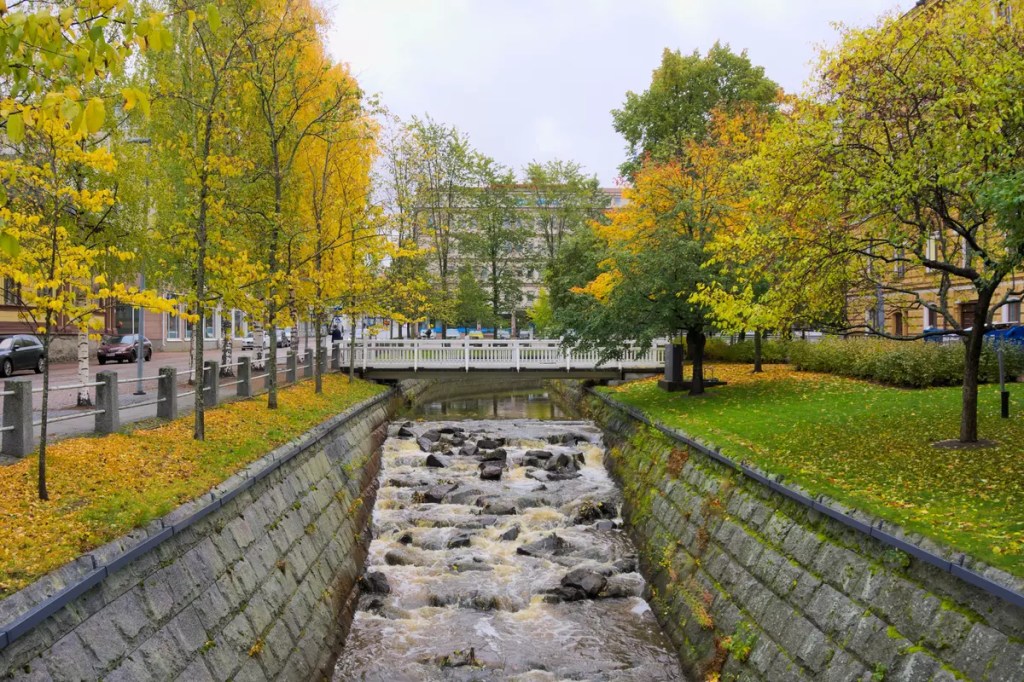
Oulu — the stop before Lapland! It is the fourth largest city in Finland, located around 170 km south of the Arctic Circle. The city has been chosen as the European Capital of Culture for 2026. So if you happen to find yourself in this city, here is a list of things that you may want to check out.
Hunt the auroras: I mention this first as this was what brought me to the city for the first time. It was September of 2021 when I saw news of a period of high solar activity that may bring in good auroras. Oulu is one of the southernmost locations in Finland with frequent auroras. Unfortunately, the weekend we travelled to Oulu was cloudy and we got no show. However, it was during another trip later that year, that I finally managed to see the aurora in Oulu. The Facebook group Oulu Aurora Spotters has a map that tells the best locations in Oulu to see auroras. The group also has active members who post about aurora sightings almost immediately.
Winter cycling: Oulu is the winter cycling capital of the world and home to the Winter Cycling Federation. It has the most extensive network of cycling routes in Finland covering the entire city and also the neighbouring municipalities. Not only that they have the routes, but most of them are well maintained and kept illuminated even through the cold dark winters which is basically about half the year. The real thrill of cycling does come when the temperatures go as low as -20°C.
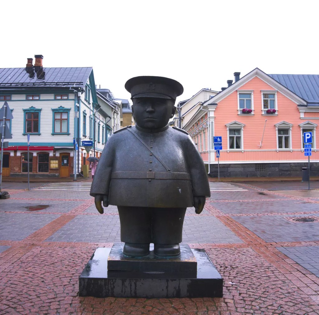
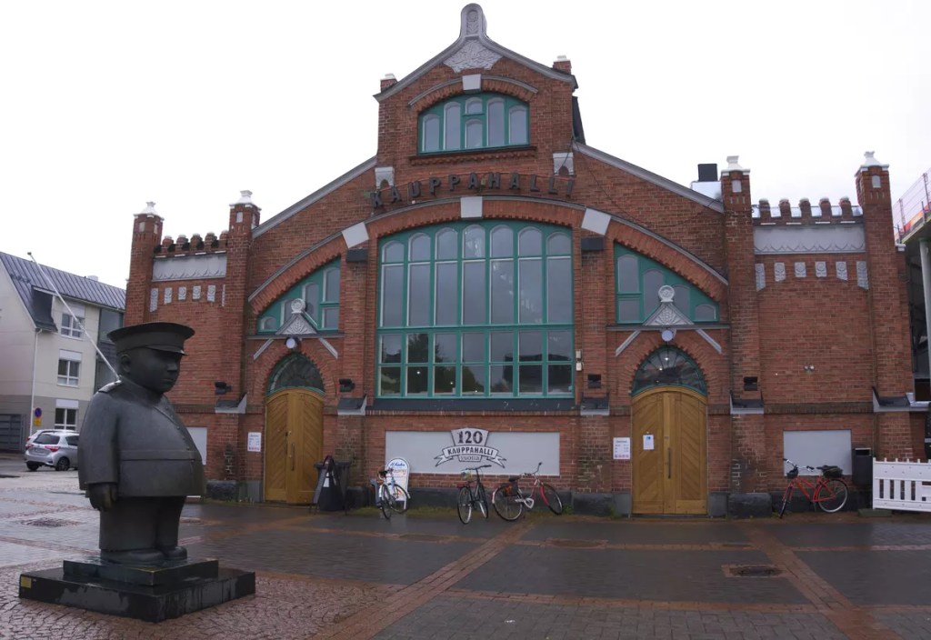
Meet the Toripolliisi: Be it sun or snow, the policeman is on duty overseeing the Oulu’s market square. The bronze statue sculpted by Kaarlo Mikkonen was unveiled in September 1987. It is dedicated to the market police officers who patrolled the area between 1934 and 1979. The Toripolliisi is probably the most recognizable and photographed landmark in the city. So don’t forget to get yourself clicked with the officer.
Eat and shop local at Kauppahalli: Built in 1901, the market hall or kauppahalli, as in Finnish, is one of the iconic buildings at Oulu’s market square. It is the third oldest market hall in Finland after Helsinki and Turku. The red brick building hosts several local merchants selling vegetables, meats, and other locally produced/manufactured items. A cup of coffee and some pastry or piirakka at one of the cafes here might be a good way to start your day in Oulu. Also, if you are looking for souvenirs to take back home, the Kauppahalli is the place to shop at.
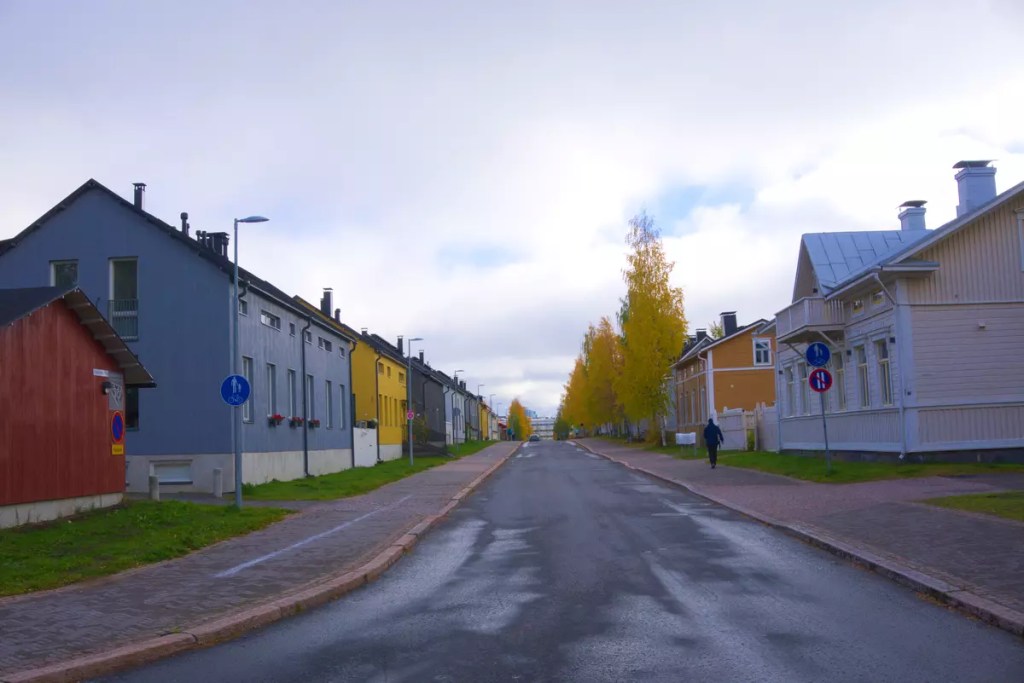
Wonder the Wooden City: Just a walk away from the Kauppahalli is the historic Pikisaari island. Located in the estuary of Oulujoki River, the island was once used to house shipyards apart from several other industrial setups like sawmills, distilleries, wool mills, and machine workshops. The island derives its name from the pitch distillery established during the 17th century. Even today you can see some of the old wooden buildings that survived the fires and the test of time. The Sailor’s Home Museum from the early 18th century is said to be among the oldest. Currently, the island is a protected area with limited traffic and is home to some of the charming restaurants of the city. One that I can definitely recommend is the Sokeri-Jussin Kievari, located on a red wooden building just after you have crossed the bridge while coming from Kauppahalli.
Relax at Nallikari: Exit Pikisaari from the other end and head straight until you hit the sea — that’s where Nallikari beach is. In summer, you can enjoy a dip in the blue sea or practice a variety of water sports. While in winter, as the sea freezes, it is an ideal time to hone your skills in skiing, snow-shoeing, and even ice-fishing. Fat-biking on the vast flat whites is also something you must try while in Oulu.
Hop through the museums of Oulu: The Northern Ostrobothnia Museum is your destination if you want to learn more about the history of this once ‘most internationalized’ Finnish city. The museum, established in 1896, is more than 120 years old and houses exhibits and photographs far older. Among the exhibits, the primary eye-catcher is a miniature model of Oulu before the World War II bombings. Have a nice look at this model and head to the 45-meter tower adjoining Science Centre Tietomaa. See if you can identify where some of the important old buildings were located. The Science Centre Tietomaa was the first science centre in Finland and tells stories ranging from technological advancements in Finland to some of the unique natural phenomena that happen in these arctic regions. I remember among the exhibits was a collection of mobile telephonic devices manufactured by Nokia including the game-changer Mobira Cityman 900. Close to the Science Centre is the Oulu Museum of Art which hosts an extensive collection of art, especially Oulu and Northern Ostrobothnia.
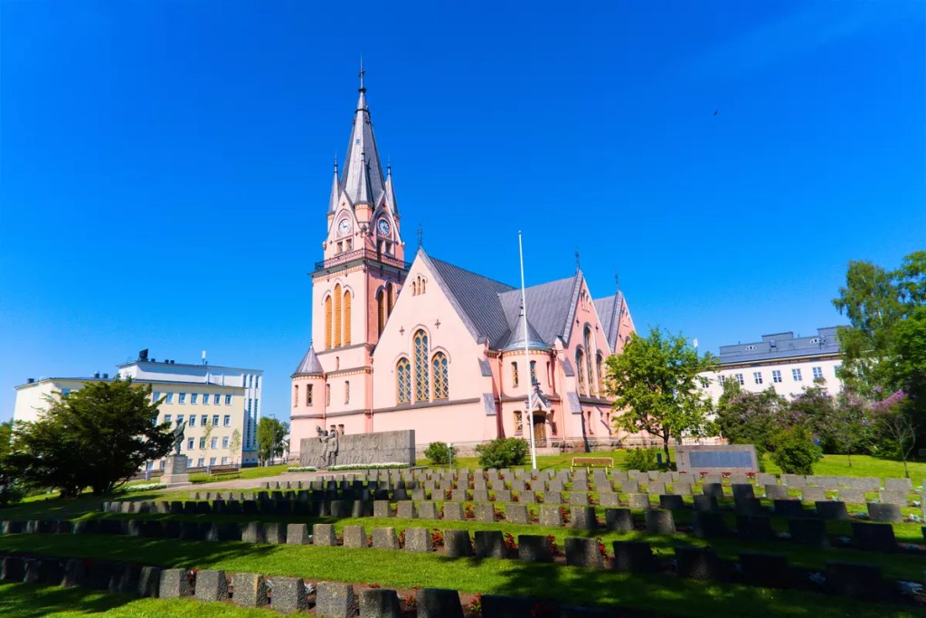
Pray at Oulu Cathedral: A distinguishing architecture with a dome and clock tower that you might observe while viewing the city from the top of Tietomaa is the Oulu Cathedral. While the current building was completed in 1832, it stands in the place of an erstwhile wooden church dating back to the 1610s. The current building was built atop the remanent of the stone church that was built to replace the wooden church in 1777 but was burnt down completely during the Oulu fire of 1822.
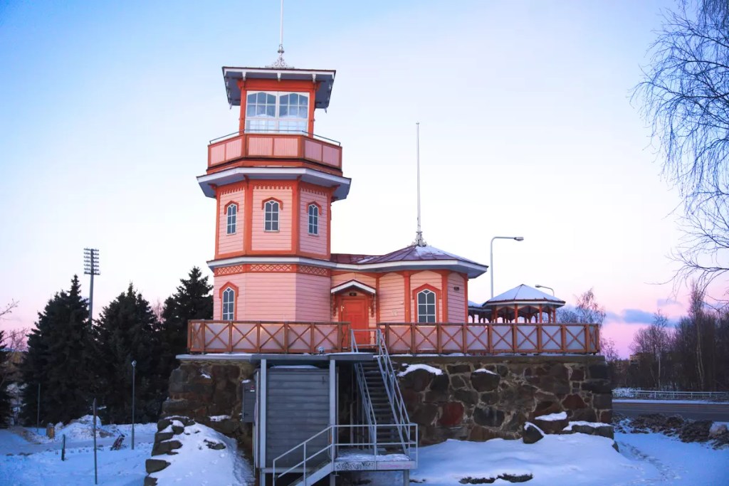
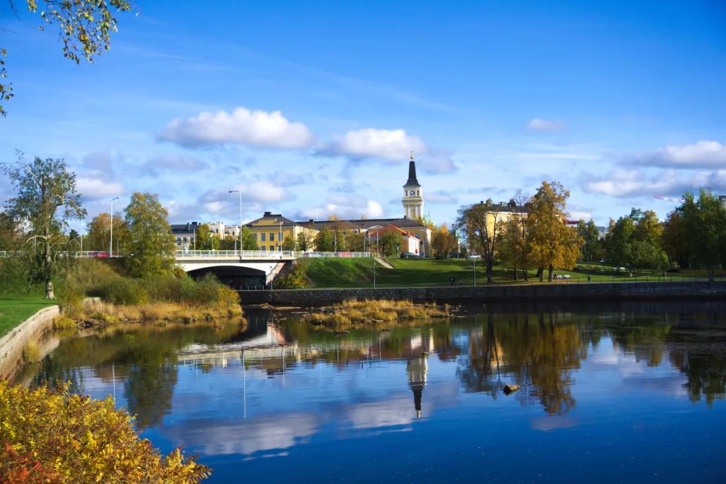
Check out the remains of Oulu castle: Close to the market square, in the vast green zone along the Oulujoki River, is reminiscent of centuries of history. While it might now be difficult to identify the observation tower as a castle, it is at this site a once impenetrable castle stood in the 1370s. As per records, the castle was built and rebuilt several times and what stands today dates to 1875 when the Oulu School of Sea Captains built their observatory. Currently, the observatory hosts a cafeteria with a small exhibition on the castle’s history.
Ruska: If you are visiting Oulu somewhere around late September or early October, you are just in time for one of the most beautiful seasons to visit Finland. The trees turn yellow preparing to shed their leaves for the winter but put on a final show before they go barren. Especially during the golden hour, the autumn foliage adds a wonderful splendour of colours to the already beautiful landscape. Either experience it up close by taking a stroll in the parks of Oulu or drive down the highways and admire the streets lined with yellowed birch trees. If nothing else, the yellow mohabbatein leaves at Ainolan Puisto would definitely help you fall in love with the city.
Bonus: Where to stay? While there are several options you will find on Booking.com or AirBnB or any other websites, I will recommend a property that is named “Lovely apr with sauna at the best area of Oulu“. It is a studio apartment suitable for up to two people. Undoubtedly, this is one of the best places I have stayed in while travelling. It is about 4 km from the city centre in an area with limited public transport facilities but just 1 km from the Nallikari beach (one of the recommended places for aurora hunting). If you prefer walking, the shortest path passes through Pikisaari Island.
BTW how to reach Oulu? Oulu is literally connected by all three modes of transport to the world. You can sail through the Baltic Sea and the Gulf of Bothnia, from anywhere to Oulu. Oulu also has its own airport with direct connections to several European destinations. However, if you are already within Finland or in the Nordics, you might also consider taking the trains or buses. Oulu is connected to Helsinki and other Finnish cities with regular services throughout the day including an overnight train with sleeping berths. A limited number of buses also operate between Oulu and Tornio, where you can cross over to Sweden. The Haparanda bus and railway station have onward connections to several destinations within Sweden. During the peak summer and winter months, there are also direct buses all the way up to Tromsø in Norway. The Arctic Route buses operated from Tromsø connect to Rovaniemi and Oulu in Finland and some of the finest winter destinations in the Arctic including Narvik, Skjervoy, and the Lyngen Alps.
Did I miss anything? Please mention them in the comments below or message me on Instagram (@ag1805x). I might explore them during my next trip! Until then, check out my pictures from Oulu here.
Kemi is a small town just at the base of the Finnish Lapland where it touches the Gulf of Bothnia. The place might not exactly be on someone’s itinerary more than being a stopover on way further up to Lapland or while returning from there. Even I had just passed through Kemi on my way to Rovaniemi twice — in June and December 2021. But I finally got some time to explore the town during my mid-summer 2022 bike-packing trip. While I may tell about that trip in a separate post, I will here focus on what to do if you happen to be in Kemi.
How to reach?
Kemi is well connected to Helsinki and most other major cities in Finland through buses and trains. Almost all buses and trains on the way to Rovaniemi from Helsinki stop over at Kemi. It might also be possible to hop on the only overnight train service from Helsinki to Rovaniemi. Kemi also has its own airport, but the number of connections is limited.
What to do?
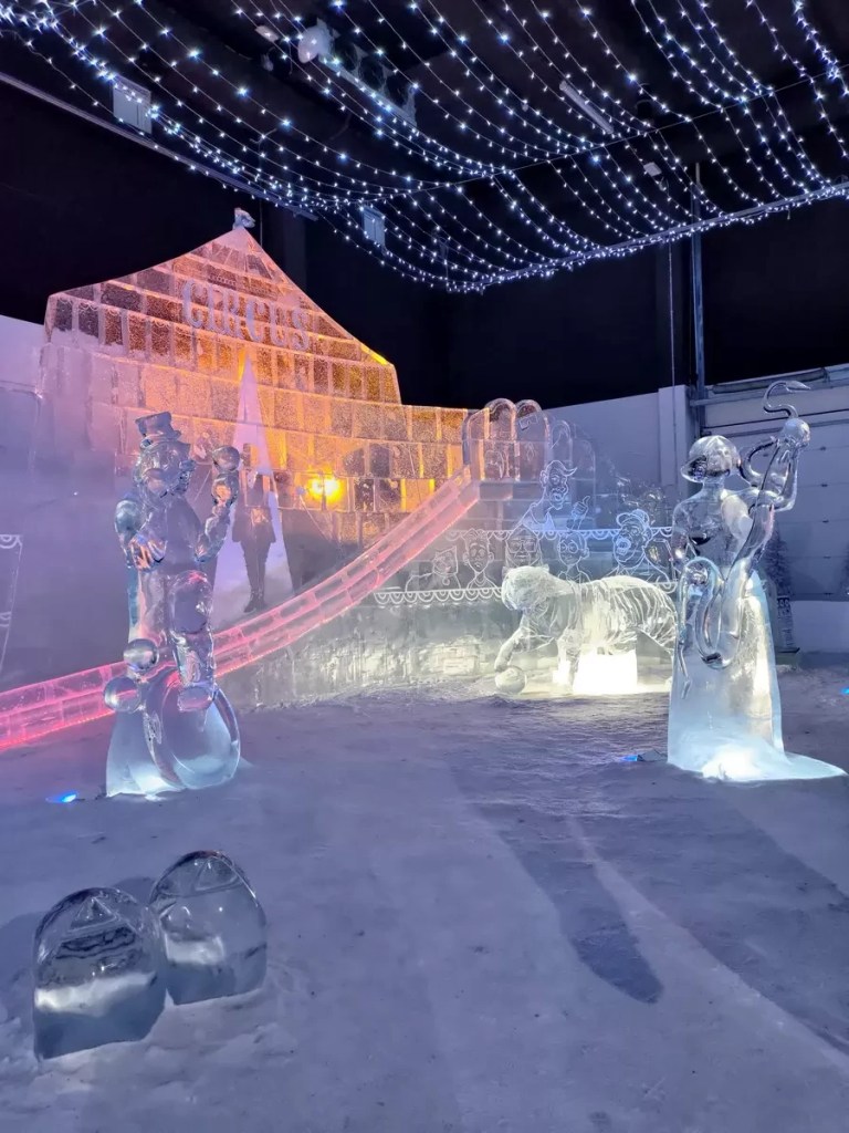
Kemi snow castle: A ‘mirage made of diamonds’ emerging from the sea. The primary crowd puller to this town is the snow castle that has been erected every winter since 1996 from the ice and snow sourced from the frozen Gulf of Bothnia. In fact, it is the largest snow castle in the world. The castle is said to be adorned with beautiful sculptures made of ice. Not only that, but you might also be able to sleep on a bed of ice here. As of July 2022, I am yet to visit the castle. Maybe the upcoming winter on my ‘half-yearly trip to Lapland’.
Snow Experience 365: In case you cannot make it to the winter snow castle, there is a smaller castle that can be experienced throughout the year. Similar to the winter ice castle but smaller and obviously built indoors, even this has a couple of beautiful ice sculptures to admire. You might also be able to enjoy a drink sitting on an ice table and stool. Tip: do not miss the ice slide. It’s fun! [W: experience365.fi]
Icebreaker Sampo: This is a unique cruise that starts from Kemi and traverses the Gulf of Bothnia breaking the frozen sea en route. The northern part of the Gulf of Bothnia is among the few places on earth where the sea completely freezes. The three-hour cruise also includes an experience of floating on the icy waters dressed in a survival suit. [W: experience365.fi/icebreakersampo/]
Kemi church: It is a Finnish Evangelical Lutheran church dating back to 1903.
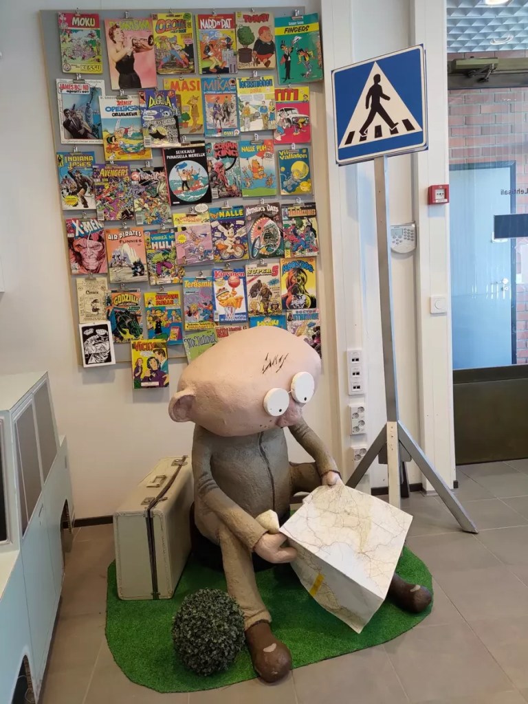
Kemi Museums: Kemi might be a small town but it has been historically important due to its location. It has seen several wars including the two World Wars, the Winter War and the Continuation War. You can learn more about the history of Kemi at the Kemi History Museum. The same building also houses an art and gem gallery. While I was visiting in June 2022, they had an interesting concept of presentation — a gem matched to the colour of a painting. Another interesting collection under the same roof is that of comics. Here you can get yourself familiarised with comics that were once popular in Finland.
Where to next?
Sweden: Just about 30 km west of Kemi is the Swedish border. The border town of Haparanda-Tornio is in itself a unique experience. I stayed in Sweden and ate in Finland. You can freely cross the border. But beware, crossing the border also means crossing over to a different time zone and that can mess up your plans. From Haparanda, you can get bus and train connections further into Sweden.